MBTiles
MBTiles is a file format for storing map tiles in a single file. It is, technically, a SQLite database. Latest format specification as of Feb 2018 is 1.3.
Serving MBTiles
Since the only qualification for implementing languages is basic SQLite support, the logic is easily ported. A list of implementations is maintained by the project.
- A simple PHP MBTiles Server script for serving image tiles only: https://github.com/asd20752/PHP-MBTiles-Server
- A more sophisticated PHP TileServer supporting UTFGrid & TileJson: https://github.com/infostreams/mbtiles-php
- With Apache, you can serve tiles from multiple MBTiles with a mod_mbtiles module: https://github.com/systemed/mod_mbtiles
- Serving and unpacking MBtiles using Elixir and Phoenix https://github.com/dkuku/tile_server
- Demo: https://blog.thematicmapping.org/2012/11/exploring-mapbox-stack-mbtiles-tilejson.html
- If you need more performance there is also a node.js server for image tiles only. https://github.com/asd20752/node-mbtiles
- QGis can serve a project that has a MBTiles layer: https://docs.qgis.org/latest/en/docs/server_manual/index.html
Data Download
MBTiles with OSM data for analysis are available from https://osmlab.github.io/osm-qa-tiles/ , these are provided by the Humanitarian OpenStreetMap Team and updated weekly. The planet, as well country extracts are available. These tiles were initially provided by Mapbox and made available daily.
The BBBike extract service offers mbtiles for an area of your choosing.
Generating MBTiles
Vespucci's documentation page Generating MBTiles files with custom imagery has a list of tools and resources for creating MBTiles files with custom data.
QGis can also generate MBtiles: menu View > Panels > Processing Toolbox > Raster tools > Generate XYZ tiles (MBTiles)
OpenSeaMap
You can get OpenSeaMap offline-charts in MBTiles-format:
Usable for:
| Navi-Programm | Website |
|---|---|
| GPXSee | GPXSee.org |
| Locus | |
| OruxMaps | |
| OpenCPN | OpenCPN.org |
| WinNav | WinNav.de |
Look and Feel
Offline-Karten
Folgende Karten sind im Format MBTiles verfügbar:
| Revier | Download | Grösse | Abdeckung |
|---|---|---|---|
| Adria | Adria | 0,5 GB | 
|
| Biskaya | Biskaya | 0,5 GB | 
|
| Englischer Kanal | Englischer Kanal | 0,5 GB | 
|
| Magellanstrasse | Magellanstrasse | 0,1 GB | 
|
| Mittelmeer Ost | Mittelmeer Ost | 1,2 GB | 
|
| Mittelmeer West | Mittelmeer West | 1,0 GB | 
|
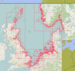
| Nordsee | Nordsee | 1,4 GB | 
|
| Ostsee | Ostsee | 1,2 GB | 
|
Other uses
You can bring a layer into JOSM from an MBTiles database using JOSM/Plugins/Mbtiles


