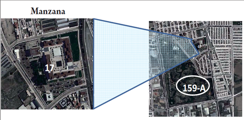
Mexico Block
Polygon shaped geographic space of variable surface consisting of a single or a group of houses, buildings, land, lots or land for housing, commercial, industrial, or services uses, among others.
It is considered as the minimum unit of the National Geostatistical Framework for the operational work of censuses and surveys, you can usually surround the totality of its extension and is bounded by streets, walkways, gaps, sidewalks, fences, streams, parcel boundaries and other elements.
The classification of blocks is urban or rural, according to the setting of the locality to which they belong.
Each of the blocks is encoded by a three-digit key, assigned in ascending order from 001 until covering the total blocks of the AGEB in urban localities and of the locality in the rural localities.
Example:
001
002
003
...
It's important to note that in the cartographic printed products, the zeros at the left are not shown.
01 Key of the state Aguascalientes.
001 Key of the municipality Aguascalientes.
0001 Key of the locality Aguascalientes.
159-A AGEB Key
017 Block Key
