MinidebconfIndia2011
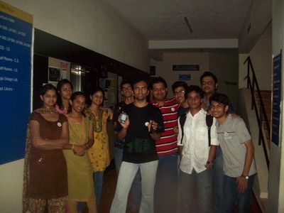
Mini Debian Conference India 2011 held at Nitte, Mangalore, India had a mapping party on 30th October 2011 .
Event Location
| V・T・E |
| latitude: 13.183233, longitude: 74.934598 |
| Browse map of Nitte 13°10′59.64″ N, 74°56′04.55″ E |
| Edit map |
|
External links:
|
| Use this template for your locality |
Nitte is a village in Karnataka, India at latitude 13°10′59.64″ North, longitude 74°56′04.55″ East.
The mapping party was held at the venue of MiniDebconf India 2011 which was held at Nitte Village of Udupi District , Karnataka . It is also near to the Mangalore city .
Imagery
The location being very remote and full of forest cover doesnt have any presence in Bing Imager or landsat or mapquest imagery .
GPS Devices
We had one Nokia N900 and another Android mobile phone .
Loss of Tracks
Unfortunately we lost the traces in Android device . We used Open GPS Tracker in Android for recording tracks but we couldn't find them on the mobile phone immediately . The tracks has some more clear details of the venue .
Tools used
Editors
We used JOSM as the main tool for editing the map . JOSM needed an install of OpenJDK-JRE for smooth running of JOSM on Debian single CD install .
Phone
- OpenGPS Tracker on Android
- Maep on Nokia N900 Maemo
Participants
Team 1 with N900
- Rithesh shenoy
- Dinesh sahu
- Pavan Rao
- Preethi
- Anusha
- Shirish Agarwal
Team 2 with Android
- Abhilash
- Vinayak
- Vineeth
- Supriya
- Tripthi
- Pavithran

