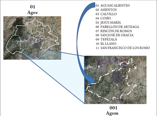
Municipal Geostatistical Area (AGEM)
It is the land area that corresponds to the geographical area of each of the municipalities of the political division of the states of the United States of Mexico; the total number of agem by state shall be the total of its municipalities; and in the case of the Federal District, are the political delegations; Currently there are 2456 municipalities nationwide.
The geostatistical boundaries of the AGEM stick when possible to the political-administrative limits of each municipality or delegation.
Within these areas are all urban and rural localities belonging to each of the municipalities and delegations.
The geostatistical key of these areas is composed by three numbers that are assigned in ascending order starting at 001 according to the alphabetical order of the names of the municipalities, although municipalities created after the initial key assignation are assigned their geostatistical key as they are created.
Example:
001 Armería
010 Villa de Álvarez
