Philippines/Featured images/2010
Jump to navigation
Jump to search
| Week | Image | Description | Global featured image? |
|---|---|---|---|
| Dec 26 | 
|
During the Intramuros Mapping Party. Participants to the Intramuros Mapping Party plan their course of action during the morning meetup. | |
| Dec 19 | 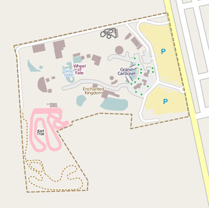
|
Enchanted Kingdom traced from Bing. Bing Maps' satellite imagery covers much more of the Philippines than Yahoo and among the covered places is the Enchanted Kingdom theme park in Sta. Rosa, Laguna. | |
| Dec 12 | 
|
Intramuros Mapping Party Walking Paper. Walking Papers were extensively used in the just concluded Intramuros Mapping Party. Shown is the Walking Paper for slice 4, where many unmapped POIs and data corrections are plotted in a very dense commercial area of Manila south of Intramuros. Since the area is dense, numbers were written on the map and the name and other details are cross-referenced in a notebook. | |
| Nov 28 | 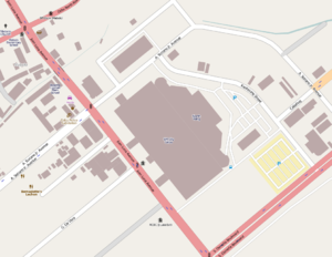
|
Mapping from helicopter imagery. In the absence of satellite imagery for Cebu, Totor has taken to the skies in a helicopter snapping DIY aerial imagery. He has warped and georeferenced his photos and mapped SM City Cebu (pictured), Ayala Center Cebu, and other places through them. Learn how he did it. | |
| Nov 21 | 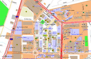
|
Rally's Garmin TYP file. This image shows Rally's TYP style for the OSM-PH Garmin Map. It is the default style for that Garmin map and highlights the richness of OSM's data such as buildings, POIs, landuses, and roads. | |
| Oct 31 | 
|
UP Los Baños Campus. Just like with San Pablo City, Ian Lopez has single-handedly mapped his university's campus, making it the most detailed campus map of any college or university in the Philippines. And it's still not yet finished! | |
| Oct 10 | 
|
Pangasinan roads traced from donated DigitalGlobe imagery. In the wake of Typhoon Pepeng, DigitalGlobe agreed to donate Quickbird satellite imagery of flooded areas in north-central Pangasinan. With the help of Andy Allan, this image was made available as a tile map service for tracing into OpenStreetMap. The image above shows the extent of imagery available and the excellent tracing work done by OpenStreetMappers in the Philippines and around the world. | |
| Oct 3 | 
|
Cavite Road Network Mapping Party animation. A visually appealing animation of the GPS tracks collected during the Cavite Road Network Mapping Party. | |
| Sep 19 | 
|
Cavite Road Network Mapping Party group photo. Participants of the Cavite Road Network Mapping Party gamely pose for the camera after the surveying. | |
| Sep 12 | 
|
Cavite Road Network Mapping Party traces. 1,300 POIs, 500 kilometers, 13 towns/cities, 12 GPS units, 9 people, 3 teams, 1 massive mapping party. | |
| Aug 22 | 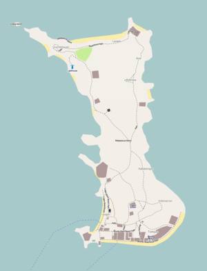
|
Malapascua Island. The resort island of Malapascua in Cebu has been almost completely and single-handedly mapped by Jim Morgan aka Plutocrat. There is no other freely-available map with more detail anywhere of this island. | |
| Aug 8 | 
|
2008 A Year of Edits. A frame of the famous 2008 video by ITO World showing the Philippines in the center. | |
| Jul 25 | 
|
MapQuest embraces OpenStreetMap. During State Of The Map 2010, MapQuest announced support for OpenStreetMap. Shown is their rendering of OSM data in the Philippines and Metro Manila using their own house style ported to Mapnik. | |
| Jul 18 | 
|
State of the Philippines 2010 poster. Although no one from the Philippines was able to attend State Of The Map 2010 in Girona, Spain, the country was represented by a poster showing a timeline of OSM-PH milestones from 2009 to mid-2010. | |
| Jul 11 | 
|
OSM-PH Sawtooth Coastlines Webmap. This is a webmap created by seav showing the location of sawtooth coastlines (i.e., coastlines derived from the SRTM dataset) in the Philippines. This webmap was created to aid the coastlines correction activity. | |
| Jun 27 | 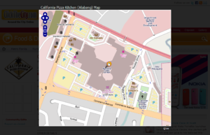
|
ClickTheCity.com uses OpenStreetMap. ClickTheCity.com, one of the most popular city guides in the Philippines, is using OpenLayers with OpenStreetMap Mapnik tiles to show the location of restaurants, shops, and other locations in its database. | |
| Jun 13 | 
|
OSM-PH Inc. lives! Shown here is the OpenStreetMap Philippines Inc. Certificate of Incorporation issued by the Securities and Exchange Commission. | |
| May 30 | 
|
Ortigas-Mandaluyong Mapping Party. People from the Ortigas-Mandaluyong Mapping Party gamely posing with the OSM banner. | |
| May 23 | 
|
OSM Sketchpad. You don't need those fancy gear to do mapping for OSM. Sometimes, all you need is a sketchpad, pen and some attention to details. Here's seav's sketchpad of the Ortigas slice during the Ortigas-Mandaluyong Mapping Party. | 
|
| May 16 | group photo of the Tagaytay Mapping Party to celebrate the 1st-year anniversary | ||
| Mar 21 | 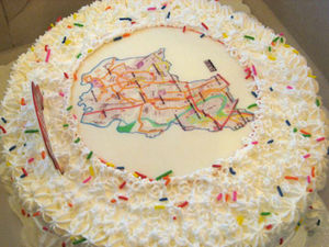
|
The cake test. Marikina Mapping Party cake! Need we say more? | 
|
| Mar 14 | 
|
OpenStreetMap workshop at FEATI University. Rally is shown here teaching the students of FEATI University how to use the GPS units. The cake slices for the field mapping around Quiapo is shown in the foreground. | 
|
| Mar 7 | 
|
CloudMade routing at the C-5–Kalayaan interchange. OpenStreetMap is not all about producing maps, it is also about producing accurate geodata, which can be used in applications such as routing. The image above shows a calculated route from CloudMade traversing both elevated U-turn roads at the C-5–Kalayaan interchange. These elevated U-turn roads are the first in the country and OpenStreetMap is the first map to accurately model them. | |
| Feb 28 | 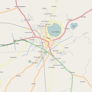
|
San Pablo City. San Pablo City has been mapped almost single-handedly by Ian Lopez with not much more than a GPS device (thanks to the GPStogo program). This shows that you can map even without high-resolution satellite imagery. | |
| Feb 21 | 
|
OpenOrienteeringMap of Ayala Center. Pseud-O style OpenOrienteeringMap rendering of Ayala Center, Makati showing fine detail in the building shapes. | 
|
| Feb 14 | 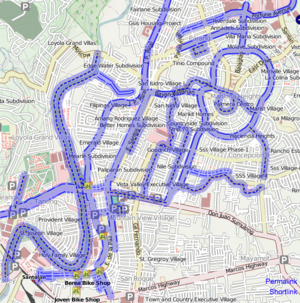
|
Cycleways in Marikina City. The City Government of Marikina encourages cycling as an alternative mode of transportation within the city. Here we see bike routes highlighted on OpenCycleMap. And for Valentine's Day, go biking: it's good for the heart! | |
| Feb 7 | 
|
MapAction uses OSM data. In the wake of any natural disaster, easily- and fast-obtainable mapping data is a must for assessing the situation, and coordinating rescue and relief activities and rehabilitation. After Typhoon Ondoy struck the Philipines, MapAction sprung to action producing situation maps. Some of these maps, like the one above showing depth of flooding, uses OSM road data. | |
| Jan 31 | 
|
One year of edits in Metro Manila. Metro Manila (and surrounding areas) far and away remains the most active area in terms of OpenStreetMap editing in the Philippines. This image shows the editing activity over the course of the past 12 months. Brighter areas show more recent activity. | |
| Jan 24 | 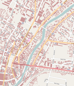
|
Naga City import. Naga City's GIS department released their geo data to the public domain. And into OSM it goes! See the Data sources page for more examples of Philippine data imported into OSM. | 
|
