Philippines/Featured images/2012
Jump to navigation
Jump to search
| Week | Image | Description | Global featured image?
|
|---|---|---|---|
| Dec 10 | 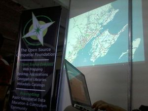
|
Cebu City Edits. Animation showing the progress of data coverage in Cebu City created by Totor. The animation was showcased in the OSM-PH exhibit during the Philippine 1st Geomatics Symposium (PhilGEOS2012). Animation available here in various format. | |
| Sep 23 | 
|
OSM Workshop at Software Freedom Day 2012. Maning is shown in this photo leading a workshop on OpenStreetMap during the Software Freedom Day celebrations in the Philippines held last September 15, 2012. | |
| Sep 16 | 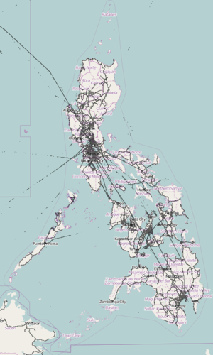
|
GPS data points map. This map shows the raw point map of GPS data points in and around the Philippines that have been submitted by contributors to OpenStreetMap. The major national routes and highways (as well as some airline routes) are quite visible. | |
| Jul 8 | 
|
South Cotabato OSM Workshop. Maning went to Mindanao to promote the use of FOSS and also taught local government employees in South Cotabato how to contribute to OpenStreetMap. | |
| Jun 10 | 
|
GPS data points density. This map shows the density of GPS data points in and around the Philippines that have been submitted by contributors to OpenStreetMap. The major national routes and highways (as well as some airline routes) are quite visible. | |
| Jun 3 | 
|
Node density increase in the Philippines. This is a visualization of the increase in the node density of OSM data in the Philippines between the 2012-01-02 and 2012-06-03 extracts. Each pixel represents a 0.01°×0.01° degree square or approximately 1 square kilometer. Brighter pixels represent areas with higher node count increases. See the base 2012-01-02 node density visualization for comparison. | |
| Apr 29 | 
|
NMT Mapping Workshop. OpenStreetMap Philippines again partnered with the Ateneo School of Government's Innovations at the Base of the Pyramid in Southeast Asia Program (iBoP Asia) to conduct a non-motorized transportation (NMT) mapping workshop last April 21, 2012 as part of their New Mobility project. Shown in the photo is seav giving an introduction to OpenStreetMap. | |
| Apr 15 | 
|
New Mobility Mapping Workshop. OpenStreetMap Philippines was invited to a mapping workshop last January 31 to February 1, 2012. This workshop is part of the New Mobility project organized by the Ateneo School of Government through their Innovations at the Base of the Pyramid in Southeast Asia Program (iBoP Asia). Maps from OSM were used during the event and OpenStreetMap Philippines will also be partnering with iBoP Asia in future events. | |
| Apr 8 | 
|
More OpenStreetMap in Watercolor. Here's another watercolor rendering this time of Intramuros and Rizal Park in Manila. (Just because Stamen's Watercolor style is so awesome!) | |
| Mar 25 | 
|
OpenStreetMap in Watercolor. Stamen has provided a breathtakingly beautiful watercolor-styled tileset using OpenStreetMap data. Who says maps always have to be functional? | |
| Mar `18 | 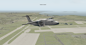
|
MNL in X-Plane. This is a screenshot from the X-Plane flight simulator depicting a SEAIR Dornier 328 airplane having took off from Ninoy Aquino International Airport (NAIA) (IATA: MNL) towards Iloilo. The roads, water bodies, and many other elements in the scenery were derived from OSM data. | |
| Mar 11 | 
|
Makati CBD in MapBox Streets. foursquare recently switched to using OpenStreetMap away from Google Maps and they used the MapBox Streets tileset as their basemap. There are many foursquare users in the Philippines and they can now see their check-ins on the web via a beautifully-rendered OSM map such as this one of the Makati Central Business District. | |
| Mar 4 | 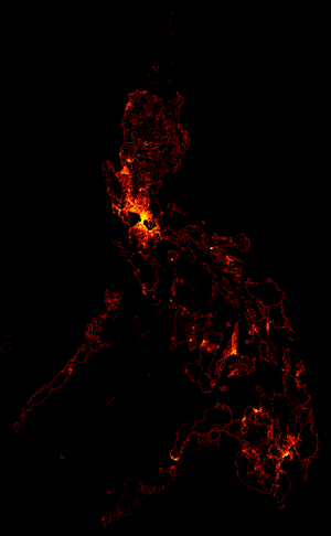
|
Node density in the Philippines. This is a visualization of the node density of OSM data in the Philippines taken from the 2012-01-02 extract. Each pixel represents a 0.01°×0.01° degree square or approximately 1 square kilometer. Brighter pixels represent areas with higher node counts. As expected, brighter areas are places with a large population, where there is a large amount of editing, and where there is available high-resolution imagery since there would be more features (such as buildings) that can be traced. An example in is the conurbation of Metro Manila. | |
| Feb 26 | 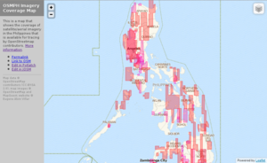
|
OSMPH Imagery Coverage Map. Due to the recent large update of satellite imagery for the Philippines on Bing Maps, documenting the areas covered via lists and tables on the wiki has become infeasible. This simple imagery coverage slippy map was then created by seav to better document and show what areas are exactly covered by each type of imagery. | |
| Feb 19 | 
|
New Bing aerial imagery. Bing Maps added a lot of aerial imagery in the Philippines (and elsewhere in the world) and this of course resulting in a lot of editing activity. Two areas that have seen increased edits are Lucena City in Quezon, and western Pangasinan as shown by these two OSM Mapper images. | |
| Feb 12 | 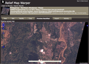
|
Sendong imagery from Theos. Many satellite providers allows the use of their imagery for free during disasters. This image shows rectified imagery provided by Thailand's satellite (Theos) after the flooding in Cagayan de Oro caused by Tropical Storm Sendong. We rectified this image and it is now available for tracing in OSM. Other Theos imagery is available in our list. | |
| Feb 5 | 
|
New OSMPH Garmin map style. The OSM Philippines community released an improved Philippine Garmin map last July 2011. Among the many improvements is a new default style with better colors and new icons that display more varied types of POIs. The style helps to showcase the wealth of information that have been added by mappers in the country as evident in this screenshot centered on San Pablo City in Laguna. | |
| Jan 29 | 
|
One year of edits in Metro Manila (2012). Compared to 2 years ago, the map of Metro Manila and its surrounding areas has now reached a certain level of maturity where the data is now more on adding the finer details such as buildings and POIs and on maintaining the existing data, rather than on filling in missing streets. This image shows the editing activity in 2011. Brighter areas show more recent activity. | |
| Jan 22 | 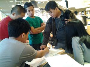
|
Greenhills Christmas/Mapping Party. OpenStreetMap Philippines celebrated Chirstmas the OSM way: via a Mapping Party! In this photo, participants discuss what to map and by whom during the afternoon meeting just before the field survey. | |
| Jan 15 | 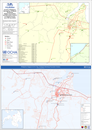
|
Sendong maps. In the wake of any natural disaster, easily- and fast-obtainable mapping data is a must for assessing the situation, and coordinating rescue and relief activities and rehabilitation. After Tropical Storm Sendong struck the Philipines, MapAction and UN OCHA produced situation maps. Some of these maps, like these two that show locations of evacuation centers, use OSM road data. |
