Proposal talk:More to be Mapped
Jump to navigation
Jump to search
Discussion
- I'm all for the use of landuse=FIXME instead. Ivansanchez 12:17, 26 January 2007 (UTC)
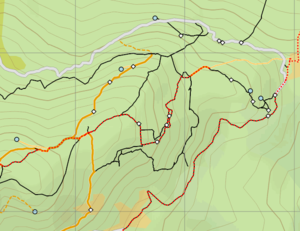
- The flaws in that proposal are clearly stated above. This is about more than just a tag. Please read it more carefully. I've added images to make it clearer. 'Fixme' is example 2, or end node of 3. Ben. 15:19 26th January 2007 (UTC)
- I'd extend that proposal to ways. For several ways I use TODO=yes/name/highway/... where i don't have accurate values (old gps tracks, no chance to take notes etc.) Frank 22:05, 25 April 2007 (BST)
- Yes, it would be handy for use in labelling ways wich lack specific elements, such as the names. It would be nice to see such things on the maplint layer actually. This would mean that the tag would need to be something like stub=yes/name/status etc. 'yes' would refer the the way itself, while other values could refer to the ways tags I suppose. Ben. 02:06, 26 April 2007 (BST)
- I have seen a nice use of ellipsis (three dots, made of unconnected nodes at the end of mapped way), which isn't effecting how things are rendered. Abuse of nodes, but visible in any editor & not on map. Ascii art:
       o
       o
       o
       o
       |
       |
 o-----o------o
       |
       |
       o
--Stefanb 22:20, 7 October 2007 (BST)
- I'd use a "todo" tag. Possible contents:
- continue (nodes at the end of ways, of areas, or ways)
- The advantage of using it on a stub way, as opposed to a node, is that you know the type of road
- name (obvious)
- pronunciation (if you don't know, or aren't sure of, the IPA lettering) (assuming a pronunication=* tag of course)
- accuracy (somebody with no or flaky GPS mapped this)
- I really dislike adding features to a map which aren't part of the world. That rules out proposals 1 and 4. We've got editors which can be programmed to display appropriate icons! Drawing our own makes no sense whatsoever.
Smurf 14:06, 22 June 2008 (UTC)
- Everything is part of the world, including the information that something is missing. Anyway, since OSM is open-minded, people can and will enter whatever they think is appropriate for them or for the general community. I myself have been using the "todo" tag for 6 months now. I use it when hiking to mark junctions for which I didn't explore all of the ways (todo=junction) and for marking paths which I haven't finished (todo=continue). I then extended Kosmos rendering rules to draw these nodes. The added benefit is that you can export those nodes to a GPS unit, so you can see what needs to be covered when you're on the move. --Breki 21:38, 22 June 2008 (UTC)
- I like this, and have used it in a few places. todo=junction and todo=continue are good candidates for default rendering on the map. They represent real-life features and are a good help when using the map for navigation. Norpan 12:09, 29 June 2009 (UTC)
Openstreetbugs
I suggest using Openstreetbugs and add a "bug" to mark areas where work is required. The recent addition of the Openstreetbug plugin in JOSM makes this really easy. -- Xoff 16:58, 18 October 2008 (UTC)
