Shadows
Simulated shade from buildings
There are projects that combine the building areas and heights of OSM with the known position and angle of the sun in different locations and times to calculate the location of shaded areas. This can be helpful for those looking for a location or route that is shadowed, or the opposite: locating places that are exposed to the sun at a given time. It is also possible to calculate an area's full-day sun exposure, for example for identifying places that are expected to be cooler or warmer, or locations that are appropriate for solar panels. Yet another use case is to locate good places to view the sunrise or sunset.
Some projects that do this are:
- JveuxDuSoleil (also available as an iOS and Android app)
- Shade Map (source code repository, live demo)
- ShadowMap
Drop shadows in roads
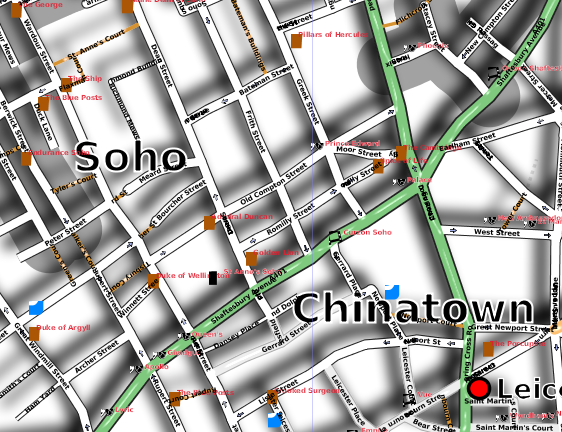
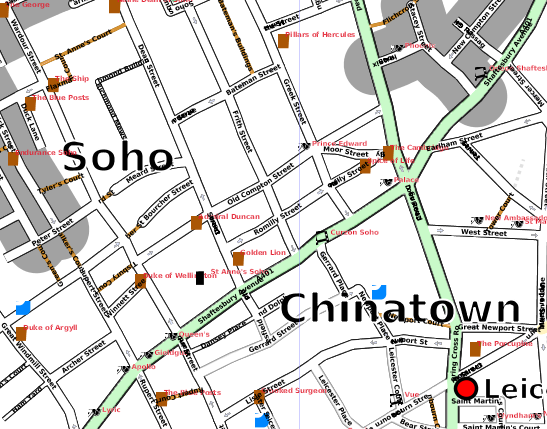
Shadows can help "lift" parts of an image and give it a 3D feel. SVG supports filter effects that let you create drop shadows. Below is a bit of London rendered with a shadow (at about 10am) in the left, and the same area without the shadow on the right, for comparison.
 ||
|| 
This was presented by Barry Crabtree at State Of The Map 2007. Robert (Jamie) Munro suggested we might use it more selectively under bridges.
Batik was used to render the SVG, as Inkscape doesn't support filter effects properly yet.