South Korea Road Classification
If you know about the current state of affairs, please help keep everyone informed by updating this information. (Discussion)
This is a discussion document. It is not yet ready for use!! Please discuss this topic on the talk-ko mailing list.
This page attempts to summarize the types of road that exist in South Korea, and how to tag them in OSM.
Firstly, it is important to note that the roads are already classified by the Korean Road Traffic Authority (도로교통안전공단). A list of road signs for each classification can be found here:
http://commons.wikimedia.org/wiki/Category:Road_signs_in_South_Korea
They look like this
These can be summarized by the following list:
Korean Highway (red/blue shield)
Korean National Route (blue oval)
Korean Metro Expressway (white hexagon or octagon with red flash)
Korean Metro Route (white hexagon or octagon)
Korean Local Route (yellow rectangle)
There are other classes of road which are very common:
Residential street
Rural road
Access roads (e.g. around rice fields)
From this list we can start assigning OSM tags to each road classification:
My first draft suggestion is as follows:
| Symbol | Classification | Tags | Explanation |
|---|---|---|---|
| Korean Highway | highway=motorway ref=* |
It's a motorway. These are toll roads. They are indicated with a blue and red shield with white numbers. | |
| Korean National Route | highway=trunk ref=* |
It's an important road making a national network. They are marked with a blue oval and white numbers. Some sections of these roads have been upgraded to 'motorway' status, but they are not toll roads, and they still retain the blue oval symbol. In this case use highway=trunk motorroad=yes ref=* | |
| Korean Metro Expressway | highway=primary motorroad=yes ref=* |
These are common near major cities. They are marked with a white hexagon with a red stripe and black numbers. We use Motorroad to differentiate this (an Expressway) from the regular Metro route (see below). | |
| Korean Metro Route | highway=primary bicycle=no ref=* |
These are common in and through major cities. They are marked with a white hexagon and black numbers as above, but no red stripe. Bicycles are not permitted. | |
| Korean Local Route | highway=secondary ref=* |
Maintained by local governments. They are marked with a yellow rectangle and black numbers. Some sections of these roads have been upgraded to 'motorway' status, but they are not toll roads, and they still retain the yellow rectangle symbol. In this case use highway=secondary motorroad=yes ref=* | |
| Other roads | highway=tertiary | Other 'significant' roads which have a painted centreline but do not fit into the above categories. | |
| Residential street | highway=residential | Streets in towns and villages and residential city areas. | |
| Rural road | highway=unclassified highway=track |
If its main purpose appears to be agricultural in nature- to, through, or around farms or fields it is likely a track. Best explained here | |
| Access roads | highway=service | Explained later in Unclassified. |
Here is a simple flowchart to quickly determine the type of road:
| No |
Yes |
highway=motorway |
| No |
Yes |
Has it been upgraded to motorway status? | ||
| No |
Yes |
highway=trunk motorroad=yes | ||
| highway=trunk | ||||
| No |
Yes |
Does the sign have a red flash? | ||
| No |
Yes |
highway=primary motorroad=yes | ||
| highway=primary | ||||
| No |
Yes |
Has it been upgraded to motorway status? | ||
| No |
Yes |
highway=secondary motorroad=yes | ||
| highway=secondary | ||||
| Does it have a painted line down the centre? | ||
|---|---|---|
| No |
Yes |
highway=tertiary |
The next classifications are subjective, but we can still make some easy rules to guide mappers:
| Is it a well-used road? | ||||
|---|---|---|---|---|
| No |
Yes |
Is it in a residential area? | ||
| No |
Yes |
highway=residential | ||
| highway=unclassified | ||||
| Is it a concrete track servicing a farm or a rice field? | ||||
|---|---|---|---|---|
| No |
Yes |
Is it well-used? | ||
| No |
Yes |
highway=service | ||
| highway=track tracktype=grade1 surface=concrete | ||||
| Is it a driveway? | ||
|---|---|---|
| No |
Yes |
highway=service service=driveway |
| Is it an alley? | ||
|---|---|---|
| No |
Yes |
highway=service service=alley |
| Is it an unpaved track? | ||
|---|---|---|
| No |
Yes |
highway=track tracktype=* grade2, 3, 4 |
| It's something else. Use the Wiki or ask on the mailing list. |
|---|
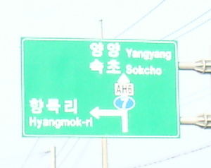
The Asian Highway Network
Some roads in Korea are part of the Asian Highway Network. These should be tagged with int_ref=* e.g. int_ref=AH6
