Uploads by Hungerburg
Jump to navigation
Jump to search
This special page shows all uploaded files.
| Date | Name | Thumbnail | Size | Description | Versions |
|---|---|---|---|---|---|
| 11:30, 25 December 2023 | Casually Attentive Walking Path.jpg (file) | 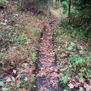 |
531 KB | {{Information | description=Footpath between casual and attentive walking | source=Camera | date= | author=Hungerburg | other_versions= }} | 1 |
| 22:27, 19 December 2023 | Impeded walking.jpg (file) | 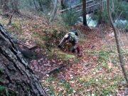 |
507 KB | {{Information | description=Casual Use of Hands While Walking | source=Camera | date=2023-12-17 | author=Hungerburg | other_versions= }} | 1 |
| 16:05, 29 July 2023 | Blockgletscher Hangschutt.jpg (file) | 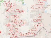 |
204 KB | {{Information | description=Rock glaciers (red outline) under Scree near Radurschlbach | description:de=Blockgletscher (rot umranded) unter Hangschutt nahe Radurschlbach | source=Austrian rock glacier inventory RGI_1, OSM-Carto | date= | author= | other_versions= }} | 1 |
| 21:51, 29 May 2023 | Trail visibility really good.jpg (file) | 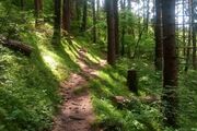 |
234 KB | Set in mountain hiking scene | 2 |
| 23:04, 22 May 2023 | Trail visibility really no.jpg (file) | 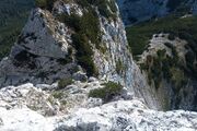 |
269 KB | {{Information | description= | source= | date= | author= | other_versions= }} | 1 |
| 22:47, 22 May 2023 | Trail visibility really horrible.jpg (file) |  |
307 KB | {{Information | description= | source= | date= | author= | other_versions= }} | 1 |
| 22:46, 22 May 2023 | Trail visibility bad.jpg (file) |  |
246 KB | {{Information | description= | source= | date= | author= | other_versions= }} | 1 |
| 22:45, 22 May 2023 | Trail visibility intermediate.jpg (file) | 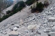 |
265 KB | {{Information | description= | source= | date= | author= | other_versions= }} | 1 |
| 22:41, 22 May 2023 | Trail visibility excellent.jpg (file) |  |
375 KB | {{Information | description= | source= | date= | author= | other_versions= }} | 1 |
| 22:02, 27 July 2022 | Radfahrerüberfahrten.svg (file) |  |
2 KB | {{Information | description=Markings of Pedestrian and Cyclist Crossings in Austria (and other countries) | source=Own Drawing | date= | author= | permission= | other_versions= }} | 1 |
| 10:02, 14 July 2022 | JOSM Multipolygon Tutorial OGC.jpg (file) |  |
84 KB | {{Information | description= | source= | date= | author= | permission= | other_versions= }} | 1 |
| 10:05, 9 December 2021 | Kraspesferner-12-08-18.jpg (file) | 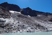 |
3.08 MB | Remnants of glacier Kraspesferner in Sellrain, Tyrol, close to Zwieselbacher Rosskogel; The ice is fully covered with rubbish from the walls above. Mightiness of the ice on the right side (just out of the frame, at water level) maybe tow meters, as seen from looking down cracks there. Own work; Straight from the camera; No post-processing. | 1 |
| 08:09, 9 August 2021 | ScrubByNumbersNLvsAT.png (file) | 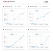 |
93 KB | Charts from the HeiGIT ohsome-dashboard showing the use of the natural=scrub tag in Austria and in the Netherlands over the years, as count and as area mapped. | 1 |
| 17:56, 7 June 2021 | JOSM Multipolygon Tutorial H.jpg (file) |  |
109 KB | 1 | |
| 17:55, 7 June 2021 | JOSM Multipolygon Tutorial G.jpg (file) |  |
117 KB | 1 | |
| 17:55, 7 June 2021 | JOSM Multipolygon Tutorial F.jpg (file) |  |
109 KB | 1 | |
| 17:54, 7 June 2021 | JOSM Multipolygon Tutorial E.jpg (file) |  |
107 KB | 1 | |
| 17:54, 7 June 2021 | JOSM Multipolygon Tutorial D.jpg (file) |  |
111 KB | 1 | |
| 17:54, 7 June 2021 | JOSM Multipolygon Tutorial C.jpg (file) |  |
103 KB | 1 | |
| 17:54, 7 June 2021 | JOSM Multipolygon Tutorial B.jpg (file) |  |
93 KB | 1 | |
| 17:53, 7 June 2021 | JOSM Multipolygon Tutorial A.jpg (file) |  |
99 KB | 1 | |
| 17:53, 7 June 2021 | JOSM Multipolygon Tutorial 0.jpg (file) |  |
83 KB | 1 | |
| 17:28, 19 April 2021 | Waldnutzung-Vomperloch.png (file) |  |
293 KB | Waldnutzung im Vomperloch OSM-Carto überlagert mit Daten zu Waldkategorien des Amtes der Tiroler Landesregierung | 1 |
| 17:28, 19 April 2021 | Waldnutzung-Trins.png (file) | 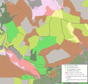 |
295 KB | Waldnutzung im Gschnitztal OSM-Carto überlagert mit Daten zu Waldkategorien des Amtes der Tiroler Landesregierung | 1 |
| 17:27, 19 April 2021 | Waldnutzung-Paschberg.png (file) | 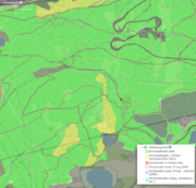 |
547 KB | Waldnutzung am Paschberg OSM-Carto überlagert mit Daten zu Waldkategorien des Amtes der Tiroler Landesregierung | 1 |
| 17:32, 28 January 2021 | Sidewalks-Length-South-America.png (file) |  |
27 KB | Correct accounting for sidewalk=both | 2 |
| 17:31, 28 January 2021 | Sidewalks-Length-Not-North-America.png (file) |  |
31 KB | 2 | |
| 17:31, 28 January 2021 | Sidewalks-Length-East-Coast.png (file) |  |
30 KB | Correct accounting for sidewalk=both | 2 |
| 17:29, 28 January 2021 | Sidewalks-Length-World.png (file) |  |
30 KB | Correct accounting for sidewalk=both | 2 |
| 17:27, 28 January 2021 | Sidewalks-Length-Poland.png (file) |  |
26 KB | Correct accounting for sidewalk=both | 2 |
| 17:26, 28 January 2021 | Sidewalks-Length-Britain.png (file) |  |
27 KB | Correct accounting for sidewalk=both | 2 |