Uploads by Kempelen
Jump to navigation
Jump to search
This special page shows all uploaded files.
| Date | Name | Thumbnail | Size | Description | Versions |
|---|---|---|---|---|---|
| 12:13, 7 March 2022 | Mary purple2 hu.png (file) |  |
12 KB | Hungarian hiking trail Mária út Lila túristajelzés CC-BY-SA edited from: https://wiki.openstreetmap.org/wiki/File:Mary_blue_hu.png | 1 |
| 11:56, 7 March 2022 | Kerékpáros Nyom.jpg (file) |  |
97 KB | Kerékpáros nyom a Margit híd pesti oldala előtt. CC-BY-SA geox123/Mapillary (Mapillary image ID: 5484105528328642) | 1 |
| 08:06, 4 May 2021 | Openstreetmap hu nevjegy 90x50.jpg (file) |  |
251 KB | two sided version | 2 |
| 18:52, 24 March 2021 | Hawle ref.jpg (file) |  |
499 KB | Ref number on Hawle fire hyrdants. | 1 |
| 09:48, 19 March 2018 | Render-mymap.png (file) |  |
684 KB | render(myMap) screenshot | 1 |
| 20:03, 22 August 2014 | Kerb-45deg.jpg (file) | 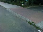 |
105 KB | A kerb type. | 1 |
| 22:59, 7 January 2014 | Osmand turareteg orig.png (file) | 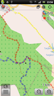 |
63 KB | OsmAnd Hiking overlay original. | 1 |
| 22:58, 7 January 2014 | Osmand turareteg domcsi.png (file) | 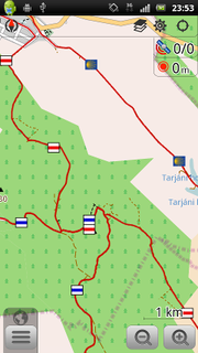 |
59 KB | Hungarian hiking overlay. | 1 |
| 21:17, 30 September 2013 | Hungary urban landuse example.png (file) | 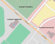 |
88 KB | Landuse - not overlapping with highways. Drawn with multipolygon lines. | 1 |
| 09:48, 2 July 2013 | Bing hungary 2013-07.png (file) | 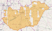 |
274 KB | Hungary Bing Coverage 2013-07 | 1 |
| 22:25, 27 May 2013 | Multipolygon.png (file) | 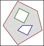 |
7 KB | based on File:Multipolygon Illustration 2.svg | 1 |
| 22:15, 27 May 2013 | Drawing roads.png (file) | 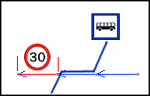 |
5 KB | Example of splitting OSM way object for drawing roads | 1 |
| 22:30, 28 March 2013 | Magyarkert.png (file) | 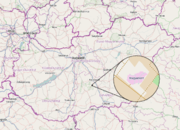 |
339 KB | Magyarkert: Hungary shaped park in Hungary, mapped from Bing. | 1 |
| 22:33, 4 November 2012 | Clc-relation.png (file) | 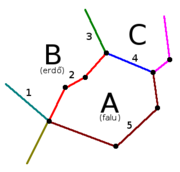 |
8 KB | added area example names | 2 |
| 22:12, 27 April 2012 | Nodes-ways-closedways-hu.png (file) | 5 KB | Hungarian labels for Beginners guide picture: nodes, ways, closed ways. | 1 | |
| 22:19, 17 December 2011 | JOSM download.png (file) |  |
62 KB | Downloading map and GPS data in JOSM | 1 |
| 21:56, 17 December 2011 | JOSM GPS tracing.png (file) | 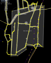 |
89 KB | Town drawing in JOSM based on GPS tracks | 1 |
| 19:59, 3 July 2011 | P2 panel.png (file) | 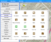 |
107 KB | Update with current P2, and include an example node. | 2 |
| 19:57, 3 July 2011 | P2 panel 2.png (file) | 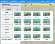 |
86 KB | Update with current P2, include example way. | 2 |
| 22:51, 1 July 2011 | Potlatch2-tagging-hu.png (file) | 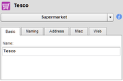 |
7 KB | Fixed cutting. | 2 |
| 22:44, 1 July 2011 | Potlatch2-icon-hu.png (file) | 13 KB | P2 icons with Hungarian comments. | 1 |