Uploads by Maxbe
Jump to navigation
Jump to search
This special page shows all uploaded files.
| Date | Name | Thumbnail | Size | Description | Versions |
|---|---|---|---|---|---|
| 11:58, 21 December 2018 | Stationszeichen B471 620 2000.png (file) | 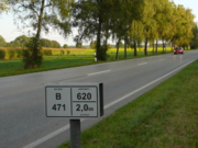 |
497 KB | Stationszeichen an der B41, Abschnitt 620, Station 2.000 | 1 |
| 14:48, 8 May 2018 | Maxbe lakelabel otm chiemsee.png (file) | 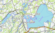 |
84 KB | Cheimsse und Simssee mit gebogener Beschriftung aus der OpenTopoMap | 1 |
| 23:11, 5 May 2018 | Maxbe simssee.png (file) | 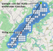 |
150 KB | Einfache Beschriftung als Diagonale | 1 |
| 23:08, 5 May 2018 | Maxbe chiemseezacken.png (file) |  |
133 KB | 1 | |
| 23:07, 5 May 2018 | Maxbe chiemseekaestchenbepunktet.png (file) | 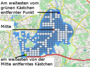 |
149 KB | 1 | |
| 23:06, 5 May 2018 | Maxbe chiemseekaestchen.png (file) | 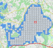 |
75 KB | kurvige und diagonale Beschriftung von Seen | 1 |
| 23:06, 5 May 2018 | Maxbe medialaxis test.png (file) | 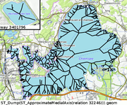 |
246 KB | mediale Achse des Chiemsees | 1 |
| 23:05, 5 May 2018 | Maxbe lakelabel simschiemsee wunsch.png (file) | 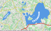 |
176 KB | kurvige und diagonale Beschriftung von Seen | 1 |
| 22:11, 18 November 2017 | Maxbe dominanz uebersicht.png (file) |  |
55 KB | 1 | |
| 22:10, 18 November 2017 | Maxbe dominanz z14 alle.png (file) | 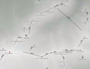 |
489 KB | Dominanz von Gipfeln, Hintergrund OSM Carto, darüber Höhendaten von SRTM | 1 |
| 22:10, 18 November 2017 | Maxbe dominanz z12 1k.png (file) | 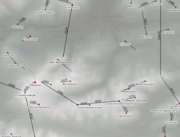 |
384 KB | Dominanz von Gipfeln, Hintergrund OSM Carto, darüber Höhendaten von SRTM | 1 |
| 22:09, 18 November 2017 | Maxbe dominanz z10 5k.png (file) | 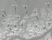 |
655 KB | Dominanz von Gipfeln, Hintergrund OSM Carto, darüber Höhendaten von SRTM | 1 |
| 22:09, 18 November 2017 | Maxbe dominanz z7 25k.png (file) | 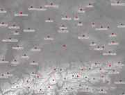 |
782 KB | Dominanz von Gipfeln, Hintergrund OSM Carto, darüber Höhendaten von SRTM | 1 |
| 22:08, 18 November 2017 | Maxbe dominanz z6 100k.png (file) | 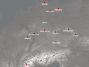 |
609 KB | Dominanz von Gipfeln, Hintergrund OSM Carto, darüber Höhendaten von SRTM | 1 |
| 22:10, 21 January 2017 | Maxbe saettel aus hwerten 2.png (file) |  |
59 KB | Bestimmung der Richtung eines Sattels aus Höhrnlinien. Bild: openstreetmap.org / opencyclemap Höhendaten: viewfinderpanoramas.org | 1 |
| 22:08, 21 January 2017 | Maxbe saettel aus hwerten 1.png (file) |  |
98 KB | Bestimmung der Richtung eines Sattels aus Höhrnlinien. Bild: openstreetmap.org Höhendaten: viewfinderpanoramas.org | 1 |
| 20:03, 9 December 2016 | Maxbe glaswandbeispiel.png (file) | 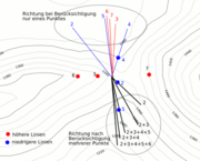 |
39 KB | Reales Beispiel für einen Sattel, Höhenlinien SRTM | 1 |
| 19:06, 9 December 2016 | Maxbe sattelsimpel unten.png (file) | 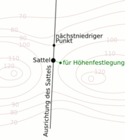 |
12 KB | Sattel mit Ausrichtung an der nächstniedrigeren Höhenline | 1 |
| 19:06, 9 December 2016 | Maxbe sattelsimpel obenundunten.png (file) | 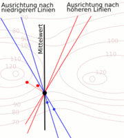 |
13 KB | Sattel mit Ausrichtung nach mehreren Höhenlinien | 1 |
| 19:05, 9 December 2016 | Maxbe sattelsimpel oben.png (file) | 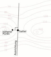 |
10 KB | Sattel mit Ausrichtung an der nächsthöheren Höhe | 1 |
| 19:05, 9 December 2016 | Maxbe sattelsimpel hlinienproblem.png (file) | 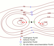 |
17 KB | Sattel mit Höhenlinen, Problem der Näherungspunkte bei tieferen Höhenlinen | 1 |
| 19:04, 9 December 2016 | Maxbe realsattel.png (file) | 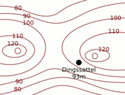 |
9 KB | Sattel mir Höhenlinen, etwas falsch platziert | 1 |
| 19:03, 9 December 2016 | Maxbe mieminger saettel.png (file) | 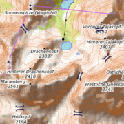 |
51 KB | OpenTopoMap mit SRTM-Höhenlinien und überlagerten Sätteln | 1 |
| 19:02, 9 December 2016 | Maxbe idealsattel.png (file) | 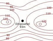 |
9 KB | Sattelpunkt mit Höhenlinien, Idealfall | 1 |
| 08:31, 2 May 2015 | Maxbe mtbvergleich.png (file) | 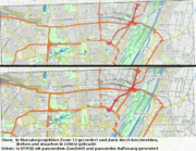 |
192 KB | besseres Beispiel gefunden | 2 |
| 22:51, 1 May 2015 | Maxbe otm 6332 15 gk4.png (file) |  |
372 KB | Messtischblatt aus der OpenTopoMap in GK4 mit 15m/px Auflösung Karte: OpenTopoMap | 1 |
| 22:48, 1 May 2015 | Maxbe mtbschiefutm32.png (file) |  |
176 KB | Messtischblätter in UTM Z32 Karte: osm.org | 1 |
| 22:47, 1 May 2015 | Maxbe mtbnummern.png (file) | 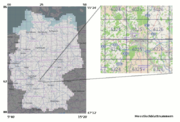 |
170 KB | Blattschnitt und Nummerierung der Messtischblätter Karte: osm.org | 1 |
| 07:06, 10 April 2015 | Maxbe sattelausrichtung.png (file) | 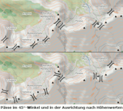 |
97 KB | Ausrichtung von natural=saddle oder mountain_pass=yes anhand der Höhendaten | 1 |
| 10:03, 8 February 2015 | Kieselsteine an der Isar.jpg (file) |  |
263 KB | Kieselsteine | 1 |
| 20:33, 16 January 2015 | Maxbe buergersteigrouting zusammen vergleich.png (file) | 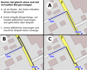 |
71 KB | Illustration zum Bürgersteigrouting | 1 |
| 20:32, 16 January 2015 | Maxbe buergersteigrouting zusammen unsichere verbindungen.png (file) |  |
4 KB | Illustration zum Bürgersteigrouting | 1 |
| 20:32, 16 January 2015 | Maxbe buergersteigrouting zusammen situation.png (file) | 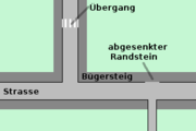 |
5 KB | Illustration zum Bürgersteigrouting | 1 |
| 20:32, 16 January 2015 | Maxbe buergersteigrouting zusammen real.png (file) | 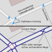 |
45 KB | Illustration zum Bürgersteigrouting | 1 |
| 20:31, 16 January 2015 | Maxbe buergersteigrouting zusammen mapping.png (file) | 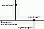 |
6 KB | Illustration zum Bürgersteigrouting | 1 |
| 20:31, 16 January 2015 | Maxbe buergersteigrouting zusammen kreuzungen.png (file) | 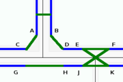 |
3 KB | Illustration zum Bürgersteigrouting | 1 |
| 20:31, 16 January 2015 | Maxbe buergersteigrouting zusammen interpretation.png (file) |  |
8 KB | Illustration zum Bürgersteigrouting | 1 |
| 20:30, 16 January 2015 | Maxbe buergersteigrouting zusammen aufbruch.png (file) |  |
2 KB | Illustration zum Bürgersteigrouting | 1 |
| 20:30, 16 January 2015 | Maxbe buergersteigrouting zusammen 1.png (file) |  |
6 KB | Illustration zum Bürgersteigrouting | 1 |
| 20:30, 16 January 2015 | Maxbe buergersteigrouting zielvergleich.png (file) | 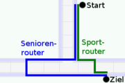 |
6 KB | Illustration zum Bürgersteigrouting | 1 |
| 20:29, 16 January 2015 | Maxbe buergersteigrouting ziel.png (file) | 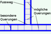 |
8 KB | Illustration zum Bürgersteigrouting | 1 |
| 20:29, 16 January 2015 | Maxbe buergersteigrouting ss vergleich.png (file) | 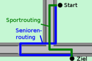 |
7 KB | Illustration zum Bürgersteigrouting | 1 |
| 20:29, 16 January 2015 | Maxbe buergersteigrouting situation.png (file) |  |
4 KB | Illustration zum Bürgersteigrouting | 1 |
| 20:28, 16 January 2015 | Maxbe buergersteigrouting getrennt zuweitweg.png (file) |  |
29 KB | Illustration zum Bürgersteigrouting | 1 |
| 20:28, 16 January 2015 | Maxbe buergersteigrouting getrennt vwege.png (file) | 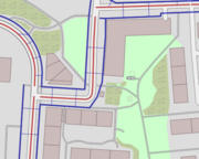 |
77 KB | Illustration zum Bürgersteigrouting | 1 |
| 20:28, 16 January 2015 | Maxbe buergersteigrouting getrennt vergleich.png (file) | 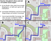 |
113 KB | Illustration zum Bürgersteigrouting | 1 |
| 20:26, 16 January 2015 | Maxbe buergersteigrouting getrennt sperrflaechen.png (file) |  |
20 KB | Illustration zum Bürgersteigrouting | 1 |
| 20:26, 16 January 2015 | Maxbe buergersteigrouting getrennt sideundstrassen.png (file) | 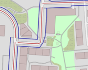 |
75 KB | Illustration zum Bürgersteigrouting | 1 |
| 20:26, 16 January 2015 | Maxbe buergersteigrouting getrennt sidepuffer.png (file) | 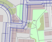 |
146 KB | Illustration zum Bürgersteigrouting | 1 |
| 20:25, 16 January 2015 | Maxbe buergersteigrouting getrennt kosten.png (file) |  |
21 KB | Illustration zum Bürgersteigrouting | 1 |