Uploads by Michi2
Jump to navigation
Jump to search
This special page shows all uploaded files.
| Date | Name | Thumbnail | Size | Description | Versions |
|---|---|---|---|---|---|
| 16:42, 12 August 2013 | Single-track.jpg (file) |  |
371 KB | Better colors and higher contrast | 3 |
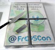
| 19:03, 20 August 2012 | Froscon-cake-1.jpg (file) |  |
84 KB | white balance; cutted. | 3 |
| 20:30, 24 August 2010 | Tactile paving incorrect02.jpg (file) |  |
352 KB | Removed red tint. | 2 |
| 20:29, 24 August 2010 | Tactile paving incorrect01.jpg (file) |  |
371 KB | Removed red tint. | 2 |
| 23:42, 20 January 2010 | Schweinfurt 080319.png (file) |  |
237 KB | Screenshot of a map of Schweinfurt, based on OSM data of 19 March 2008. License: [http://creativecommons.org/licenses/by-sa/2.0/ CC-BY-SA 2.0] | 1 |
| 22:41, 3 January 2010 | Warnemünde.png (file) |  |
5 KB | Warnemünde, the harbor of Rostock on a Garmin GPSmap 60Cx, using maps from the OpenSeaMap project. License: CC-BY-SA 3.0 Category:Garmin Category:OpenSeaMap | 1 |
| 01:24, 6 December 2009 | Osmarender-barrier-city wall.png (file) |  |
3 KB | Rendering of {{tag|barrier|city_wall}} using Osmarender. | 1 |
| 00:06, 4 December 2009 | Sw-borders.png (file) |  |
81 KB | Boundaries of Schweinfurt and communities | 1 |
| 00:44, 31 August 2009 | Man made-observatory.png (file) |  |
375 KB | Distribution of the tag {{tag|man_made|observatory}}, taken from the planet file of August 12, 2009. | 1 |