Uploads by Wollschaf
Jump to navigation
Jump to search
This special page shows all uploaded files.
| Date | Name | Thumbnail | Size | Description | Versions |
|---|---|---|---|---|---|
| 20:13, 10 October 2006 | Weinheim-small.png (file) | 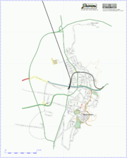 |
127 KB | more roads | 5 |
| 11:22, 3 October 2006 | Gpsgl.png (file) | 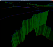 |
35 KB | Screeenshot of my OpenGL tracklog visualisation program. Rounding errors in the OpenGL engine make it a bit holey, though. It's more than unfinished, it barely works. ;) | 1 |
| 07:56, 8 September 2006 | Osm-coverage-europe.png (file) | 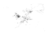 |
25 KB | Crop from Image:Osm-coverage-world.png | 1 |
| 07:54, 8 September 2006 | Osm-coverage-world.png (file) |  |
52 KB | planet-060827.osm; Number of nodes as basis. Non-linear luminance, as huge differences in node coverage exist. Combination of two "exposures": the grey areas in the USA were pitch black blocks while europe still was a faint glimmer of grey, so all of thos | 1 |
| 22:12, 7 September 2006 | Nodes by lat.png (file) | 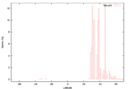 |
9 KB | Percentage of nodes for a given latitude; Analysis of planet-060827.osm May be wrong, my basic parser is not tested thoroughly yet. | 1 |
| 20:26, 7 September 2006 | Int32 bits over lat.png (file) | 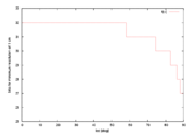 |
5 KB | Using a binary planet.osm, coordinates can be converted from double (64bit) to int32. Bit consumption of lon is constantly 32bit for 1cm resolution, but latitudes only require 32bit around the equator. As circumference decreases with increasing latitudes | 1 |