Key:city_limit
Jump to navigation
Jump to search
| Description |
|---|
| Defines which side of the city limit sign is significant to the driving direction |
| Group: Highways |
| Used on these elements |
| Requires |
| Useful combination |
| Status: in use |
| Tools for this tag |
|
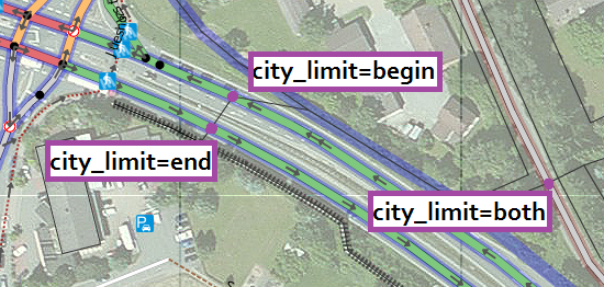
city_limit=* in addition to traffic_sign=city_limit defines which side of the sign is significant to the driving direction. It shows whether traffic is entering or leaving city limits (village boundary).
Important: city_limit=* requires traffic_sign=city_limit !
| Key | Value | Description | Image | Notice |
|---|---|---|---|---|
| city_limit | both | default value | For highways with more than one driving direction. | |
| city_limit | begin | Beginning of a town (entering a town) in driving direction. |  |
Only applicable to highways with a single driving direction. |
| city_limit | end | Ending of a town (leaving a town) in driving direction. |  |
Only applicable to highways with a single driving direction. (Image shows a split sign announcing next town in 6 km.) |
Notices:
- In most cases, city-limit signs are double-sided with begin on one side and end on the other side.
- Single driving direction: each direction or lane is mapped as a separate way.

