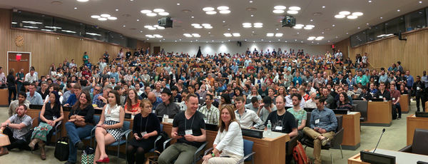
State of the Map U.S. 2015
(Redirected from State Of The Map U.S. 2015)
Jump to navigation
Jump to search
State of the Map U.S. 2015 was held at the United Nations building in New York City, June 6-8
- Follow
 @SOTMUS on twitter
- and tweet with the
 #SOTMUS hashtag
- Use the
 sotmus tag on flickr
- (Open licensing your flickr photos is also a good idea)
Main conference June 6 and 7
Saturday June 6 and Sunday June 7 are 2 full days of three tracks of sessions from and for mappers, non profits, governments and businesses - everyone involved in and around OpenStreetMap and everyone who wants to learn more about OpenStreetMap.
Hack day June 8
Mon June 8 is the hack day with code sprints, documentation sprints, Missing Maps mapping party and a Maptime summit. Share your ideas and coordinate your activities for the hack day on the Wiki here:
State_Of_The_Map_U.S._2015/Hack_day
I'm Going!
- Martijn van Exel (talk) 21:11, 3 February 2015 (UTC)
- Alan McConchie (talk)
- ToeBee (talk) 04:38, 15 May 2015 (UTC)
- Richard Welty (talk)
- Ahasanul Hoque
And everyone on the list on the registration page.
Room Sharing
| Name | Offer or Ask | Details |
|---|---|---|
| Eric Brelsford | Offer | A couch in Brooklyn. You'll have to be okay with being in an apartment with a cat. |
| Brian DeRocher | Offer | Room to share at The Roosevelt Hotel, $115 per night, free wifi, 15 minute walk to conference. Email me brian@derocher.org. |
Ride Sharing
| Name | Offer or Ask | Details |
|---|---|---|
Slides
Approximate transcripts of all sessions, one text file per room per day, are available in a zip bundle.
