State of the Map Scotland 2015/Day 5
This is day 5 of State of the Map Scotland 2015.
Workshops Sunday 4th October
Two distinct workshops, one the more experienced mappers and the making of 3D models and one for new mappers from your first edit making paper maps.
Workshop 1 : Getting Crafty with Map.Makars
Intro
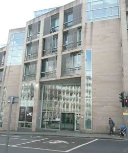
Let's get physical! Our event held at Evolution House was focused on the preparation and creation of physical maps based on OpenStreetMap data in a variety of materials such as paper, textiles, 3D printing, wood, origami, cross-stitch. A group of students, mappers, artists, makers, coders, designers help create maps. We welcomed participants from all backgrounds and experience levels to collide and come up with fun, interesting, useful, alternative ways to fabricate, materialise, interact and make maps from OpenStreetMap.
Maps 'show n tell'
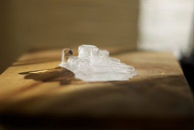
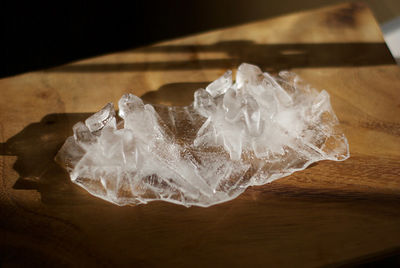
3D ice cube model of the Scottish Parliament
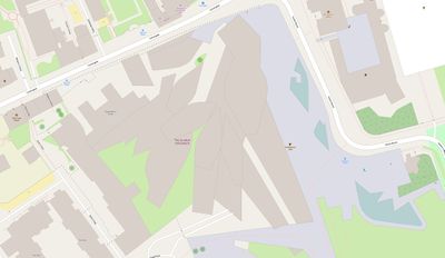
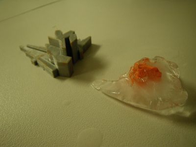
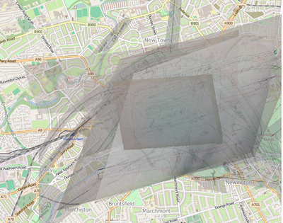
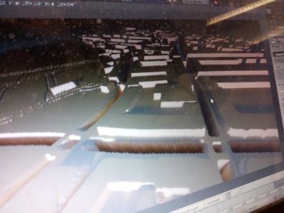
A number of participants worked on creating a 3D model based on OpenStreetMap data. First we discussed a number of building outline we could use. The difficulty was selecting a building from OSM that had a very distinctive outline and was well known. We discussed printing a large area or a single building, settling upon the Scottish Parliament buildings as being recognisable and small enough to add details. OSM data from exported into Blender - which most of us were no to using. There some handy tips here for using this powerful 3D rendering programme. Blender imports only 2D vectors which need to be extrude into 3D models. We spent some time adjusting the model to look realistic. We then printed a small 3D model using a Ultimaker 2 printer which took around 1 hr to print. As a quick hack, we tried using plasticine as a 3D mold - this worked okay but it was difficult to get crisp 3D details and was fiddly removing plasticine without breaking the ice.
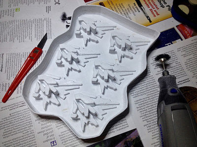
Later, Gary improved the size of the model and used a rubber mold. This still was tricky to use without damaging the finer features but gave much better results:
No map, map
What happens when you ask a number of people to draw a map from memory of the same place? Gregory discusses the outcome on his blog here:
http://www.livingwithdragons.com/maps/nomap-map/
Displaying roads as Impassable Canyons to pedestrians
A road busy with traffic may be as dangerous and impassable as a deep ravine or canyon. We looked at ways to display this using OpenStreetMap data
The schedule
| Sunday: Map.Makars at Evolution House, Edinburgh College of Art | ||
|---|---|---|
| Time | Main Presentation Area | Slides, Resources, Video etc |
| 10:00-10:30 | Introduction to Openstreetmap, how to design customise maps, exporting data for fabrication, ideas and inspiration | |
| 10:30-12:00 | Collide! 90 mins discussion in groups to come up with ideas | |
| 12:00 12:30 | Start making maps! (3D printing, textiles, paper etc) | |
| LUNCHn | ||
| 13:30-15:30 | Continue making maps! | |
| 15:30-16:00 | Show 'n' Tell | |
Registration
Registration is closed!
Ideas and inspriation
- Woodcut maps - http://setosa.io/blog/2014/08/10/woodcut-data-visualization/
- 3D paper buildings - https://mapzen.com/blog/getting-crafty
- Paper globes - http://www.openstreetmap.org/user/Hawkeye/diary/26087
- 3D colour maps of battlefields - http://makezine.com/2015/09/13/hold-a-moment-of-history-in-your-hand-with-3d-printed-maps/
Suggestions
- Request to do raster tile creation with a digital embroidery machine --Hawkeyes (talk) 19:53, 2 March 2015 (UTC))
- Arduino / GPS mapping ideas
Free/Open Source Software suggestions
- Sign up for a free OpenstreetMap account!
- QGIS (Quantum Geospatial Information System) - Free cartography and geo-spatial program. Allows downloading of data direct from OpenStreetMap, colour/design or analyse data - export in a variety of formats
- OSM2World - Convert OpenStreetMap into files suitable for 3D print
- Overpass Turbo/ API - API for programmatically accessing OpenStreetMap data
Taking your ideas forward
This is a one-off event in collaboration with the ECA but we hope to run similar events in future. If you would like to further develop ideas after the event, there will be opportunities to connect with like-minded collaborators, student projects or personal pet projects. OpenStreetMap community meets regularly in Edinburgh and around Scotland in informal meetups where ideas can be explored further.
Accessibility
- Evolution House is wheelchair accessible but assistance is required. See full access detail including car parking and floor plans (workshop in the main room on 1st floor): here.
- The workshop will be informal, and participants can take breaks at anytime. We are not currently planning to video record the workshop or live transcripts.
- Please contact osm.scotland.2015@gmail.com if you need assistance or have any questions
Workshop 2 : For new mappers - Missing Maps
Starting at 11am our free event is dedicated to those who are brand new to Openstreetmap. Today is guided by our friends at Missing Maps. This is a group of people from the Red Cross and Medecins Sans Frontier who use the maps you create for Humanitarian purposes. The event is kindly hosted by Skyscanner and Pizza by Medecins Sans Frontier. The event is Free. Please register here
Contact Bob Kerr osm dot scotland dot 2015 at gmail.com mbl 0787 96 06 938
The location is
 Skyscanner Ltd
 Quartermile One
 15 Lauriston Place
 Edinburgh EH3 9EN
 United Kingdom
You will be given an introduction and overview then we will teach you to make your first edit. To participate in this workshop you will need to bring a laptop with an external mouse. You may need to share but it usually helps if you do. Please do not be worried about having any technical skills. If you can trace using paper you can edit our map.
To make your day more enjoyable and productive please spend 10 minutes setting up your account and watching our video. All the instructions are here at Mapgive
After the introduction we will have people available to answer your questions, we usually find that it is the smallest of questions that are important, so please ask.
After lunch we will also show those that are interested how to print paper maps and how to edit wikipedia.
| Workshop 2: For New Mappers | ||
|---|---|---|
| Time | Main Presentation Area | Slides, Resources, Video etc |
| 11:00-11:30 | Introduction to Openstreetmap ,Missing Maps, Mapgive, LearnOsm |
|
| 11:30-13:00 | Open Time | |
| LUNCH | ||
| 14:00-14:30 | Editing Wikipedia | |
| 14:30-15:00 | Making A-Z and Paper Maps |
|
| 15:00-16:00 | Winding down | |
If you complete the day you will receive a Certificate of OSMness
Sponsors
| Skyscanner | |
| Mapbox | |
| eBusinessInformation | |
| EB Dirigo | |
| EeGeo | |
| Pidgin Perfect | |
 |
Edinburgh University Global Development Academy |
| Missing Maps |
