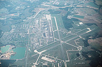
Tag:aerodrome:type=military
Jump to navigation
Jump to search
| Description |
|---|
| A place where military planes take off and land. |
| Group: aeroways |
| Used on these elements |
| Requires |
| Useful combination |
|
| Status: in use |
| Tools for this tag |
|
Description
- See military airbase on Wikipedia
An military aerodrome is a place where military planes take off and land. Some military air forces permits or combine use of military aerodrome with civil operations.
A more common tag for military aerodromes, including air bases and airfields, is military=airfield.
How to map
- aeroway=aerodrome – indicates that it is an aerodrome or airfield
- aerodrome=* obligatory
- landuse=military obligatory
- name=*
- operator=*
- icao=* – ICAO Code of the air base
- iata=* – IATA Code of the air base
For more tags see Aeroways.

