Tag:beacon:type=VOR
Jump to navigation
Jump to search
| Description |
|---|
| VOR System |
| Group: aeroways |
| Used on these elements |
| Requires |
| Status: de facto |
| Tools for this tag |
|
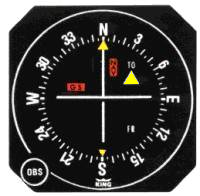
Very High Frequency (VHF) Omni-Directional Range (VOR) is a type of short-range radio navigation system for aircraft, enabling aircraft with a receiving unit to determine its position and stay on course by receiving radio signals transmitted by a network of fixed ground radio beacons.
A similar system that is more precise is called DVOR and can be marked with beacon:type=DVOR
How to map
Set a node ![]() where the transmitter is and add
where the transmitter is and add
Useful combination tags
- beacon:code=*
- beacon:frequency=*
- beacon:channel=*
- operator=*
- ele=*
Photo
Symbol
Symbol for VOR and DVOR
See also
- beacon:type=VOR/DME - VOR with distance measurement


