Tag:denotation=urban
Jump to navigation
Jump to search
| Description |
|---|
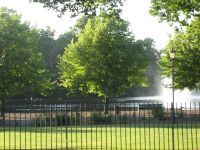
| An "urban" tree, usually found within settlements, e.g. in parks or spread through residential areas. |
| Group: properties |
| Used on these elements |
| Requires |
| Status: de facto |
| Tools for this tag |
|
An "urban" tree, usually found within settlements, e.g. in parks or spread through residential areas. For large or dense groups of trees it may be better to just map the surrounding polygon with landuse=forest.
See also
- denotation=* - Other denotations
