Tag:industrial=automotive_parts
Jump to navigation
Jump to search
| Description |
|---|
| A factory which produces auto parts |
| Group: industrial |
| Used on these elements |
| Requires |
| Useful combination |
| Status: in use |
| Tools for this tag |
|
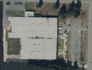
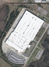
Establishments primarily engaged in manufacturing and/or rebuilding motor vehicle parts and accessories. Examples include engines and engine parts, electrical and electronic equipment, steering and suspension components, brake systems, transmissions and power train parts, seating and interior trim, and stampings. See Wikipedia for a full list.
Use product=* to tag the exact product(s) produced.
How to map
Draw an area ![]() around the grounds of the auto part factories or place a node
around the grounds of the auto part factories or place a node ![]() at the centre of the grounds.
at the centre of the grounds.
Add
Examples
| Photo | Tagging | Note |
|---|---|---|

|
man_made=works landuse=industrial name=Stant operator=Stant Manufacturing Inc. product=automotive_radiators |
A tagging example |
