New Popular Edition
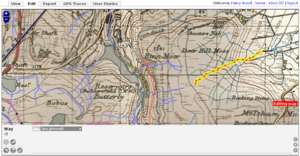
The New Popular Edition (NPE) is a complete set of 1-inch-to-the-mile mapping of England and Wales, published by the Ordnance Survey in the 1940s and now out of copyright. It has been scanned, rectified (i.e. squared up), and cut into tiles which are available for tracing and for mashups (view online).
The New Popular Edition is not to be confused with the similarly named Popular Edition, an older set of maps used on npemaps.org.uk to provide coverage for Scotland. See the grid at Out-of-copyright maps#Old maps which OSM people have.
Alternatively, the newer 7th Series 1-inch maps are starting to emerge from their copyright protection and into OSM - especially important for most of Scotland not covered by NPE.
Tracing from the New Popular Edition
When tracing from NPE, please tag source=NPE to indicate the way comes from NPE maps.
Potlatch
To show NPE maps, select 'OS New Popular Edition historic' from the Background menu.
The NPE maps can be only be used at zoom levels. 13, 14 and 15 (To check your zoom level, hover your mouse over the 'Edit' tab and the URL will have 'zoom=14' in it.)
Sometimes, the Ordnance Survey's surveying was slightly askew, and doesn't match up with real GPS traces. To line NPE up with real data, hold down Space and drag the map.
JOSM
To use NPE maps in newer versions of JOSM simply activate the 'OS New Popular Edition historic' layer in the Edit→Preferences→WMS/TMS tab. In older versions you may have to 'Add' the layer using tms[6:15]http://ooc.openstreetmap.org/npe/{zoom}/{x}/{y}.png as the 'Imagery URL' (read more).
You can now select the layer from the Imagery menu when editing.
Scotland note: ooc.openstreetmap.org does not have maps of Scotland - use the older nick.dev.openstreetmap.org instead.
Merkaartor
You'll need to add NPE to the TMS adapter (Tools->Preferences->Background Image) with the following:
- Name: New Popular Edition
- Server address: ooc.openstreetmap.org
- Path:/npe/%1/%2/%3.png
- Tile size:256
- Minimum zoom:6
- Maximum zoom:15
Unlike the JOSM plugin, there is no grid of expected intersections, so it's best used only for getting names, summit heights etc. If you must use it for tracing, please only do so if you can independently confirm at least some of the positions on the way(s).
Deploying NPE tiles in your Website or Software
Using OpenLayers
The javascript file at http://ooc.openstreetmap.org/openlayers/OOC.js provides an OpenLayers.Layer.NPE class which can be used to add an NPE layer to an OpenLayers map as follows:
 var npe = new OpenLayers.Layer.NPE("OS NPE");
 map.addLayer(npe);
Using elsewhere
The newly rectified tiles used by Potlatch are at http://richard.dev.openstreetmap.org/npe/z/x/y.jpg, where z, x and y are standard "like-Google" tile co-ordinates (See Slippy map tilenames) Please respect the licence which is the same as that used by npemap - tracing is unrestricted, but the images themselves are subject to a non-commercial restriction which may be relaxed on application.
Error Checklist
If you find rogue tiles anywhere on Potlatch's NPE layer, please flag them up here.
Mainland
- Odd misplaced squares in Devon and Cornwall
- http://www.openstreetmap.org/?lat=50.9942&lon=-3.8257&zoom=14&layers=B000FTF South of S Molton
- http://www.openstreetmap.org/?lat=51.0412&lon=-4.1674&zoom=14&layers=B000FTF East of Appledore
- http://www.openstreetmap.org/?lat=50.9946&lon=-4.2053&zoom=14&layers=B000FTF Just S of Bideford
- http://www.openstreetmap.org/?lat=50.7719&lon=-4.5795&zoom=14&layers=B000FTF Just S of Bude
- Sheet joins:
- Eastern Lake District, Howgill Fells, Yorkshire Dales to edge of North York Moors: from http://www.openstreetmap.org/edit?lat=54.4242&lon=-2.848&zoom=13 (Troutbeck) to http://www.openstreetmap.org/edit?lat=54.414&lon=-1.1922&zoom=13 (NE of Northallerton)
- Tiny missing bits of coastline where it goes outwith the usual sheet boundaries (probably won't fix)
- Aberaeron: missing coastline - http://www.openstreetmap.org/edit?lat=52.2432&lon=-4.26&zoom=14
- Whitby: missing coastline - http://www.openstreetmap.org/edit?zoom=14&lat=54.47224&lon=-0.57143
- Snippet of coastline north of Hunstanton missing - http://maps.compton.nu/?zoom=13&lat=52.97589&lon=0.56127&layers=000000000000B0
- Incorrectly positioned area in North Dorset / South Somerset
Islands and peninsulas
Islands and peninsulas in insets are not yet rectified to their true position:
Key
Other projects using New Popular Edition mapping
- npemap.org.uk - map browser and postcode collection interface
- gpx.npemap.org.uk - generate GPX files by tracing
- SABRE Maps - Find roads and layer contemporary OSM traces over New Popular mapping (also with a variety of other out of copyright maps)
More info
- FAQ at npemap.org.uk


