Template:Tag:highway=pedestrian
Jump to navigation
Jump to search
This documentation is transcluded from Template:Tag:highway=pedestrian/doc. (Edit | history)
Note to editors: Please don't categorize this template by editing it directly. Instead, place the category in its documentation page, in its "includeonly" section.
Note to editors: Please don't categorize this template by editing it directly. Instead, place the category in its documentation page, in its "includeonly" section.
Usage
All parameters are optional. By default, text is in English. English writers shall write their comments in the template itself (avoiding double edition). Other languages are translated in template arguments, not in the template itself.
Notes
The Gallery translation doesn't work as expected...
Syntax
Parameters
Examples
Template for copy/paste...
<noinclude>{{Languages|Template:Sv:Tag:highway=pedestrian}}</noinclude>{{Tag:highway=pedestrian

|head:Examples==== Examples ===
|head:photo=Photo
|head:tags=Tags
|head:OSM_Carto=OSM-Carto
|OSM_Carto=OSM-Carto
|Lloydpassage:desc=
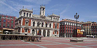
|Valladolid:desc=
|Ettlingen:desc=
|Ped_Street:desc=
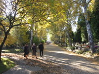
|cemetery:desc=Cases like this might also be tagged as a footway or a path, depending on the local community’s standards
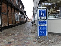
|Kørsel_tilladt:desc=Similar to {{Tag|highway|living_street}}, but slightly stricter on vehicles.
See also
Examples
| Photo | Tags | OSM-Carto |
|---|---|---|

|
highway=pedestrian name=Lloydpassage |
 |

|
highway=pedestrian area=yes name=Weyher Marktplatz place=square | |

|
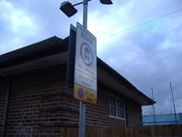
highway=pedestrian access:conditional=delivery @ (00:00-11:00) bicycle=yes |
— |

|
highway=pedestrian name=The Moorings motorcar=destination motorcycle=destination |
— |

|
highway=pedestrian noname=yes Cases like this might also be tagged as a footway or a path, depending on the local community’s standards |
https://www.openstreetmap.org/#map=19/50.09722/19.97816 |

|
highway=pedestrian name=Fiskergade vehicle=yes note="Gågade" Pedestrian street with "Kørsel tilladt" vehicles allowed. Driving is allowed here, but (tourist)pedestrians are prioritized higher, so motorists basically can't expect to move faster than the pedestrian in front of them. Similar to highway=living_street, but slightly stricter on vehicles. |
This table is a wiki template with a default description in English. Editable here.
Example table for Tag:highway=pedestrian
| Parameter | Description | Type | Status | |
|---|---|---|---|---|
| === Examples === | head:Examples | Origin | String | optional |
Lloydpassage:desc | Comments | String | optional | |
Valladolid:desc | Comments | String | optional | |
Ettlingen:desc | Comments | String | optional | |
Ped_Street:desc | Comments | String | optional | |
| Cases like this might also be tagged as a footway or a path, depending on the local community’s standards | cemetery:desc | Comments | String | optional |
| Similar to {{Tag|highway|living_street}}, but slightly stricter on vehicles. | Kørsel_tilladt:desc | Comments | String | optional |