US National Inventory of Dams
The United States National Inventory of Dams is maintained by the U.S. Army Corp of Engineers and has an ID number for each dam they've cataloged in the United States. In OpenStreetMap the NID's ID number can be stored on dams and weirs using ref:US:NID=*.
The U.S. Army Corp of Engineers maintains the database as well as many of the largest dams in it. However information on most of the over 90,000 dams recorded in it are provided to them by state-level agencies. This article was created to document progress on tagging dams in OSM with their NID ID where applicable. This article also serves as a place to record information on the other state-level agencies in the United States that catalog information on dams.
For more information about the NID, please also see Key:ref:US:NID.
Identifying and tagging dams in the United States
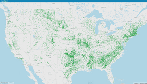
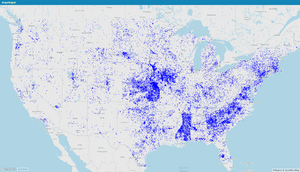
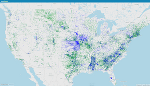
As of December 28, 2023 47,339 dams and weirs in the United States have been tagged with ref:US:NID=*, representing 46,687 unique NID dams. This number is most likely the high-water mark, at least until more dams are created in OSM.
From the 50 MapRoulette challenges listed below, all have been completed. Nine users participated, accepting 11,031 of the 12,263 tag change tasks.
At present 55.08% of the 85,942 existing dams and weirs in the United States in OSM have been tagged with ref:US:NID=*. These cover 50.83% of the 91,843 dams in the NID.
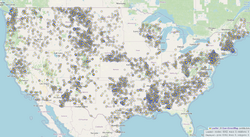
Regarding GNIS, there are 56,959 dams listed in the historical files updated for the final time in 2021 and 48,969 of them still exist in OSM, the 8k difference having been deleted sometime in the past decade or possibly never imported. Of the 49k still existing, 41,836 have been matched and tagged with ref:US:NID=*. Of the remaining 7 thousand, about 1 thousand have been turned into ways already and likely exist where they are drawn. Of the remaining just over 6,000 GNIS-imported nodes still out there that couldn't be cross referenced with the NID, the data from the individual states could still be used to confirm their names and locations but no action on that front has been taken yet.
During the past two months, approximately 4,700 GNIS dam nodes were manually moved at least 100 meters to put them closer to where they belong thanks to the coordinates from the NID. Approximately 2,000 of those also had a reservoir node at the same coordinates that was moved with it. (Examples: 143630801 (achavi, OSMLab), 143628532 (achavi, OSMLab))
For the 30,586 dam nodes tagged with ref:US:NID=*, they should mostly be within 500 meters or less of where they belong and it should hopefully be possible for mappers to tell what body of water they belong next to based on satellite imagery.
There are still some dam nodes where both GNIS and the NID confirm the location of a dam and yet nothing is visible on satellite. These dams may be gone, or the NID could still be updated in the future with better coordinates. For example, Alabama's office in charge of regulating dams was only established in 2023, and will likely provide updates to the NID in the future.
The below table details efforts during November and December 2023 to tag existing OSM dams and weirs.
- Matches by name and location
- If a dam in the NID is within about a kilometer of a dam in OSM and one of its name fields matches after considering differences such as "Number One" vs. "No. 1", then the OSM node, way, or relation was tagged with ref:US:NID=*.
- Possible matches by location
- If the coordinates of a dam in the NID are within about 750 meters of a dam or weir in OSM, and the additional dam data from the particular state doesn't show another non-NID dam existing any closer, then a MapRoulette task was created to ask if tagging the dam or weir is appropriate (example).
A table of the conflated data is at US National Inventory of Dams/Data Conflation (Page 2) (Page 3) (Page 4) (Page 5) (Page 6) (Page 7) (Page 8).
A project containing all of the MapRoulette challenges is at Dam IDs in the United States.
API
The NID can be queried through its API, with documentation at: https://nid.sec.usace.army.mil/api/developer/static/index.html
Some examples (using Guam because there's only one dam):
- https://nid.sec.usace.army.mil/api/query?sy=@stateKey:GU
- https://nid.sec.usace.army.mil/api/query?sy=@stateKey:GU&addProps=nidId,formerNames,otherNames,damHeight,damLength,riverName,city,county,state,damTypeIds,stateFedId
- https://nid.sec.usace.army.mil/api/query?sy=@stateKey:GU&addProps=all
- https://nid.sec.usace.army.mil/api/dams/GU82301/inventory
You can also query by coordinates, the radius parameter is in miles: https://nid.sec.usace.army.mil/api/query?nr={lon},{lat},{radius}
Dam type IDs:
| 1 | Arch |
| 2 | Multi-Arch |
| 3 | Stone |
| 4 | Roller-Compacted Concrete |
| 5 | Rockfill |
| 6 | Buttress |
| 7 | Masonry |
| 8 | Earth |
| 9 | Gravity |
| 10 | Timber Crib |
| 11 | Concrete |
| 12 | Other |
Viewing as a JOSM layer
Here you can download the complete National Inventory of Dams as a either a *.gpkg or *.csv file. Currently the GeoPackage file is about 76 MB while the csv is about 64 MB. Before opening in JOSM, the csv file will need its first line removed since the actual header is on line 2. And its columns need rearranged so latitude and longitude are first or else the OpenData plugin will have trouble opening it.
Once opened in JOSM as its own layer the data can be formatted using MapCSS. If using the GeoPackage file (no modification necessary), or if using the csv with the header replaced with the below text, then the following MapCSS will display each dam as a large orange dot with other useful information off to the side:
CSV header:
latitude,longitude,name,otherNames,formerNames,nidId,otherStructureId,federalId,ownerNames,ownerTypes,primaryOwnerType,numberofAssociatedStructures,isAssociatedStructure,designerNames,nonFederalDamonFederalProperty,primaryPurpose,purposes,sourceAgency,stateorFederalAgencyId,state,county,city,distancetoNearestCity,riverName,congressionalDistrict,sectionTownshipOrRangeLocation,stateRegulatedDam,federallyRegulatedDam,stateJurisdictionalDam,stateRegulatoryAgency,statePermittingAuthority,stateInspectionAuthority,stateEnforcementAuthority,federalAgencyOwners,federalAgencyInvolvementFunding,federalAgencyInvolvementDesign,federalAgencyInvolvementConstruction,federalAgencyInvolvementRegulatory,federalAgencyInvolvementInspection,federalAgencyInvolvementOperation,federalAgencyInvolvementOther,builtUndertheAuthorityoftheSecretaryofAgriculture,nRCSWatershedDamAuthorization,primaryDamType,damTypeIds,coreTypes,foundation,damHeight,hydraulicHeight,structuralHeight,nidHeight,nidHeightCategory,damLength,volume,yearCompleted,yearCompletedCategory,yearsModified,nidStorage,maxStorage,normalStorage,surfaceArea,drainageArea,maxDischarge,spillwayType,spillwayWidth,numberofLocks,lengthofLocks,lengthofSecondaryLock,lockWidth,secondaryLockWidth,outletGateType,dataLastUpdated,lastInspectionDate,inspectionFrequency,hazardPotentialClassification,conditionAssessment,conditionAssessmentDate,eAPPrepared,eAPLastRevisionDate,websiteURL,operationalStatus,operationalStatusDate,americanIndianAlaskaNativeNativeHawaiian
MapCSS:
node|z7-[federalId]
{
	symbol-stroke-color: #00ffff;
	symbol-fill-color: orange;
	symbol-shape: circle;
}
node|z7-[damTypeIds~=Earth]
{
	symbol-stroke-color: brown;
}
node|z7-9[federalId]
{
	symbol-size:10;
}
node|z10[federalId]
{
	symbol-size:25;
	text: eval(tag("federalId"));
	font-size: 14;
}
node|z11-12[federalId]
{
	symbol-size:25;
	text-halo-color: black;
	text-halo-radius: 1;
	text: eval(concat(tag("federalId"), " ", tag("name")));
	font-size: 14;
}
node|z13-[federalId]
{
	symbol-size:30;
	symbol-stroke-width: 3;
	text-halo-color: black;
	text-halo-radius: 2;
	text: eval(concat(tag("federalId"), " ", tag("name")));
	font-size: 14;
}
node|z15-[federalId]::layer_1
{
	text: eval(concat(tag("damLength")," feet"));
	font-size: 12;
	text-color: #555555;
	font-weight: bold;
	text-halo-color: white;
	text-halo-radius: 2;
	text-offset-x: 16;
	text-offset-y: 17;
}
node|z15-[federalId]::layer_2
{
	text: eval(concat(tag("damTypeIds")," - ",tag("riverName")));
	font-size: 12;
	text-color: #555555;
	font-weight: bold;
	text-halo-color: white;
	text-halo-radius: 2;
	text-offset-x: 16;
	text-offset-y: 6;
}
node|z15-[federalId]::layer_3
{
	text: eval(concat(tag("county"), ", ", tag("state")));
	font-size: 12;
	text-color: #555555;
	font-weight: bold;
	text-halo-color: white;
	text-halo-radius: 2;
	text-offset-x: 16;
	text-offset-y: -26;
}
The result:
State notes
The states of the United States have their own agencies responsible for regulating dams. They provide that data to the U.S. Army Corp of Engineers for the National Inventory of Dams, but not all dams make the cut. Getting the data for all of the other dams that have been recorded can be useful when identifying dams in OpenStreetMap. For this project, this data is being used to help avoid conflating OSM dams with dams in the NID incorrectly. In the future, this information could be useful when looking at GNIS-imported dam nodes that still haven't been turned into ways, to confirm their coordinates from GNIS are correct and that they still exist. The below information is recorded in the hope that it is of use to anyone else.
When querying ArcGIS APIs and outputting to json, it will include exceededTransferLimit: true if your query returned more than 1000 records. In which case you can use the URL parameter resultOffset=1000 to skip the first 1000 when querying it again, and so on. It may be necessary to sort the results with orderByFields=OBJECTID when doing this. Also resultRecordCount can be used to limit the number of results.
In the National Inventory of Dams they store state dam IDs in the field "stateFedId". This can be used to correlate the state data to the NID.
Some states simply use NID formatted identifiers (KY00000) for all of their dams.
Alabama
Alabama's dam safety program was established in 2023.
In some cases the NID's coordinates match those from GNIS, which may or may not have been very precise. In some instances the dams in OSM look good and the coordinates in the NID appear off. In these cases, the dam length measurements from the NID can help identify the correct nearby body of water with one flat side of the same length. Or, when multiple NID dams are at the same coordinates (which they've fixed already in other states) dam length can be used to figure out which goes to which nearby body of water if their sizes are different enough.
For the dams in Alabama now tagged with NID numbers that based on satellite still appear to be misplaced, checking if their coordinates in the NID are updated in the future would be a good idea.
- Website: https://adeca.alabama.gov/water/
Alaska
If the Alaska Department of Natural Resources provides their dam inventory anywhere, it wasn't readily findable.
Arizona
If the Arizona Department of Water Resources provides their dam inventory anywhere, it wasn't readily findable.
- Website: https://www.azwater.gov/dam-safety
Arkansas
NID formatted IDs are in the field "arnum". Then latitude and longitude are "latdd" and "longdd". When querying, the limit is 500 items at a time, so the resultOffset parameter is needed.
- Website: https://www.agriculture.arkansas.gov/natural-resources/divisions/water-management/dam-safety/
- Map: https://www.arcgis.com/home/webmap/viewer.html?url=http%3A%2F%2Fgis.arkansas.gov%2Farcgis%2Frest%2Fservices%2FFEATURESERVICES%2FStructure%2FFeatureServer%2F16&source=sd
- https://gis.arkansas.gov/arcgis/rest/services/FEATURESERVICES/Structure/FeatureServer/16/query?f=json&where=1%3D1&returnGeometry=false&sr=102100&orderByFields=OBJECTID&outFields=*
California
Under Publications on the below website, there are pdfs containing lists of the same dams available from the GIS api. Either way, they contain fields for State_ID and National_ID, Longitude and Latitude. Also either way, they contain almost exactly what is in the NID. Interestingly, many of the dams in OSM in California that were imported from GNIS contain the state's dam ID in their names. This information from the field "stateFedId" from the NID was helpful in matching, and was added to the conflated data in the "former_name" column since most NID dams didn't have anything there.
- Website: https://water.ca.gov/programs/all-programs/division-of-safety-of-dams
- Map: https://gis.data.ca.gov/datasets/98a09bec89c84681ae1701a2eb62f599
- https://gis.water.ca.gov/arcgis/rest/services/Structure/i17_California_Jurisdictional_Dams/FeatureServer/1/query?f=json&where=1%3D1&returnGeometry=false&sr=102100&orderByFields=OBJECTID&outFields=*
Colorado
The Colorado Division of Water Resources split their dams into two categories: jurisdictional and non-jurisdictional. For each group, they provide their dam inventory in multiple formats. All four of the API endpoints below work. Whether using the data.colorado.gov one or the dwr.state.co.us option the same information for the same number of dams is returned, the only difference is format and field names. Either way, the state's dam ID, latitude, and longitude are present. The data.colorado.gov endpoints do not force dam names to be in all caps.
The field nidId is only present for 'jurisdictional' dams and when prefixed with "CO" forms a valid NID ID. Some of the NID dams come from the 'non-jurisdictional' set however. The NID's field stateFedID or just name and coordinates can be used to match them up.
- Website: https://dwr.colorado.gov/services/dam-safety
- Map: https://maps.dnrgis.state.co.us/dwr/Index.html?viewer=mapviewer
- Jurisdictional Dams: https://data.colorado.gov/Water/DWR-Dam-Safety-Jurisdictional-Dam/mgjv-xmr5/about_data
- Non-jurisdictional Dams: https://data.colorado.gov/Water/DWR-Dam-Safety-Non-Jurisdictional-Dam/6smc-zj6j/about_data
Connecticut
DAM_NO is used as the ID. It corresponds to stateFedId for some but not all of what is in the NID from Connecticut. Fields LATITUDE and LONGITUDE contain coordinates.
- Website: https://portal.ct.gov/DEEP/Water/Dams/Dams-Safety
- Map: https://ctdeep.maps.arcgis.com/apps/webappviewer/index.html?id=7c45a89912654f40afc80f86311864bb
- https://services1.arcgis.com/FjPcSmEFuDYlIdKC/arcgis/rest/services/Dams_Public/FeatureServer/0/query?f=json&where=1%3D1&returnGeometry=false&sr=102100&orderByFields=OBJECTID&outFields=*
Delaware
Delaware doesn't seem to have any information outside of the dams in the NID. From their website: “The NID lists 83 regulated and unregulated dams in Delaware.” And: “Since 2008 however, further, more in-depth review of each dam has reduced the number of regulated dams to the current 45.”
Florida
Florida's data closely matches almost exactly what is in the NID. IDs are in the fields NID_ID and FEDERAL_ID. LATITUDE and LONGITUDE are included in the regular json.
- Website: https://floridadep.gov/water/engineering-hydrology-geology/content/florida-dam-safety-program
- Map: https://ca.dep.state.fl.us/mapdirect/?webmap=117572fc888c43c3a03e18c47626d2de
- https://ca.dep.state.fl.us/arcgis/rest/services/OpenData/WRM_UIC_PUBLIC/MapServer/7/query?f=json&where=1%3D1&returnGeometry=false&sr=102100&orderByFields=OBJECTID&outFields=*
Georgia
Georgia offers their dam inventory as a file download currently dated November 2019. Some lines appear duplicated due to multiple owners of the same dam.
- Website: https://epd.georgia.gov/watershed-protection-branch/safe-dams-program
- Spreadsheet: https://epd.georgia.gov/document/document/inventory-dams-november-2019/download
Hawaii
Hawaii's dam information almost exactly matches exactly what is in the NID. Fields stateid and nidid contain ID. Fields latitude and longitude are part of the regular json output.
- Website: https://dlnreng.hawaii.gov/dam/
- List: https://dams.hawaii.gov/
- Map: https://dams.hawaii.gov/Map.aspx
- API: https://geoportal.hawaii.gov/datasets/HiStateGIS::dams/about
- https://geodata.hawaii.gov/arcgis/rest/services/Infrastructure/MapServer/10/query?where=1%3D1&outFields=*&outSR=4326&f=json
Idaho
StateID and NIDID contain IDs. Coordinates require outputting to GeoJson.
- Website: https://idwr.idaho.gov/dams/
- Map: https://data-idwr.hub.arcgis.com/datasets/dams/explore
- https://gis.idwr.idaho.gov/hosting/rest/services/Compliance/Dams/MapServer/0/query?f=geojson&where=1%3D1&returnGeometry=true&sr=102100&orderByFields=OBJECTID&outFields=*
Illinois
If the Illinois Department of Natural Resources provides their dam inventory anywhere, it wasn't readily findable.
Indiana
The main ID is in the field state_id, but then the NID ID is in the field national_id whether the dam is in the NID or not. Latitude and longitude not in any of the fields, so it's necessary to query this one as f=geojson and returnGeometry=true. The geometries are all points.
- Website: https://www.in.gov/dnr/water/dams-and-levees/
- Map: https://www.indianamap.org/datasets/idnr-dam-locations-1/explore
- https://gisdata.in.gov/server/rest/services/Hosted/DAMS_DNR_WATER_IN_RO/FeatureServer/0/query?f=geojson&where=1%3D1&returnGeometry=true&orderByFields=objectid&sr=102100&outFields=*
Iowa
Iowa offers a download of their dam inventory as *.shp and *.dbf files. These contain all of the relevant information including coordinates.
- Website: https://www.iowadnr.gov/Environmental-Protection/Land-Quality/Dam-Safety
- Database?: http://iowadnr.knack.com/dams
- Download: https://www.arcgis.com/home/item.html?id=42b47ba311f14dfaa014dfacd2ef278d
Kansas
Kansas has publicly available GIS data on reservoirs and on what areas would flood if a particular dam was breached but no obvious listing of all the dams they've inventoried.
Something to note is Kansas has over 6,000 dams in the NID and 3,700 of those only have a name in the "otherNames" field. The main "name" field is blank. Then another 460 don't have a name in either field. The completely unnamed dams do visibly exist on satellite at their coordinates though.
Kentucky
The main ID is in the field SUBJECT_ITEM_DESIGNATION. When combined with "KY" it forms an NID ID. As the states get to pick how to number their dams in the NID, Kentucky assigns valid "KY#####" numbers to all of their dams, even if they're not actually included in the NID. Latitude and longitude are in the fields Y_COORD_VALUE and X_COORD_VALUE.
- Website: https://eec.ky.gov/Environmental-Protection/Water/FloodDrought/Pages/DamSafety.aspx
- Map: https://opengisdata.ky.gov/datasets/ky-water-resources-regulated-dams/explore
- Both return the same results:
- https://kygisserver.ky.gov/arcgis/rest/services/WGS84WM_Services/Ky_WaterResources_WGS84WM/MapServer/1/query?f=json&where=1%3D1&returnGeometry=false&sr=102100&outFields=*
- https://eppcgis.ky.gov/arcgis/rest/services/Dams/Ky_Dow_Regulated_Dams_WGS84WM/MapServer/0/query?f=json&where=1%3D1&returnGeometry=false&sr=102100&outFields=*
Louisiana
If the Louisiana Department of Transportation and Development provides their dam inventory anywhere, it wasn't readily findable.
Maine
Maine's dam inventory is great. If layer 1 is queried as geojson each dam is represented as a point. If layer 3 is queried then each dam is represented as a polygon. Relevant fields in layer 1 include ID which is the NID formatted identifier (whether the dam is in the NID or not), and MSV_ID seems to be the main state identifier.
- Website: https://www.maine.gov/mema/hazards/dam-safety
- Map: https://maine.hub.arcgis.com/maps/42548401c6ad4bbda82af0b82bb3e607/explore
- https://gis.maine.gov/arcgis/rest/services/dep/Maine_Dams_Levees_Impoundments_Barriers/MapServer/1/query?f=geojson&where=1%3D1&returnGeometry=true&sr=102100&orderByFields=OBJECTID&outFields=*
Maryland
Fields State_ID and National_ID contain identifiers and Latitude and Longitude have coordinates.
- Website: https://mde.maryland.gov/programs/water/damsafety/pages/index.aspx
- Map: https://mdewin64.mde.state.md.us/WSA/Dams/index.html
- https://mdewin64.mde.state.md.us/arcgis/rest/services/DamSaftey/MD_Dams/MapServer/0/query?f=json&where=1%3D1&returnGeometry=false&sr=102100&orderByFields=OBJECTID&outFields=*
Massachusetts
The data from Massachusetts is good, but it's only available as a shapefile download or an online geoserver map.
- Website: https://www.mass.gov/office-of-dam-safety
- Download and map: https://www.mass.gov/info-details/massgis-data-dams
Michigan
Michigan has dam ID numbers in the field Dam_ID and then federal IDs in NIDID. Dam_ID is just the number taken out of the NID ID. Latitude and longitude have their own fields of the same names.
- Website: https://www.michigan.gov/egle/about/organization/water-resources/dam-safety
- Map: https://egle.maps.arcgis.com/apps/webappviewer/index.html?id=f8c0637f34864bcbabb9c794fd8e452b
- https://gisagoegle.state.mi.us/arcgis/rest/services/EGLE/DamInventoryOpenData/MapServer/0/query?f=json&where=1%3D1&returnGeometry=false&sr=102100&orderByFields=OBJECTID&outFields=*
Minnesota
GeoJson is necessary for coordinates. The field nid_id has IDs for all dams, in the NID or not.
- Website: https://www.dnr.state.mn.us/waters/surfacewater_section/damsafety/index.html
- Map: https://arcgis.dnr.state.mn.us/ewr/dam_finder/
- https://arcgis.dnr.state.mn.us/arcgis/rest/services/ewr/dam_finder_db/MapServer/0/query?f=geojson&where=1%3D1&returnGeometry=true&sr=102100&orderByFields=OBJECTID&outFields=*
Mississippi
The field STATEID contains NID formatted IDs (MS12345). LatDD and LongDD have coordinates. This data contains almost 7,000 dams.
Mississippi dams in the old GNIS data versus the current NID have an interesting phenomenon where GNIS will have multiple dams with the same name (example, there are five different instances of "Farm Land Company Lake Dam"). However they aren't duplicates, the NID will have given them distinct names, adding "Number 2", etc. Then, the coordinates from GNIS will have been accurate but not precise - they'll all be offset from their bodies of water in one direction or another by up to several hundred meters. In these cases it was mostly straightforward to figure out which dam went where when looking at them visually. Hopefully most of the occurrences of this are now fixed.
- Website: https://www.mdeq.ms.gov/water/dam-safety/
- Map: https://msdeq.maps.arcgis.com/apps/webappviewer/index.html?id=86480c3ec4f04bc19c677d17287bf5fd
- https://gis.deq.ms.gov/arcgis/rest/services/olwr/MSDamsApp/MapServer/0/query?f=json&where=1%3D1&returnGeometry=false&sr=102100&orderByFields=OBJECTID&outFields=*
Missouri
Layer 0 is regulated dams (about 700 of them), layer 1 is non-regulated (about 4,800 dams). Fields LATITUDE and LONGITUDE have coordinates, ID_NO has the NID-compatible identifier. Many dams have additional descriptions included in their names in parenthesis (dry, not built, too small, breached, ...).
- Website: https://dnr.mo.gov/land-geology/dam-reservoir-safety/dams
- Map: https://gis-modnr.opendata.arcgis.com/maps/dams/explore
- Regulated: https://gis.dnr.mo.gov/arcgis/rest/services/water/dams/MapServer/0/query?f=json&where=1%3D1&returnGeometry=false&sr=102100&orderByFields=OBJECTID&outFields=*
- Unregulated: https://gis.dnr.mo.gov/arcgis/rest/services/water/dams/MapServer/1/query?f=json&where=1%3D1&returnGeometry=false&sr=102100&orderByFields=OBJECTID&outFields=*
Montana
This information comes from Montana Fish, Wildlife & Parks which published it in 2019. Unfortunately it seems mostly the same as what GNIS had. Coordinates are in the fields LAT and LONG_.
- Website: https://dnrc.mt.gov/Water-Resources/Dam-Safety/
- Map: https://gis-mtfwp.hub.arcgis.com/datasets/bf7118ba1a0149a78677362c436a7b61/explore
- https://services3.arcgis.com/Cdxz8r11hT0MGzg1/arcgis/rest/services/REFRNC_DAMS/FeatureServer/0/query?f=json&where=1%3D1&returnGeometry=false&sr=102100&orderByFields=OBJECTID&outFields=*
Nebraska
Field NIDID contains the NID ID. Latitude and Longitude are part of the regular json. Use the url parameter resultOffset to get up to 2000 records at a time.
About 270 of Nebraska's dams in the NID have the number part of their NID ID tacked onto their name for some reason, most likely to cause dams to have unique names. This was stripped out for data conflation purposes as it couldn't possibly match otherwise.
- Website: https://dnr.nebraska.gov/dam-safety
- Map: https://gis.ne.gov/portal/apps/webappviewer/index.html?id=2aab04a13817421992dc5398ad462e22
- https://gis.ne.gov/Agency/rest/services/Dams_External_Feature_Service/FeatureServer/0/query?f=json&where=1%3D1&returnGeometry=false&sr=102100&orderByFields=OBJECTID&outFields=*
Nevada
Fields NATID and STATEID have identifiers. LATITUDE and LONGITUDE have coordinates.
- Website: http://water.nv.gov/programshomes.aspx?program=Dams%20and%20Dam%20Safety
- Map: https://www.arcgis.com/apps/mapviewer/index.html?layers=cd8be45bed90495989b8b33e708ecc10
- https://arcgis.water.nv.gov/arcgis/rest/services/NDWR/Dam_Sites/FeatureServer/0/query?f=json&where=1%3D1&returnGeometry=false&sr=102100&orderByFields=OBJECTID&outFields=*
New Hampshire
State ID is in the filed DAM. NID IDs are in the field NATDAMID but only some of the time. LATITUDE and LONGITUDE contain coordinates. The field STATUS seems to indicate which dams no longer exist with the values "REMOVED" or "RUINS".
- Website: https://www.des.nh.gov/water/dam-maintenance-and-management
- Map: https://new-hampshire-geodata-portal-1-nhgranit.hub.arcgis.com/datasets/nh-dam-inventory/explore
- https://nhgeodata.unh.edu/nhgeodata/rest/services/IWR/Dams/MapServer/0/query?f=json&where=1%3D1&returnGeometry=false&sr=102100&orderByFields=OBJECTID&outFields=*
New Jersey
If the New Jersey Department of Environmental Protection provides their dam inventory anywhere, it wasn't readily findable.
New Mexico
Closest thing to a state dam inventory is at the url below. It contains 105 dams described as "major". 83 match what is in the NID, leaving 22 extra dams.
- Website: https://www.ose.state.nm.us/dams/
- New Mexico Major Dams: https://rgis.unm.edu/rgis6/dataset.html?uuid=e390956e-c89f-4925-a8cf-706a360d0977
New York
The New York Department of Environmental Conservation provides their dam inventory as either a KMZ file or through an ArcGIS service. Both have roughly the same number of dams and both look to have been last updated in the past year. The KMZ (zipped KML) file contains more fields however, including FEDERAL_ID. If using the service, requesting GeoJson is necessary to get coordinates. The maximum number of results at a time is 2000.
- Website: https://www.dec.ny.gov/lands/4991.html
- Download KMZ: http://www.dec.ny.gov/maps/nysdams.kmz
- Map: https://www.arcgis.com/home/item.html?id=5a7d83359cc842e08711215408f5b55c
- https://services6.arcgis.com/DZHaqZm9cxOD4CWM/arcgis/rest/services/Dams/FeatureServer/29/query?f=geojson&where=1%3D1&returnGeometry=true&sr=102100&orderByFields=OBJECTID&outFields=*
North Carolina
The North Carolina dam inventory can be downloaded as an Excel spreadsheet, a KML file, or a zipped shapefile. Last updated May 2023, which is really good.
- Website: https://www.deq.nc.gov/about/divisions/energy-mineral-and-land-resources/dam-safety
- Download: https://northcarolinadeptofenvandnat.sharefile.com/d-s5bc5eb354fa54907b0d903b2de0c447a
North Dakota
The dam inventory from the North Dakota Department of Water Resources can be downloaded as a shapefile from their map page. Dams is under "Water Resources". They also have a search page but no api.
- Website: https://www.swc.nd.gov/reg_approp/dam_safety/
- Map: https://mapservice.dwr.nd.gov/index.php?active=Dams
- Search: https://www.dwr.nd.gov/info_edu/map_data_resources/structures/
Ohio
The main identifier for Ohio is called FILENO. Most though not all of the NID dams are in classes 1 thorugh 3. Latitude and longitude are in the fields LAT_CALC and LONG_CALC.
- Website: https://ohiodnr.gov/discover-and-learn/safety-conservation/about-ODNR/water-resources/ohio-dam-safety
- Map: https://gis.ohiodnr.gov/MapViewer/?config=ohiodams
- Class I dams: https://gis.ohiodnr.gov/arcgis/rest/services/DSW_Services/Ohio_Dams/MapServer/1/query?f=json&where=1%3D1&returnGeometry=false&sr=102100&outFields=*
- Class II dams: https://gis.ohiodnr.gov/arcgis/rest/services/DSW_Services/Ohio_Dams/MapServer/2/query?f=json&where=1%3D1&returnGeometry=false&sr=102100&outFields=*
- Class III dams: https://gis.ohiodnr.gov/arcgis/rest/services/DSW_Services/Ohio_Dams/MapServer/3/query?f=json&where=1%3D1&returnGeometry=false&sr=102100&outFields=*
- Other dams: https://gis.ohiodnr.gov/arcgis/rest/services/DSW_Services/Ohio_Dams/MapServer/4/query?f=json&where=1%3D1&returnGeometry=false&sr=102100&outFields=*
Oklahoma
Oklahoma uses the field nidid for the ID every dam. No fields for latitude and longitude, so f=geojson and returnGeometry=true are needed. Interesting are the dams with a "gis_type" of "OWRB - Drained". So, according to the Oklahoma Water Resources Board, who provides all of this information, these dams may be gone.
- Website: https://oklahoma.gov/owrb/dam-safety.html
- Map: https://owrb.maps.arcgis.com/apps/webappviewer/index.html?id=cbbbc867f4c64aebb3b829c8a62739e4
- https://owrb.csa.ou.edu/server/rest/services/Hazard/Dam_Inventory/MapServer/10/query?f=geojson&where=1%3D1&returnGeometry=true&sr=102100&orderByFields=OBJECTID&outFields=*
Oregon
The Oregon Water Resources Department provides a user interface for searching their dam inventory. Searching without providing any parameters simply returns all of their data as an HTML table. The first column is an NID-formatted string (OR00000) whether the dam is in the NID or not.
- Website: https://www.oregon.gov/owrd/programs/streamslakessanddams/dams/dsprogram/pages/default.aspx
- Data: https://apps.wrd.state.or.us/apps/misc/dam_inventory/
Pennsylvania
From the Pennsylvania Department of Environmental Protection: “For security reasons, information regarding Dams, Explosive Storage Locations, Public Water Supplies, and certain Water Pollution Control, Water Resource, and Radiation Facilities are not displayed on eMapPA.”
Many dams in Pennsylvania include their state ID number as part of their name, e.g. "Core Creek (Pa-620)", or even as their entire name: "Pa-470 Dam". This occurs in a few dozen instances in both OpenStreetMap and in the National Inventory of Dams for dams in Pennsylvania, but not necessarily for the same ones at the same time. So, for this project both the name before the ID number, and the ID number itself were used to find matches.
Rhode Island
GeoJson/returnGeometry is necessary to get coordinates. It might be possible to relate STATE_ID in the Rhode Island data to stateFedId in the NID but correlating dams between the two of them by coordinates and name also works.
- Website: https://dem.ri.gov/environmental-protection-bureau/compliance-and-inspection/compliance-programs/dam-safety
- Map: https://www.rigis.org/datasets/dams/explore
- https://services2.arcgis.com/S8zZg9pg23JUEexQ/arcgis/rest/services/Dams/FeatureServer/0/query?f=geojson&where=1%3D1&returnGeometry=true&sr=102100&orderByFields=OBJECTID&outFields=*
South Dakota
The South Dakota Department of Agriculture & Natural Resources doesn't seem to publish a dam inventory. They have a Dry Draw Location Notice Search that displays owners and coordinates for certain dams but nothing like a name or ID number for them.
South Carolina
The fields Site_name_alt and SITE_NUMBER appear to be the state ID to compare to the NID's stateFedId field. Latitude and Longitude are fields in the plain json.
Many of the dams in OSM in South Carolina that were imported from GNIS contain the state's dam ID in their names. This is the same as in California. This information from the field "stateFedId" from the NID was helpful in matching, and was added to the conflated data in the "former_name" column just as a place to stick it for reference.
A note that states are alowed to use letters in their NID ids and South Carolina actually does it with 52 dams having ids beginning "SCD" followed by four numerical digits.
- Website: https://scdhec.gov/BOW/dams-reservoirs-safety-program-overview
- Map: https://gis.dhec.sc.gov/scdams/
- https://gis.dhec.sc.gov/arcgis/rest/services/water/dams_eperm2/MapServer/0/query?f=json&where=1%3D1&returnGeometry=false&sr=102100&orderByFields=OBJECTID&outFields=*
Tennessee
Tennessee's data includes an ID field, but the stateFedId in the NID is blank for everything from the state so correlating which dams from this source are already in the NID is tricky. Coordinates are in the fields LAT_DD and LONG_DD.
- Website: https://www.tn.gov/environment/program-areas/wr-water-resources/water-quality/safe-dams-program.html
- Map: https://tdec-division-of-water-tdec.hub.arcgis.com/datasets/6673164a8fa2470993efd1345bc1c17c_0/explore
- https://tdeconline.tn.gov/arcgis/rest/services/DWR_Public/MapServer/0/query?f=json&where=1%3D1&returnGeometry=false&sr=102100&orderByFields=OBJECTID&outFields=*
Texas
If the Texas Comission on Environmental Quality provides their dam inventory anywhere, it wasn't readily findable. There are some pdfs and spreadsheets listing a few dams at a time, but that's it.
Utah
DamNum is both the state and federal ID. Output to GeoJson for coordinates. Page size is 2000 when using resultOffset to get the next batch of results.
Comparing the dams that are common to both the NID and the inventory from the Utah Division of Water Resources, most of them have different coordinates. The coordinates for about 750 of the 830 dams that are in both sources are between 200 and 215 meters apart - for the same dam in the NID versus the Utah inventory. This is odd since it affects so many dams by almost the same distance. In both sources, the latitude and longitude go out to 8+ decimal places so it isn't a rounding or truncating issue. In most, but absolutely not all, cases the Utah inventory appears more correct. 200 meters can make the difference from being on the water's edge to the middle of a forest, highway, or housing development. A couple of dozen OSM dams were matched to the NID manually to work around this issue.
Since the dam info from the Utah Division of Water Resources feeds into the NID, hopefully this will be sorted out in the future.
- Website: https://water.utah.gov/dam-safety/
- Map: https://maps.waterrights.utah.gov/EsriMap/map.asp?layersToAdd=Dams
- https://services.arcgis.com/ZzrwjTRez6FJiOq4/arcgis/rest/services/Utah_Dam_Inventory/FeatureServer/0/query?f=geojson&where=1%3D1&returnGeometry=true&sr=102100&orderByFields=OBJECTID&outFields=*
Vermont
IDs are in the fields StateID and NationalID, coordinates in LatNAD83 and LongNAD83. Field DamStatus also exists, values include "Drained", "Not in Use", and "Removed" which may be of interest in the future for GNIS-imported nodes still out there.
- Website: http://dec.vermont.gov/water-investment/dam-safety
- Map: https://geodata.vermont.gov/datasets/75b9d3671f474323a22165ba5a4c2677/explore
- https://anrmaps.vermont.gov/arcgis/rest/services/Open_Data/OPENDATA_ANR_FACILITIES_SP_NOCACHE_v2/MapServer/161/query?f=json&where=1%3D1&returnGeometry=false&sr=102100&orderByFields=DamsID&outFields=*
Virginia
Fields latitude and longitude contain coordinates. The field IdNumber is the state ID and also an NID formatted identifier if "VA" is added to the beginning of it. Note: Virginia in the NID uses 6-digit identifiers (VA123456) instead of every other state's 5-digits.
The ArcGIS service will return up to 2000 records at a time.
- Website: https://www.dcr.virginia.gov/dam-safety-and-floodplains/dam-safety-index
- Maps: https://dsfpm-vdcr.hub.arcgis.com/
- Map: https://dsfpm-vdcr.hub.arcgis.com/datasets/557951476d9644d988d30b7a8bf276d6_0/explore
- https://services1.arcgis.com/PxUNqSbaWFvFgHnJ/arcgis/rest/services/DamPointsRegulatory_20230126/FeatureServer/0/query?f=json&where=1%3D1&returnGeometry=false&sr=102100&orderByFields=FID&outFields=*
Washington
Access to Washington's dam inventory can be requested or it can be immediately downloaded as a pdf. The information in the pdf looks complete, it includes about 1200 dams compared to the NID's 800 for the state.
- https://ecology.wa.gov/water-shorelines/water-supply/dams
- https://ecology.wa.gov/water-shorelines/water-supply/dams/info-for-the-public/dams-we-regulate
- https://ecology.wa.gov/research-data/data-resources/geographic-information-systems-gis/data#d
- https://apps.ecology.wa.gov/publications/documents/94016.pdf
West Virginia
All four of these return different but overlapping lists of dams. IDs and latitude and longitude are all over the place. The one consistent thing is that the state ID is always a five digit number, equal to the NID ID without the "WV".
- Website: https://dep.wv.gov/WWE/ee/ds/Pages/default.aspx
- Map: https://wvdep.maps.arcgis.com/apps/dashboards/1556cc1f73dc4db8be12a34bc74f2f8b
- https://gis.transportation.wv.gov/arcgis/rest/services/Hydrology/MapServer/5/query?f=json&where=1%3D1&returnGeometry=false&sr=102100&outFields=*
- https://gis.transportation.wv.gov/arcgis/rest/services/Hydrology/MapServer/6/query?f=json&where=1%3D1&returnGeometry=false&sr=102100&outFields=*
- https://tagis.dep.wv.gov/arcgis/rest/services/app_services/dam_safety/MapServer/2/query?f=json&where=1%3D1&returnGeometry=false&sr=102100&outFields=*
- https://tagis.dep.wv.gov/arcgis/rest/services/app_services/dam_safety_app/MapServer/0/query?f=geojson&where=1%3D1&returnGeometry=true&sr=102100&outFields=*
Wisconsin
DAM_KEY_SEQ_NO is the main state ID. The field NID is populated when applicable. Fields INTERSECT_LATITUDE and INTERSECT_LONGITUDE contain coordinates. When querying, it returns 2000 results at a time. &resultOffset=2000 can be added to get the second page, etc.
The field PHYSICAL_STATUS seems to indicate whether a dam exists or not, which could be useful in the future when trying to further corral GNIS-imported dam nodes.
A large number of Wisconsin dams existing in OpenStreetMap have a string of letters and numbers included in their name tag (ex: "Twin Parks 6 2WP1780 Dam"). This value ("2WP1780") is an "Authorization Approval Description", stored in the field AUTHORIZATION in the data from the Wisconsin DNR. Unlike California, where many dams have the state's dam ID included in the name, this isn't a unique identifier.
For conflating the OSM dams to the NID's data, which does not include this serial number in the name or any other field, it was simplest to just strip it out of the OSM dam's name when making comparisons. This was done with the following regular expression patterns, in the order listed, which covered most but not all cases and allowed about 400 more dams to become exact name matches. The rest, when still physically close to an NID dam, became MapRoulette tasks as normal.
\b2[ -]?WP ?[0-9-]+a?\b
\b3[ -]?WR ?[0-9-]+a?\b
\bWP ?[0-9\.-]+a?\b
\b[CGDEH][ -]?[0-9\.-]+a?\b
\b[A-Z]?[0-9]+[A-Z]+[0-9]+a?\b
If anyone in the future wanted to actually remove these values from the name tags of the dams in OSM, if including them in the name was something only GNIS did, doing so would be possible by using data from the NID or the Wisconsin Department of Natural Resources. But that is outside the scope of this current project.
- Website: https://dnr.wisconsin.gov/topic/Dams
- Map: https://data-wi-dnr.opendata.arcgis.com/datasets/wisconsin-repository-of-dams/explore
- https://dnrmaps.wi.gov/arcgis2/rest/services/WT_DAM/WT_Dam_WTM_Ext/MapServer/0/query?f=json&where=1%3D1&returnGeometry=false&sr=102100&orderByFields=OBJECTID&outFields=*
Wyoming
If the Wyoming State Engineer's Office provides their dam inventory anywhere, it wasn't readily findable.
