User:Catmp
Calgary Area Trail Mapping Project
This user account has been set up to facilate the import and maintain the tracks from the Calgary Area Trail Mapping Project.
Their website is: http://www.calgarycachers.net/trailmaps/maps.htm
This project exists to coordinate and compile trail data for the area of interest to people living in Calgary, Alberta, Canada. This data is built into a map compatible with mapping capable Garmin and Magellan brand GPSr units. The maps are made to be "transparent" and routable with Garmin receivers. This allows other maps such as Mapsource products or the GPSr base map to be viewed at the same time. The maps can be integrated with other Mapsource products or loaded directly to the GPSr.
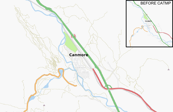
Everyone loves a screen shot:
Doing the conversion and upload
The source file ('Calgary_Area_Trail Map_1_13.mp') was auto-magically converted to '.osm' with mp2osm_catmp.py. Other users should be able to simply adjust this for there own imports (change attribution and file names).
The resultant '.osm' contained
- 2220 Ways
- 83206 Nodes
Since that is rather large just to throw at OSM, I have been using JOSM to select individual or small clusters of ways/nodes and then downloading just a small section of OSM to confirm that there's not too much contention. If it looks OK, I cut and paste between layers and upload the new stuff.
See it soon on the slippy map ;-)
Hurray! Upload completed and kinda-tidied in most places. If you find anything wacky, please correct it. --Mungewell 03:42, 19 June 2008 (UTC)
Permission Thread
The following is from an email exchange, giving permission to use their tracks
From: xxxx To: calgarytrailmaps@shaw.ca Subject: Calgary Area Trail Mapping Project/Open Street Map Collaboration Date: Mon, 5 May 2008 20:11:56 -0400 (EDT) User-Agent: SquirrelMail/1.4.9a
Hi, I found your website (http://www.calgarycachers.net/trailmaps/maps.htm) and I was pretty impressed with the amount of trails that you have managed to compile in the Calgary area.
I am one of the few mappers (in Alberta) working on the OpenStreetMap project (http://www.openstreetmap.org) which, like yourselves, is attempting to provided Free maps.
I noted that you have the source data of your trails available for download, but there does not appear to be any license for this data.
Would it be possible to import your data into OpenStreetMap? All of our data is under the CC-SA 2.0 license, and as such we would need your permission to reuse your data under these terms.
Normally we work from GPX files which would be the most convient form, but have a team of talented monkeys who can convert almost any format (just kidding about the monkeys!).
Yours, Simon Wood. (aka Mungewell)
From: Calgary Area Trail Maps <calgarytrailmaps@shaw.ca> To: xxxxx Subject: RE: Calgary Area Trail Mapping Project/Open Street Map Collaboration Date: Mon, 05 May 2008 18:25:04 -0600 X-Mailer: Microsoft Office Outlook 11
No problem.
The source data is in Polish Format at http://www.calgarycachers.net/trailmaps/Calgary%20Area%20Trail%20Map%20sourc e.zip
The license is in the other download...I suppose I should fix that.
It says:
"Calgary Area Trail Maps are for personal use only. Re-distribution or sale of these maps is stricty prohibited.
The author takes no responsibilty for the accuracy of these maps.
If you get lost, do NOT blame me!!"
However, you can put them on the Openstreet map project as long as it remains free for use.
Do you want to be on the update notification list? These update every couple of months.
Regards,
John
From: Simon Wood <xxxx> To: Calgary Area Trail Maps <calgarytrailmaps@shaw.ca> Subject: Re: Calgary Area Trail Mapping Project/Open Street Map Collaboration Date: Mon, 5 May 2008 20:01:45 -0600 X-Mailer: Claws Mail 2.10.0 (GTK+ 2.12.0; i486-pc-linux-gnu)
Hi John, Thanks for the quick reply, yes please add me to the notification list. This will be the first import I do, so it might take a while. I think the usual proceedure is to credit the source through the use of a specialised user name and I'll also add a URL tag to your website.
Just being pedantic about the license; CC-SA does not forbid commerical use - but does ensure that the data (and any derivative work) must remain Creative Commons. For example I could make a map and sell it, but I can't forbid anyone else using/distrobuting the derivative work. Is this still OK with you?
There aren't many people working OSM in Calgary (yet), personally I happy to release any of my GPS traces into the public domain. If you want any of them they are listed here: http://www.openstreetmap.org/user/Mungewell/traces
Now the days are getting longer I'm planning to get the cycle trails in the NE mapped out.... and hopefully get a bit fitter in the process.
Cheers, Simon.
From: Calgary Area Trail Maps <calgarytrailmaps@shaw.ca> To: 'Simon Wood' <xxxx> Subject: RE: Calgary Area Trail Mapping Project/Open Street Map Collaboration Date: Mon, 05 May 2008 20:23:29 -0600 X-Mailer: Microsoft Office Outlook 11
That is fine.
My username at OSM is "xxxx".
John
