User:FredB/Pedestrian
This is a list of suggestions for how to enter and tag pedestrian related data into OSM. The different tags are already documented on their own pages.
Sidewalks
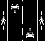
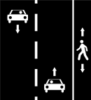
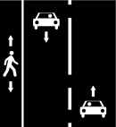
There are two main ways to map the sidewalks : on the street itself or as a separate way.
| Context | On the street | As separate way | ||
|---|---|---|---|---|
| Way A : highway=* + sidewalk=both |
Way A : highway=* | |||
| Way A : highway=* + sidewalk=right |
Way A : highway=* | |||
| Way A : highway=* + sidewalk=left |
Way A : highway=* | |||
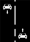
| Way A : highway=* + foot=no | ||||
Pedestrian ways independent from a street
Depending on the nature of the pedestrian way :
| highway=* | Comment |
|---|---|
| pedestrian | Pedestrian roads in shopping and residential areas |
| footway | For designated footpaths |
| path | Non-specific footpaths |
| cycleway | For designated cycleways |
| bridleway | For horses |
| steps | Steps |
Detailed description : Key:highway
Crossings
A crossing between a pedestrian way and a highway can be represented as a point (highway=crossing) and as a line (footway=crossing).
Access restrictions
Default access restrictions are already documented for the pedestrians on each highway type. However, it is sometimes necessary to add another access restriction : the tags below allow to do it for the pedestrians.
| foot=* | Comment |
|---|---|
| yes | Pedestrians are allowed |
| designated | Way specially designated for pedestrian use |
| permissive | Pedestrians have no legal right but the owner allow them on this way |
| no | Pedestrians are not allowed |
All values : Key:access.


