User:Gilbert54/MySandBox/WMS and TMS services for BE
Aerial imagery for Belgium
Aerial imagery provided by Bing is a bit outdated and the quality of the images is not so good. For Belgium we have better options: AGIV and ARCGIS. This imagery is a lot better and also more up-to-date. AGIV aerial imagery covers Flanders and Brussels. ARCGIS covers Wallonia.
Independent map viewers
While this article is intended to provide guidance how to integrate the AGIV and ARCGIS aerial imagery in JOSM, you can also view maps and the corresponding aerial imagery independently in the viewers provided by AGIV, URBIS and ARCGIS. Every region supports one or more viewers, each with its particular set of features, but all with high quality aerial images and good maps.
Flanders
Agiv supports 2 viewers, each with different features:
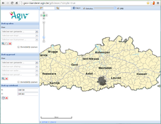
- Agiv generieke viewer: http://geo-vlaanderen.agiv.be/gdiviewer/?simple=true
- ?simple=false produces the same viewer but with different viewing features. Just try it to find out...
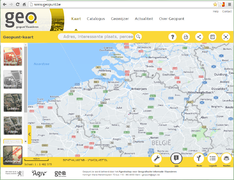
- Geopunt viewer: http://www.geopunt.be
- Note that those viewers will show aerial imagery and streetmaps of Flanders and Brussels, but GRB data (buildings, addresses and other cadastral information) is only available for Flanders.
- Note that those viewers will show aerial imagery and streetmaps of Flanders and Brussels, but GRB data (buildings, addresses and other cadastral information) is only available for Flanders.
Brussels
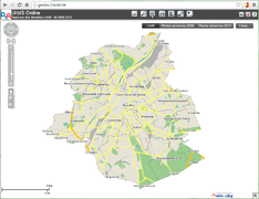
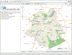
The URBIS/BRUGIS viewers will only cover the Brussels region for maps as well as for aerial imagery.
Wallonia
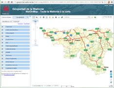
The Catalogue tab reveals a rich set of interesting selections.
Explaining the details about those viewers is beyond the scope of this wiki, but feel free to create a wiki page to cover this topic.
Integrating imagery for Belgium in JOSM
JOSM comes with a built-in plug-in to show images as overlay on the maps. A general explanation about the use and configuration of this feature can be found in the help section of JOSM:
- https://josm.openstreetmap.de/wiki/Help/Menu/Imagery
- https://josm.openstreetmap.de/wiki/Help/Preferences/Imagery
Most of the imagery available via this plug-in is aerial imagery, but you will see that also other very useful information can be displayed on your map. The only condition is that those images can be retrieved using a WMS or TMS service.
On a final note, keep in mind that the use of any imagery is subject to license conditions.There is usually no problem for viewing the images, but for some of the WMS/TMS services other uses like copying may be prohibited.
If you took a peek at the JOSM help files, you should know how to get to the point where you add a new WMS service in the JOSM preferences.
Flanders
- Select Preferences in the Edit menu (shortcut F12). The Preferences window pops up.
- In the left panel of the Preferences settings window select WMS/TMS
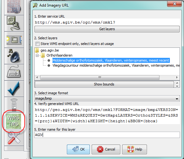
- The lower panel shows the currently activated imagery providers. Click +WMS to add a new item. The Add Imagery URL window pops up.
- Enter http://wms.agiv.be/ogc/wms/omkl? in the first field and click on Get layers
- The site will return a list with available imagery layers. Select Middenschalige orthofotomozaïek, Vlaanderen, winteropnames, meest recent; don't use the Vliegdagcontour. If you click Show bounds another window will open showing the map of Belgium with a rectangle over Flanders. This is the area covered by AGIV.
- Select the image format for the imagery overlay. The default format is BMP.
- JPEG, BMP, PNG, PNG24 and PNG32 are fine
- PNG8 or GIF works, but the images are lower in quality (noise, colour contouring artefacts)
- TIFF and SVG + XML doesn't render an image
- There may be performance differences for the different image formats, but with my high-speed internet connection I don't notice any difference in speed or image quality.
- Enter a name for this layer: AGIV
Click OK to save add he new imagery provider to the list of selected entries. Exit the preferences setting function with OK. AGIV will now appear in the Imagery drop-down selection list in JOSM.
Add AGIV GRB WMS layer to the imagery options in JOSM
The procedure to add this as a WMS layer is the same as for the aerial imagery.
- URL: http://grb.agiv.be/geodiensten/raadpleegdiensten/GRB-basiskaart/wms?
- Layer selection: GRB_Basiskaart
- The screenshots show the URL configuration screen and a mock-up of JOSP with with and without the GRB layer.

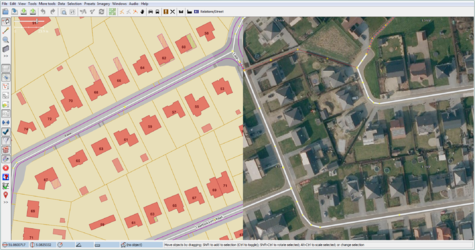
CAUTION: The intended use of the GRB layer is to facilitate verification the location of the house numbers. Copying/tracing of the house contours or other map details is not permitted.
