User:Grimaldi
This user uses or has experience with a Garmin Dakota and is willing to answer questions on it from OSM users.
| Grimaldi überträgt Daten an OpenStreetMap mit Hilfe von JOSM. |
Using Notes on a Garmin Dakota 20
Recently I discovered, that the OSM API provides access to the notes as a gpx file. So I downloaded my homezone using the API and put it on my Garmin Dakota 20 device. Unfortunately the vanilla file does not display in a way, so that it could be used for surveying and map correction.
How the standard gpx is rendered
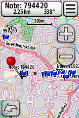
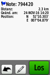
In the screenshots on the right you can see, how the Garmin device renders the standard notes.gpx file, as generated by the OSM API per default. As you can see blue flags are displayed on the map and the Note ID is shown. When selected (red pin), the Note ID is displayed on the button on the top, which - when clicked - displays the details, which is empty. A cgeoser look at the file and the options for waypoints show, that the Dakota 20 displays the name and the comment field of a waypoint (the latter limited to 30 characters), which is empty in the default notes.gpx. The API fills the description field instead, which is ignored by the device.
So how can one use notes and the Dakota 20 for mapping?
The Idea: render notes as geocaches
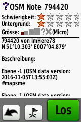
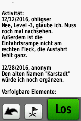
The Dakota 20 has a much richer display for Geocaches. It supports some rudimentary html-formatting like bold and italics, displays log-entries of cachers, which can be used to render the dialog found in some notes and in addition by marking a geocache as "found", the device will support a workflow on notes. Compare to the note itself.
The solution
Write a converter, which converts the default API to geocaches. Stay tuned. :-)


