User:Kendzi/buildingConstruction
Level of details inside OSM drastically increased over past few years. Currently we are in point where micro-mapping is something normal and “practiced” by many OSM committers. Never less current shape of tagging of buildings construction and building indoors is still not well defined. There are few sometimes excluding tagging schema. They are usually focused on some single aspect e.g. navigation inside building and they completely ignore some other aspect as 3d visualization of buildings. 3D presentation of indoors is extremely important aspect because mostly used localization method as GPS is is not working inside building. Other method of locating inside building are not are not commonly used or not reliable. Person which is using indoor navigation have to base on them self and on 3d preview.
Indoors tagging proposals:
- http://wiki.openstreetmap.org/wiki/IndoorOSM
- http://wiki.openstreetmap.org/wiki/F3DB
- http://wiki.openstreetmap.org/wiki/Indoor_Mapping#Tagging_proposals
Building tagging levels
Level 1
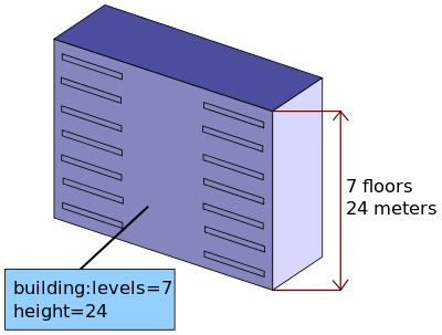
Most basic level for storing information about existing building by using its outline and some basic information about its height, number of levels or shape of roof. Tagging of building outline will give most simple overview of building.
Level 2
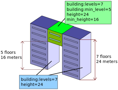
More geometrical shapes could be tagged using building:parts concept. Where single building could be build from several solid object. Each of them have its own 2d polygon, height, color, shape of top. All building parts could be connected into one logical building structure using relation or by finding overlapping polygons.
Level 3
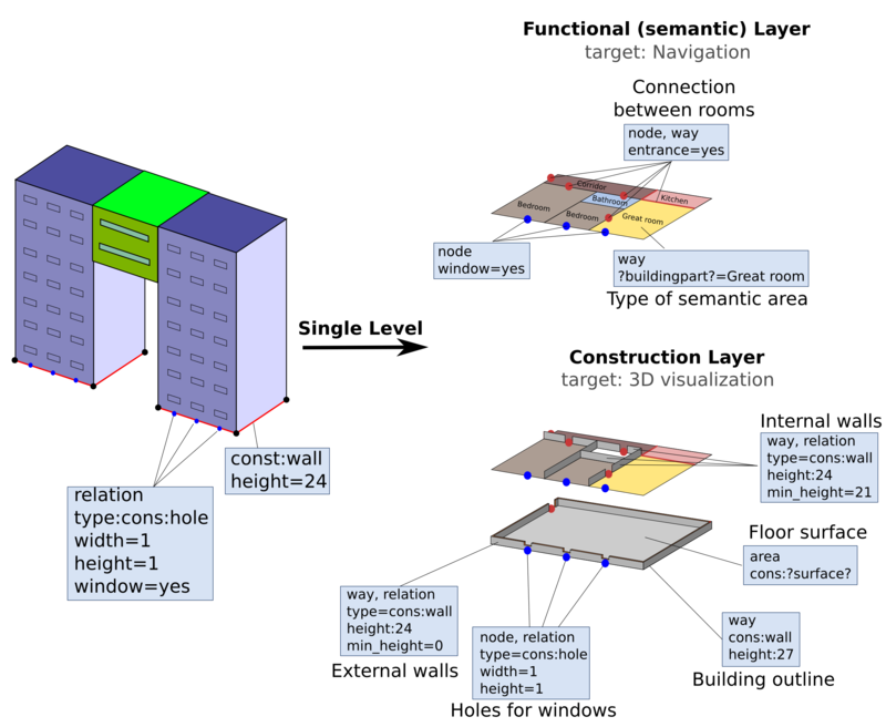
Building with its inside. That kind of level of details require to model single wall inside and outside building. At that level it is important to define TWO kind of data, semantic and construction layer. Semantic will say that is the functions of the area e.g. shop, corridor etc. Construction layer say where are walls, what size are openings like doors or windows.


