WikiProject Vanuatu
Jump to navigation
Jump to search
| V・T・E |
| latitude: -16.705, longitude: 168.393 |
| Browse map of Vanuatu 16°42′18.00″ S, 168°23′34.80″ E |
| Edit map |
|
External links:
|
| Use this template for your locality |
Vanuatu is a country in Oceania at latitude 16°42′18.00″ South, longitude 168°23′34.80″ East.
The Republic of Vanuatu is an insular nation in the South Pacific.
OSM data
Crisis mapping after devastation by Cyclone Pam in March 2015
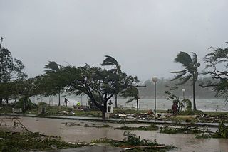
The Vanuatu islands have been hit badly by Cyclone Pam in mid-March 2015. (see Cyclone Pam on Wikipedia) The 2015 03 Vanuatu Pam Cyclone Response wiki page is used to monitor this crisis. The Humanitarian OSM Team (HOT) are looking into crisis mapping, to boost the map coverage of Vanuatu islands, as aid agencies may have use for OpenStreetMap in the coming days.
- Tasking Manager projects:
- Mapping support documents:
| Oceania – Countries and territories | |
|---|---|
| Australia · Fiji · Kiribati · Marshall Islands · Micronesia · Nauru · New Zealand · Palau · Papua New Guinea · Samoa · Solomon Islands · Tonga · Tuvalu · Vanuatu · | |

