ÖV Company Mentz Datenverarbeitung GmbH/suggestion modeling
transport routes
streets 
The highway=* tag is the main tag used for identifying any kind of road, street or path.
For a Bus : highway=service + psv=yes + bus=yes PSV stands for Public Service Vehicles. Use this tag for roads which are designated to public buses etc.
rail
| Key | Value | Comment | Modeling |
|---|---|---|---|
| railway | rail | rail for train | |
| tram | rail for tram | ||
| subway | rail for subway | ||
| monorail | A monorail is a distinctive railway where the trains run on one single rail, often suspended above streets. See http://www.monorails.org for more information.monorail=hanging | ||
| level | whole number | Level indicates the floor level of the rail, it shout be the same like platform! | |
| ref | whole number | Referenz number, the switch description. | |
| name | Name | only makes sense, z. B.: Mainroute | |
| highspeed | yes/no | High-speed traffic | |
| maxspeed | whole number | maximum speed | |
| operator | Namen | the operator from track line | |
| railway:bidirectional | regular | trackwechselbetrieb | |
| signas | Signalisierter Falschfahrbetrieb | ||
| possible | False trip possible | ||
| railway:track_ref | whole number | Track-Number | |
| railway:preserved | yes/no | received track | |
| usage | main | main line | |
| branch | backroad | ||
| industrial | Industrial track | ||
| service | yard | siding | |
| siding | Evasive othe side track | ||
| track | Company Connection | ||
| crossover | Managing track |
water
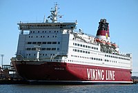
Displays the route of a ferry on sea. Use the route=ferrytag to show the route of a ferry:
| Key | Value | Comment |
|---|---|---|
| route | ferry | defines a ferryline |
| ref | Number | Referenznumber of the ferry line |
| operator | Name | operator of the ferry |
| network | Name | linked transport system |
| ferry:cable | yes/no | State whether the ferry is a rope ferry |
You can either use the tag a single way Way drawn along the whole route, or on a relation Relation (type=route) containing several ways joined end-to-end. More infomations=traffic lines.
traffic lines 
A type=route is a customary or regular line of passage or travel, often predetermined and publicized. Routes consist of paths taken repeatedly by people and vehicles: a ship on the North Atlantic route, a car on a numbered road, a bus on its route or a cyclist on a national route. A route (or variant) may belong to a route type=route_master. A route master contains all the directions, variant routes and information for that route. It permits OSM to distinguish the two routes of a two-way trip.
variants of lines
Tags
| Key | Value | Comment |
|---|---|---|
| type | route | general Tag |
| route | train | classified the line |
| light_rail | classifiedthe line asStadt-/Schnellbahnline | |
| subway | classified the line as subway | |
| tram | classified the line as tram | |
| bus | classifiedthe line as Bus | |
| ferry | classifiedthe line as ferry. Modeling without Relation possible, as you can seetransport routes | |
| ref | the number for the line | |
| from | text | at first stop |
| to | text | the final stop |
| operator | text | the operator from the line |
| network | text | the linked transport system |
| name | text | the line- name, they can be distinguished from the other |
Members
Members of the Relation:
- one station get:
- One halt point (public_transport=stop_position).With the role
stop. at Boarding stops get the Rolestop_entry_only, at Exit Stopsstop_exit_only, at Spacing Maintain the Rolestop_on_demand. - One platform (public_transport=platform). Role=
platform. at Boarding stops get the Roleplatform_entry_only, at Exit Stopsplatform_exit_only, at Spacing Maintain the Roleplatform_on_demand.
- One halt point (public_transport=stop_position).With the role
Lines
Tags
| Key | Value | Comment |
|---|---|---|
| type | route_master | general Tag |
| route_master=* | train | classified the line as railroad |
| light_rail | classified the line as City rail | |
| subway | classifiedthe line as subway | |
| tram | classifiedthe line as Tram | |
| bus | classifiedthe line as Bus | |
| ferry | classifiedthe line as ferry. Modeling without Relation possible, as you can see transport routes | |
| ref | the number for the line | |
| operator | text | the operator from the line |
| network | text | the linked transport system |
| name | text | the line- name, they can be distinguished from the other |
Members
the Route-Master-Relation contains all line variants (type=route).
Station 
chapter in detail find onDE:OpenRailwayMap/Tagging#Station / halt point .
| Key | Value | Description | ||
|---|---|---|---|---|
evidence: Use the disused: lifecycle prefix on tags that relate to features that are in a reasonable state of repair but which are currently disused: abandoned: .(example: disused:railway=station).
| ||||
| railway | station | Railway stations (including main line, light rail, subway, etc.) are places where customers can access railway services. railway=station should be applied to a node placed at the center of the station area, from the passengers' point of view (i.e. near platforms). | ||
| halt | Stations without switches where only passenger trains stops are called halts, not stations. They are tagged railway=halt A small station, may not have a platform, trains may only stop on request. | |||
| tram_stop | A tram stop is a place where a passenger can embark/disembark a tram. It generally comprises a sign, maybe with a small shelter, timetable and facilities for unattended ticket sales (vending machines). There are no operating staff present. | |||
| subway | yes | subway-Station | ||
| public_transport | station | The public_transport=station is used to tag properties associated with a railway station/port/airport/bus station/coach interchange etc.Public-Transport-Schema. Dont use the tag at goods traffic. | ||
| name | name of the station | name of the station; That what you can see on a sign. | ||
| railway:ref | station abbreviation | the Stationscode by a stations. | ||
| uic_ref | station number | UIC-Station number; by the UIC, worldwide unique. | ||
| uic_name | name of the station | UIC-Name; by the UIC, international unique. | ||
| railway:station_category | station Category | Details. | ||
| operator | operator | the operator by the Stations. | ||
| network | name of the network | network linked transport system | ||
| operating_times | Syntax similar opening_hours=* | cast time | ||
station building 
A train station building building=train_station
| Key | Value | Comment | Modeling |
|---|---|---|---|
| building | train_station | ||
| building_levels=* | natural number | number of the stories | |
| name | Name | name of the station | |
| operator | Name | operator of the stations | |
| wheelchair | yes/no | whether the productions there are accessible barrier-free | |
| building_colour=* | colour of the exterior wall | ||
| wikipedia=* | text | Titel of the Wikipedia-Artikel | |
| height=* | height of the building |
halt point (vehicle) 
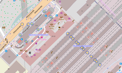
Use public_transport=stop_position to identify the place where a vehicle stops along a public transport route to pick up or drop-off passengers (put the point in the middle of the track from the platform). This tag can be used for any transport mode, or combination of transport modes (including rail, bus, tram, flight, taxi and ship). Use {tag|public_transport|platform}} and/or {tag|highway|bus_stop}} to identify the places where passengers wait for the service.
| Key | Value | Comment | Modeling |
|---|---|---|---|
| public_transport=* | stop_position | holding point | 
|
| railway | stop | holding point | |
| ref | Referenz number or a letter | ||
| train | yes/no | holding point for train | |
| subway | yes/no | holding point for subway | |
| tram | yes/no | holding point for tram | |
| bus | yes/no | holding point for Bus | |
| light_rail=* | yes/no | City rail | |
| wheelchair | yes/no | whether the productions there are accessible barrier-free | |
| wheelchair:bus=* | yes/no | Vorschlag. whether the bus-productions there are accessible barrier-free Analog: wheelchair:train=* wheelchair:tram=* wheelchair:subway=* | |
| description | Description halt-name | ||
| name | name of the station | the name by the holding point, z. B. Köln-West
| |
| railway | abbreviation by the holding point | the Stationscode . In Germany Ril 100-abbreviation like z. B. KN for Neuss Hbf
| |
| operator | operator | the operator by the holding point | |
| network | name of the network | the network bzw. the linked transport system, to appertain the holding point. | |
| uic_ref=* | Station number | UIC-Station number; by the UIC, worldwide unique. | |
| uic_name=* | name of the station | UIC-Name; by the UIC, international unique. |


