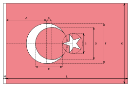
File:Flag of Turkey.svg
Jump to navigation
Jump to search


Size of this PNG preview of this SVG file: 800 × 533 pixels. Other resolutions: 320 × 213 pixels | 640 × 427 pixels | 1,024 × 683 pixels | 1,280 × 853 pixels | 1,200 × 800 pixels.
Original file (SVG file, nominally 1,200 × 800 pixels, file size: 324 bytes)
File history
Click on a date/time to view the file as it appeared at that time.
| Date/Time | Thumbnail | Dimensions | User | Comment | |
|---|---|---|---|---|---|
| current | 08:51, 8 August 2021 |  | 1,200 × 800 (324 bytes) | wikimediacommons>Jdx | Per request on COM:AN/B |
File usage
The following 97 pages use this file:
- Asia
- Comparison of Asian road signs
- Contributors
- Cs:Tag:route=train
- Default speed limits
- Et:Key:highway
- Eurasia
- Europe
- Foundation/Local Chapters/OSM 17-hour Global Mapathon
- Greece/Borders
- International highway classification equivalence
- Key:isced:level
- Key:payment:*
- Ko:Tag:highway=motorway
- Ko:Tag:highway=trunk
- Life Long Learning Mapping Project
- List of OSM centric Facebook accounts
- List of OSM centric Telegram accounts
- List of territory based projects
- MychOSM/Istanbul
- OSM 17th Birthday Celebration - Asia Pacific
- OSM tags for routing/Maxspeed
- OSM tags for routing/Minspeed
- OSM tags for routing/Tolerances
- OpenStreetMap 17th Anniversary Birthday party
- OpenStreetMap 20th Anniversary Birthday party
- OpenStreetMap in the media/2011
- OpenStreetMap in the media/2012
- OpenStreetMap in the media/2015
- Past Events 2012
- Past Events 2013
- Past Events 2016
- Past Events 2017
- Past events 2019
- Pt:Highway:International equivalence
- Pt:Life Long Learning Mapping Project
- Pt:Tag:boundary=administrative
- Ro:Life Long Learning Mapping Project
- Sl:Life Long Learning Mapping Project
- Sq:Key:highway
- Tag:boundary=administrative
- Tag:highway=motorway
- Tag:highway=trunk
- Tag:route=train
- Tr:Key:boundary
- Tr:Life Long Learning Mapping Project
- Tr:MychOSM/Istanbul
- WikiProject Metro systems
- Zh-hans:Asia
- Zh-hans:List of territory based projects
- Zh-hans:Tag:highway=living street
- Zh-hans:Tag:highway=motorway
- Zh-hant:Tag:highway=motorway
- User:3mirhan*
- User:Alv
- User:BenMaierEU
- User:Catwb77
- User:Erkinalp
- User:Gaurav Thapa
- User:Hakan
- User:Hocu
- User:Katpatuka
- User:Marek Kleciak
- User:Marek kleciak
- User:Nesim
- User:Pigsonthewing
- User:Skippern/World
- User:Unen
- User:Vulfbear
- User talk:Fredao
- User talk:Reneman/Archiv
- Template:Admin level
- Template:Countries of Asia
- Template:Countries of Europe
- Template:FR:Admin level
- Template:Highway:International equivalence
- Template:Navbar Comenius
- Template:Navbar Comenius/doc
- Template:User hails from europe
- Template:User hails from europe/doc
- DE:Life Long Learning Mapping Project
- FR:Highway:International equivalence
- FR:Key:admin level
- FR:Key:isced:level
- FR:Tag:boundary=administrative
- FR:Tag:route=train
- ES:Colaboradores
- ES:Key:isced:level
- ES:Key:payment:*
- ES:Proyecto de mapeo Aprendizaje a Largo Plazo
- ES:Tag:route=train
- IT:Contributors
- IT:Key:boundary
- IT:Key:highway
- RU:Key:highway
- JA:OSMを中心としたFacebookアカウントの一覧
- JA:協力者


