JA:WikiProject Haiti/画像とデータソース
Imagery
NOAA
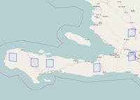
NOAA による航空写真。ソースは http://edcftp.cr.usgs.gov/pub/data/disaster/201001_Earthquake_Haiti/data/NOAA_AERIAL_NATIVE/ より。このデータは2010年1月18日のものと考えられています。データはアメリカ合衆国政府発行のため、パブリックドメインとなる予定です。(もう少々お待ちください)
| 画像セット | 境界 | JOSMで利用 | Potlatchで利用 |
|---|---|---|---|
| NOAA
日付: 2010/01/18 著作権: (c) NOAA, 2010
|
JOSMでの利用には以下のURLをWMSに指定してください(設定方法):
http://hypercube.telascience.org/cgi-bin/mapserv?map=/geo/haiti/mapfiles/4326.map&layers=noaa-01-18-4326&request=GetMap&version=1.0.0&styles=&format=image/jpeg&service=WMS& |
Potlatchでは以下のURLを設定の 'カスタム' に指定してください(設定方法):
http://hypercube.telascience.org/tiles/1.0.0/noaa-20100118-900913/!/!/!.jpg (もしくは 直接読み込む) |
GeoEye
GeoEye はハイチの衛星画像を収集している衛星画像業者による画像です。
OSM はGeoEyeyの画像を 利用する許諾を得ています。使用条件として GeoEyeの画像を利用するときには source=GeoEye のタグを付けることが必要です。
| 画像セット | 境界 | JOSMでの利用 | Potlatchでの利用 |
|---|---|---|---|
| Ikonos
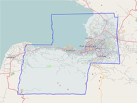
日付: 2010/01/17 著作権: (c) GeoEye, 2010
|
JOSMでの利用には以下のURLをWMSに指定してください (設定方法) :
http://hypercube.telascience.org/cgi-bin/mapserv?map=/geo/haiti/mapfiles/4326.map&layers=ikonos-01-17-4326&request=GetMap&version=1.0.0&styles=&format=image/jpeg&service=WMS& |
Potlatchでは以下のURLを設定の 'カスタム' に指定してください(設定方法):
http://hypercube.telascience.org/tiles/1.0.0/geoeye-ikonos-20100117-900913/!/!/!.jpg (or 直接読み込む) | |
| GeoEye1
日付: 2010/01/16 著作権: (c) GeoEye, 2010 更新: 毎日 |
JOSMでの利用には以下のURLをWMSに指定してください(設定方法):
http://hypercube.telascience.org/cgi-bin/mapserv?map=/geo/haiti/mapfiles/4326.map&layers=geoeye-01-16-4326&request=GetMap&version=1.0.0&styles=&format=image/jpeg&service=WMS& |
Potlatchでは以下のURLを設定の 'カスタム' に指定してください(設定方法):
http://hypercube.telascience.org/tiles/1.0.0/geoeye-geoeye-20100116-900913/!/!/!.jpg (or 直接読み込む) | |
| Ikonos
日付: 2010/01/14-2010/01/15 著作権: (c) GeoEye, 2010 更新: 毎日 |
JOSMでの利用には以下のURLをWMSに指定してください(設定方法):
http://hypercube.telascience.org/cgi-bin/mapserv?map=/geo/haiti/mapfiles/4326.map&layers=ikonos-01-14-4326&request=GetMap&version=1.0.0&styles=&format=image/jpeg&service=WMS& |
Potlatchでは以下のURLを設定の 'カスタム' に指定してください(設定方法):
http://hypercube.telascience.org/tiles/1.0.0/geoeye-ikonos-20100115-900913/!/!/!.jpg (or 直接読み込む) |
DigitalGlobe
DigitalGlobe の画像は GeoEye よりも解像度が高く、ハイチ全土をカバーしています。しかし画像の一部が雲で覆われてしまっています。そのため、場所によっては GeoEye のほうがよいソースとなるでしょう。
このタグを指定してください: source=digitalglobe
| Image set | 境界 | WMS (JOSM & Merkaartor) | Potlatchでの利用 |
|---|---|---|---|
| DigitalGlobe (キャッシュ)
日付: ? 著作権: (c) DigitalGlobe, 2010 Up日付: ? |
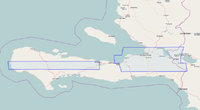
 See DigitalGlobe's Image 境界 here |
Use the following WMS URL in JOSM (設定方法) :
|
Potlatchでは以下のURLを設定の 'カスタム' に指定してください:
http://maps.nypl.org/tilecache/1/dg_crisis/!/!/!.jpg (もしくは直接読み込む) |
| DigitalGlobe (more direct)
日付: ? 著作権: (c) DigitalGlobe, 2010 Up日付: ? |
JOSMでの利用には以下のURLをWMSに指定してください(設定方法):
http://maps.geography.uc.edu/cgi-bin/mapserv?map=/home/cgn/public_html/maps/mapfiles/haiti.map&version=1.1.0&SERVICE=WMS&REQUEST=GetMap&FORMAT=image/png&LAYERS=DG_crisis_event_service& Merkaartor では以下のURLをWMSに指定してください: http://maps.geography.uc.edu/cgi-bin/mapserv?map=/home/cgn/public_html/maps/mapfiles/haiti.map&SERVICE=WMS&Request=GetCapabilities Click Get Capabilities and choose the DG_crisis_event_service or dg_crisis layers. |
Potlatch 用は準備できておりません。上記別のソースをご利用ください。 |
OSM は Digital Globe より利用許諾を得ています:
"Just confirmed: DigitalGlobe imagery can be used for OSM tracing. Just need source tag, and a note in wiki. Thx DG!" -- Mikel [1] [2]
WMS-Layer for DigitalGlobe Crisis Event Service discussion on crisismappers: [3]
New Imagery
Imagery to be made available for OSM mappers: [4]
-- Christopher Schmidt working on both datasets to make them available.
Spot Image
Spot Image has also been collecting and releasing imagery of Haiti. It can be found directly on their website.
このタグを指定してください: source=Cnes/SpotImage
JAXAの衛星画像
By NIED(National Research Institute for Earth Science and Disaster Prevention, 日本防災科学技術研究所)による地震直後の衛星画像です。写真は JAXAが撮影したものの利用許可を得た者です。詳細はWMS CapabilitiesやハイチALOS観測画像緊急WMS配信 暫定ページを参照してください。
このタグを指定してください: source=JAXA/ALOS
| Image set | 境界 | JOSMでの利用 | Potlatchでの利用 |
|---|---|---|---|
| Ikonos
日付: ?? 著作権: (c) JAXA(Japan Aerospace Exploration Agency), 2010
|
JOSMでの利用には以下のURLをWMSに指定してください(設定方法):
http://hazardmap.service-section.com/cgi-bin/mapserv?map=/map/UserRaster/alav2a.map&SERVICE=WMS&VERSION=1.1.1&REQUEST=GetMap&LAYERS=alav2a&STYLES=&EXCEPTIONS=application%2Fvnd.ogc.se_inimage&FORMAT=image/png&SRS=EPSG:4326& |
Potlatch用はまだ準備できておりません
|
Imagery coverage
Imagery Coverage Table for Named Places)
this is a suggestion - please pursue if you feel it is useful
+Imagery names are shown in form suggested for source tagging| Placename | digitialglobe | GeoEye | ikonos/geoeye | JAXA/ALOS |
|---|---|---|---|---|
| ポルトープランス (Port-au-Prince) |
yes | yes | yes | yes |
| Gonaives | yes | no | no | no |
カバー範囲外
- ランドサット(Landsat: WMS for JOSM)
- オープンエリアルマップ (Open Aerial Map: WMS for JOSM)
各ソフトでの利用方法
JOSMでの編集
- WMSプラグインをインストールしていることを確認してください。(編集 -> 設定 -> プラグイン -> wmsplugin)
- 設定 -> WMSを選択します。(Macでは環境設定->WMS)
- 追加 をクリック
- メニューの名前 にメニューに表示されるWMSの名前を指定します。例えば Haiti - GeoEye - Ikonos 等のほか、好きな文字列でも構いません。
- WMS URL に、上記表に記載されているURLを入力します。
- OKをクリックして、初期設定を保存します。
- ハイチ付近のデータをダウンロードします。
- メニューから WMS->Haiti - GeoEye - Ikonos (もしくはあなたの付けた名前) を選択し、少し待つと画像が読み込まれます。
Potlatch での編集
- 画面左下のアイコンからオプション設定 をクリックすると、設定画面が表示されます。
- 'カスタム' の欄に上記表にあるURLを入力します。
Merkaartor での編集
Merkaartor の バージョン0.15では、Potlatchと同じURLを使用してください。
Ithaca Import
Data used for this [5] was imported into OSM by Ivansanchez and John07. import changeset.
All the data has these tags:
- source=Ithaca,15/10/2010
- source:imagery=GeoEye,13/01/2010
- FIXME=Check for duplicated data tag
The import has been cleaned up and the fixme tags removed.
行政区分境界線
都市や町の行政区分は Haiti_boundaries_import のアカウントによってインポートされました。オリジナルのデータは US Census Bureau (アメリカ合衆国)によるもので https://www.geoint-online.net/community/haitiearthquake/default.aspx から取得できます。
以下のタグが使用されています。
- is_in="name of the district"
- name=*
- boundaries=administrative
- admin_level=8
- source=US Census Bureau, boundaries import, 16/01/2010
- population=*
- id_commune=ソースファイルに記載されている ID
MINUSTAH GIS and UN Cartographic Section data
WMS server here: [6]
data from here: [7]
"MINUSTAH GIS and UN Cartographic Section" must be cited as the data source >> source=MINUSTAH GIS and UN Cartographic Section
The available data set is split into several layers. WMS-links for JOSM look like this (with "value" being replaced by layer name): http://haiti.opensgi.net:80/geoserver/wms?SERVICE=WMS&SERVICE=WMS&VERSION=1.1.1&REQUEST=GetMap&&SRS=EPSG:4326&&LAYERS=value&STYLES=&FORMAT=image/png&TRANSPARENT=TRUE&
See WikiProject_Haiti/MinustahLayers for a list of layer names and ready to use JOSM WMS links for each layer.
See [8] for warped high-resolution MINUSTAH maps.
Existing Data Sets
General list of other data sets ... CrisisCommons is a pretty complete list
- List on the CrisisCommons wiki
- http://maps.yahoo.com/#mvt=h&lat=18.548639&lon=-72.32569&zoom=15&q1=haiti Yahoo has high detail satellite imagery over Port au Prince for tracing
- http://finder.geocommons.com/overlays/4492 UNJLC Haiti Roads
- http://bbs.keyhole.com/ubb/ubbthreads.php?ubb=showflat&Number=1295764#Post1295764 Keyhole BBS
- Administrative boundaries down to the third level: https://www.geoint-online.net/community/haitiearthquake/default.aspx
- Topo maps of PAP 1:12500 (1994): http://www.gelib.com/maps/haiti-earthquake/Source/PAP-Topos.zip
- http://sertit.u-strasbg.fr/SITE_RMS/2010/01_rms_haiti_2010/01_rms_haiti_2010.html features Port-au-Prince's damage evaluation and location of earthquake affected public buildings as seen in press releases, but in 10-meters resolution only.
- Joint Research Centre of the European Commission: http://dma.jrc.it/map/data
- Datasets include: built-up area (extracted from VHR imagery), slope map (Sobel algorithm)
- personal GeoDatabase and GeoTiffs of Haiti: https://www.yousendit.com/download/VGllcXluTmEwVW5IRGc9PQ
- Wikipedya Ayisyen may be a good source of Haitian Creole toponyms...? example Vèrèt is English Verrettes. Language links to English or French.
Damage assessment
- Ithaca has released the first map of the damage using OSM as basemap:
- Map image: http://www.ithaca.polito.it/maps/ITHACA_Port_au_prince_DamagesAssessment_PreliminaryAnalys_GeoEye_v1.jpg
- Imported - new updated shapefile availabe, ask John07 or mailto:fabio.giuliotonolo@polito.it
- JRC has released a few maps on the damage in the area of Port-au-Prince
UNOSAT
- UNOSAT (http://unosat.web.cern.ch/unosat/asp/UNOSAT-EQ-201001-HTI.asp)
- Any vector products can be used by OSM: "You are free to use our vectors/kmls as you want." - Einar Bjorgo
UNITAR/UNOSAT has produced map and corresponding .kml layers for inclusion in Google Earth in support to the humanitarian relief efforts following the 12 January earthquake in Haiti. Elements included are
- informal IDP sites
- bridges
- road obstacles
as identified in GeoEye-1 imagery recorded on 13 January 2010. We thank GeoEye for making the imagery available.
Note: This is a preliminary analysis; road and bridge damages may be underestimated. Please send corrections to UNITAR / UNOSAT: unosat@unitar.org.
Additional damage assessment map and .kml file of other key infrastructure will be issued tomorrow, Friday 15 January.
To download map, please go to www.unosat.org/asp/prod_free.asp?id=52 http://www.unosat.org/kml/EQ-2010-000009-HTI.kml
Some Raster PDF maps from 16 Jan, have been imported into the Warper for rectification and serving via WMS [9]
パブリックドメインの CIA Maps
- collection of (mostly) public domain CIA maps dating from 1970-2000
- These maps have been loaded into http://maps.nypl.org/relief/
- Some small effort is needed to warp them
- Once a map is warped, the "Export" tab can be used to get a WMS link that can be pasted into JOSM
- Example map: http://maps.nypl.org/relief/maps/preview/25
- Example WMS link: http://maps.nypl.org/relief/maps/wms/25?request=GetMap&version=1.1.1&styles=&format=image/png&srs=epsg:4326&exceptions=application/vnd.ogc.se_inimage&
- WMS from manual warping of 1:12.5k Port-au-Prince map sheets and whole country (coming) 1:50k topo sheets: http://hypercube.telascience.org/cgi-bin/mapserv?map=/home/ortelius/haiti/haiti.map&
- These maps have been loaded into http://maps.nypl.org/relief/
| Image set | JOSMでの利用 | Potlatchでの利用 |
|---|---|---|
| haiti-city (1:25k)
May be off by over 100m, but will get better asap |
JOSMでの利用には以下のURLをWMSに指定してください(設定方法):
http://hypercube.telascience.org/cgi-bin/mapserv?map=/home/ortelius/haiti/haiti.map&request=GetMap&service=wms&version=1.1.1&format=image/png&srs=epsg:4326&exceptions=application/vnd.ogc.se_inimage&layers=haiti-city& |
In Potlatch paste the following URL into the 'custom' setting (設定方法):
http://hypercube.telascience.org/tiles/1.0.0/haiti-city/!/!/!.jpg (or 直接読み込む) |
| haiti-tlm-50 (1:50k)
1:50k maps for whole country coming online as they upload to this server |
JOSMでの利用には以下のURLをWMSに指定してください(設定方法):
http://hypercube.telascience.org/cgi-bin/mapserv?map=/home/ortelius/haiti/haiti.map&request=GetMap&service=wms&version=1.1.1&format=image/png&srs=epsg:4326&exceptions=application/vnd.ogc.se_inimage&layers=haiti-tlm-50& |
In Potlatch paste the following URL into the 'custom' setting (設定方法):
http://hypercube.telascience.org/tiles/1.0.0/haiti-tlm-50/!/!/!.jpg (or 直接読み込む) |
Notes
- i will try to call the German Aerospace Center, German Remote Sensing Data Center, Environment and Security (Deutsches Zentrum für Luft- und Raumfahrt e. V.) for using their data. information in the evening. --Jan Tappenbeck 06:21, 18 January 2010 (UTC) They tell me that there are connection otherwise. --Jan Tappenbeck 15:38, 18 January 2010 (UTC)


