Uploads by MattMap
Jump to navigation
Jump to search
This special page shows all uploaded files.
| Date | Name | Thumbnail | Size | Description | Versions |
|---|---|---|---|---|---|
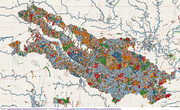
| 01:54, 12 November 2024 | NHD 2024.png (file) |  |
424 KB | {{Information | description=Map of center points of ways in OSM tagged with one of: nhd:*=*, NHD:*=*, source=NHD, or attribution=NHD. | source=OpenStreetMap, Overpass turbo, and Mapshaper | date=2024-11-11 | author= | other_versions= }} | 1 |
| 03:30, 10 November 2024 | 3DHP all service poster.png (file) |  |
3.23 MB | == Summary == {{Information | description= 3DHP 3DHP_all service poster | source=https://www.usgs.gov/media/files/3d-hydrography-program-3dhpall-2023-service | date=2023-11-28 | author=U.S. Geological Survey | other_versions= }} | 1 |
| 14:34, 9 November 2024 | 3DHP feature density and alignment compared to NHD.png (file) |  |
1.09 MB | {{Information | description= 3DHP feature density and alignment compared to NHD | source=https://www.usgs.gov/media/images/3dhp-feature-density-and-alignment-compared-nhd | date=2023-07-12 | author=U.S. Geological Survey | other_versions= }} | 1 |
| 14:28, 9 November 2024 | 3D Hydrography Program Partnerships AK.png (file) |  |
744 KB | == Summary == {{Information | description=Coverage of the 3DHP over Alaska. | source=https://www.usgs.gov/media/images/3d-hydrography-program-fy24-partnerships-alaska | date=2024-09-30 | author=U.S. Geological Survey | other_versions= }} | 1 |
| 14:25, 9 November 2024 | 3D Hydrography Program Partnerships CONUS.png (file) |  |
943 KB | {{Information | description=Coverage of the 3DHP over the coterminous United States. | source=https://www.usgs.gov/media/images/3d-hydrography-program-fy24-partnerships | date=2024-09-30 | author=U.S. Geological Survey | other_versions= }} | 1 |
| 23:42, 23 July 2024 | ODOT TIMS Copyright.png (file) | 44 KB | {{Information | description= Email from Ian Kidner, GISP, ODOT Office of Technical Services<br/> '''Transcript''':<br />Ohio is a sunshine state regarding data, and does abide by open data accessibility practices. All of the datasets published on the TIMS site are available for public use, and no copyright applies.<br /> The Official Transportation Map example included in the Copyright section of ODOT's Privacy Notice and Policies page is referring to a physical print map the Department produ... | 1 | |
| 02:33, 3 February 2024 | Waterway oklahoma before.png (file) |  |
2.15 MB | {{Information | description=Waterwaymap.org representation of waterways in Oklahoma | source=Waterwaymap.org | date=2024-01-31 | author= | other_versions= }} | 1 |
| 18:40, 29 December 2023 | Us-national-inventory-of-dams.png (file) |  |
2.51 MB | {{Information | description=Front page of the United States [https://nid.sec.usace.army.mil/ National Inventory of Dams] | source=[https://nid.sec.usace.army.mil/ | date=2023-12-29 | author= | other_versions= }} | 1 |
| 18:05, 29 December 2023 | OSM-GNIS-dam-nodes-remaining.png (file) |  |
1.07 MB | {{Information | description=Map from Overpass turbo showing {{Tag|waterway|dam}} nodes in OSM not tagged with {{Key|ref:US:NID}} | source= | date=2023-12-29 | author= | other_versions= }} | 1 |
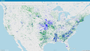
| 18:03, 29 December 2023 | OSM-NID-dam-compare.png (file) |  |
1.24 MB | {{Information | description=Map from Mapshaper showing OSM objects tagged with {{Key|ref:US:NID}} in green, and coordinates from the U.S. National Inventory of Dams not tagged in OSM in blue | source= | date=2023-12-29 | author= | other_versions= }} | 1 |
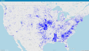
| 18:01, 29 December 2023 | NID-dams-not-in-OSM.png (file) |  |
846 KB | {{Information | description=Map from Mapshaper showing locations from the U.S. National Inventory of Dams not represented in OpenStreetMap using {{Key|ref:US:NID}} | source= | date=2029-12-29 | author= | other_versions= }} | 1 |
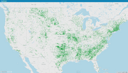
| 18:00, 29 December 2023 | OSM-NID-dams.png (file) |  |
1,001 KB | {{Information | description=Map from Mapshaper showing OSM objects tagged with {{Key|ref:US:NID}} | source= | date=2023-12-29 | author= | other_versions= }} | 1 |
| 01:00, 7 November 2023 | JOSM-MapCss-NID.png (file) |  |
626 KB | {{Information | description=Viewing data from the US National Inventory of Dams as a new layer in JOSM and styled with MapCSS. | source= | date= | author= | other_versions= }} | 1 |