Template:FR:Map Features:boundary
(Redirected from Template:Fr:Map Features:boundary)
Jump to navigation
Jump to search
Frontières (boundary)
| Clé | Valeur | Élément | Commentaire | Représentation | Photo | |
|---|---|---|---|---|---|---|
Boundary types | ||||||
| boundary | aboriginal_lands | A boundary representing official reservation boundaries of recognized aboriginal / indigenous / native peoples. | ||||
| boundary | administrative | Limite administrative (état, région, département, commune, etc) Requiert également admin_level=*. Voir aussi la relation boundary |
||||
| boundary | border_zone | A border zone is an area near the border where special restrictions on movement apply. Usually a permit is required for visiting. | ||||
| boundary | census | A census-designated boundary delineating a statistical area, not necessarily observable on the ground. | ||||
| boundary | forest | Une forêt délimitée est une zone majoritairement boisée et qui est dotée, pour cette raison, de limites précises. Elle peut recouvrir différents peuplements, des zones non boisées, des routes… mais toute la zone incluse dans les limites définies est considérée et gérée comme une unique forêt. | ||||
| boundary | forest_compartment | Une parcelle forestière est une sous-section numérotée d'une forêt délimitée, dont les limites sont matérialisées. | ||||
| boundary | hazard | A designated hazardous area, with a potential source of damage to health, life, property, or any other interest of value. | ||||
| boundary | health | Health division boundaries. Some mappers use health_level=* instead of admin_level=* to specify level in the health system hierarchy. | ||||
| boundary | historic | Frontière historique. | ||||
| boundary | local_authority | Describes the territory of a local authority. | ||||
| boundary | low_emission_zone | A geographically defined area which seeks to restrict or deter access by certain polluting vehicles with the aim of improving the air quality. | ||||
| boundary | maritime | Frontière maritime. | ||||
| boundary | marker | A boundary marker, border marker, boundary stone, or border stone is a robust physical marker that identifies the start of a land boundary or the change in a boundary, especially a change in direction of a boundary. See also historic=boundary_stone | ||||
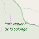
| boundary | national_park | Parc naturel national. | ||||
| boundary | place | boundary=place is commonly used to map the boundaries of a place=*, when these boundaries can be defined but these are not administrative boundaries. | ||||
| boundary | political | Zone électorale ? | ||||
| boundary | postal_code | Code postal | ||||
| boundary | protected_area | Zone protégée, comme pour les parcs nationaux, les zones de protection marine, les réserves indigènes. | ||||
| boundary | religious_administration | Frontière administrative religieuse (ex: paroisse,diocèse,...). Requiert également admin_level=*. Voir Talk:Key:boundary#Religious authority boundaries |
||||
| boundary | special_economic_zone | A government-defined area in which business and trade laws are different. | ||||
| boundary | statistical | An official boundary recognised by government for statistical purposes. | ||||
| boundary | disputed | An area of landed claimed by two or more parties (use with caution). See also Disputed territories. | ||||
| boundary | timezone | Boundaries of time zone | ||||
| boundary | user defined | Consulter les valeurs couramment utilisées en accord avec Taginfo | ||||
Attributs | ||||||
| admin_level | (number) | S'applique à boundary=administrative et est habituellement dans un écart de 1 à 10, excepté pour l'Allemagne où cela pourrait être 11. Voir boundary. | ||||
| health_level | (number) | Used by some mappers instead of admin_level=* in conjunction with boundary=health and is usually in the range 1 to 10. | ||||
| postal_code_level | (number) | Used by some mappers instead of admin_level=* in conjunction with boundary=postal_code and is usually in the range 1 to 10. | ||||
| religious_level | (number) | Used by some mappers instead of admin_level=* in conjunction with boundary=religious_administration and is usually in the range 1 to 10. | ||||
| border_type | * | Pour distinguer entre les types de frontières où l'"admin_level" n'est plus suffisant. Utilisé de plusieurs manières différentes; par exemple dans des contextes maritimes. | ||||
| start_date | (date) | Useful if the boundary is very recent (or if it will become effective in a near future). | ||||
This table is a wiki template with a default description in English. Editable here.


