Template:Pl:Map Features:boundary
Jump to navigation
Jump to search
Granice (Boundary)
| Klucz | Wartość | Element | Opis | Renderowanie | Zdjęcie | |
|---|---|---|---|---|---|---|
Boundary types | ||||||
| boundary | aboriginal_lands | A boundary representing official reservation boundaries of recognized aboriginal / indigenous / native peoples. | ||||
| boundary | administrative | Granica administracyjna. Użyj border_type=* aby sprecyzować (country, state, itd.) | ||||
| boundary | border_zone | A border zone is an area near the border where special restrictions on movement apply. Usually a permit is required for visiting. | ||||
| boundary | census | A census-designated boundary delineating a statistical area, not necessarily observable on the ground. | ||||
| boundary | forest | A delimited forest is a land which is predominantly wooded and which is, for this reason, given defined boundaries. It may cover different tree stands, non-wooded areas, highways… but all the area within the boundaries are considered and managed as a single forest. | ||||
| boundary | forest_compartment | A forest compartment is a numbered sub-division within a delimited forest, physically materialized with visible, typically cleared, boundaries. | ||||
| boundary | hazard | A designated hazardous area, with a potential source of damage to health, life, property, or any other interest of value. | ||||
| boundary | health | Health division boundaries. Some mappers use health_level=* instead of admin_level=* to specify level in the health system hierarchy. | ||||
| boundary | historic | Historyczne granice administracyjne, tymczasowo przechowywane w OSM, wraz z tagami start_date=* i end_date=* w celu określenia dat historycznych. Wymaga dodatkowego tagu admin_level=*. | ||||
| boundary | local_authority | Describes the territory of a local authority. | ||||
| boundary | low_emission_zone | A geographically defined area which seeks to restrict or deter access by certain polluting vehicles with the aim of improving the air quality. | ||||
| boundary | maritime | Granica obszaru wód terytorialnych. | ||||
| boundary | marker | A boundary marker, border marker, boundary stone, or border stone is a robust physical marker that identifies the start of a land boundary or the change in a boundary, especially a change in direction of a boundary. See also historic=boundary_stone | ||||
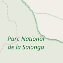
| boundary | national_park | Granica parku narodowego | ||||
| boundary | place | Granica place=* w przypadku gdy nie jest to granica administracyjna | ||||
| boundary | political | Granica polityczna. | ||||
| boundary | postal_code | Granica pocztowa. | ||||
| boundary | protected_area | Obszary chronione: parki krajobrazowe, rezerwaty, Natura 2000... | ||||
| boundary | religious_administration | Religijna granica administracyjna. Więcej na boundary=religious_administration |
||||
| boundary | special_economic_zone | A government-defined area in which business and trade laws are different. | ||||
| boundary | statistical | An official boundary recognised by government for statistical purposes. | ||||
| boundary | disputed | An area of landed claimed by two or more parties (use with caution). See also Disputed territories. | ||||
| boundary | timezone | Boundaries of time zone | ||||
| boundary | user defined | All commonly used values according to Taginfo | ||||
Atrybuty | ||||||
| admin_level | (number) | Dotyczy boundary=administrative i zazwyczaj ma zakres od 1 do 11 - patrz boundary. | ||||
| health_level | (number) | Used by some mappers instead of admin_level=* in conjunction with boundary=health and is usually in the range 1 to 10. | ||||
| postal_code_level | (number) | Used by some mappers instead of admin_level=* in conjunction with boundary=postal_code and is usually in the range 1 to 10. | ||||
| religious_level | (number) | Used by some mappers instead of admin_level=* in conjunction with boundary=religious_administration and is usually in the range 1 to 10. | ||||
| border_type | * | Dla doprecyzowania granicy. | ||||
| start_date | (date) | Przydatne, jeśli istnieją konkurencyjne historyczne granice lub granica jest bardzo aktualna (lub jeśli zacznie obowiązywać w niedalekiej przyszłości) i jeśli zachowane poprzednie granice są nadal potrzebne osobno (w tym dla map statystycznych opartych na starszych granicach). | ||||
This table is a wiki template with a default description in English. Editable here.
This documentation is transcluded from Template:Pl:Map Features:boundary/doc. (Edit | history)
Note to editors: Please don't categorize this template by editing it directly. Instead, place the category in its documentation page, in its "includeonly" section.
Note to editors: Please don't categorize this template by editing it directly. Instead, place the category in its documentation page, in its "includeonly" section.
Usage
See also
| Tag | Komentarz Notes |
|---|---|
| type=boundary | |
| boundary=administrative | |
| admin_level=* | Poziom podziału administracyjnego, ustalony drogą konsensusu. Dla Polski:
|
| wikipedia=* | Nazwa artykułu w Wikipedii (dodaj prefiks pl:, jeśli artykuł jest po polsku) |
| name=* | Nazwa gminy, powiatu itd. wg schematu: "gmina Kowalewo", "powiat niżański", "województwo śląskie" |
| teryt:terc=* | Numer TERC z bazy TERYT |
This documentation is transcluded from Template:Pl:Map Features:boundary/doc. (Edit | history)
Note to editors: Please don't categorize this template by editing it directly. Instead, place the category in its documentation page, in its "includeonly" section.
Note to editors: Please don't categorize this template by editing it directly. Instead, place the category in its documentation page, in its "includeonly" section.


