Template:JA:Map Features:properties
Jump to navigation
Jump to search
属性 (Properties)
他の要素に対して一般的な物に関する追加情報を設定します。
| キー | 値 | 要素 | コメント | 写真 |
|---|---|---|---|---|
| area | yes | 通常は線形の地物がエリアであることを示します。すでにエリアの種別が定義されている地物には追加するべきではありません。 | ||
| brand | user defined | Brand of the feature. | ||
| bridge | yes / aqueduct / viaduct / cantilever / movable / covered / … | 橋を表し、layer=*タグと一緒に使います。通常の値はyesですが、橋の種類を指定することもできます。 | ||
| capacity | amount | Used for specifying capacity of a facility. | ||
| charge | amount | 施設を利用したり通行したりするのにどれだけの金額がかかるかを示すために使用します。 toll=* や fee=* を参照してください。 | ||
| clothes | see key's page | Tagged on shops and other features to denote if they sell clothes or not and what type of clothes they sell. | ||
| covered | yes | ノード、ウェイ、エリアが他のものに覆われている(場合によっては地中にある)ことを表すために使用します。レイヤーの使用が適切でないときは、追加の分類が必要です。 | ||
| crossing | no / traffic_signals / uncontrolled / island / unmarked | highway=crossingやrailway=crossingでタグ付けされたノードを将来的に詳細化するため | ||
| crossing:island | yes / no | Specifies whether a pedestrian crossing has a refuge island | ||
| cutting | yes / left / right | 切土。道路や鉄道を通すための切通し、堀割です。ほとんどの場合高い所にあります。切土(Wikipedia)を参照。 | ||
| disused | yes | 地物が利用できるが使用されていない状態です。設備が撤去されている場合はabandoned=*を使用します。 | ||
| drinking_water | yes / no | Describes whether a drinking water is available | ||
| drive_through | yes / no | 薬局、銀行、ATM、ファストフード、郵便局などのドライブスルーサービスを示すのに使われます。 | ||
| drive_in | yes / no | 映画館がドライブインシネマ(車に乗ったまま見る映画館)を提供していたり、レストランがドライブインサービス(車に乗ったまま食事をすること)を提供していたりすることを示すのに使います。ドライブスルー(drive_thru)とは異なります。 訳注: 日本語で言う「ドライブイン」(車を降りて利用する休憩施設)とは異なります。 |
||
| electrified | contact_line / rail | 鉄道路線に車両に電気を供給する設備があることを示します | ||
| ele | 数値 | |||
| embankment | yes | 盛土。低い土地や湿地を跨いで、道路、鉄道、あるいは運河を通すために盛り上げた所(盛土(Wikipedia)を参照)。 | ||
| end_date | 日付 | その地物が撤去された日です。 | ||
| est_width | 数値 | ウェイのおおよその幅(メートル)。 | ||
| fee | yes / no | Used for specifying whether fee is charged for use/access to a facility. See also toll=*. | ||
| fire_object:type | poo / szo | Potentially dangerous and socially significant objects | ||
| fire_operator | Name | Fire station, which serves the object | ||
| fire_rank | 1bis / 2 to 5 | Rank fire, defined for a particular object | ||
| frequency | 数値 | Hz単位の周波数です。 | ||
| hazard | see hazard | Indicates of the hazards. | ||
| hot_water | yes / no | Describes whether a hot water is available | ||
| inscription | ユーザー定義 | 建物や記念碑などにある銘文の全文です。 | ||
| internet_access | yes / wired / wlan / terminal / no | このタグは建物、店舗、レストランなどの地物で、有料もしくは無料で公共インターネット接続を提供していることを示します。 | ||
| layer | -5~5 | 0は地面(既定値)、-1~-5は地下、1~5(+1ではない)は地面より上 これは、実際の物理的な分離状況を示すのが目的で、レンダリングの順番を表現するために使うべきではありません。 |
||
| leaf_cycle | evergreen / deciduous / semi_evergreen / semi_deciduous / mixed | 木の葉の季節学を記述します。 | ||
| leaf_type | broadleaved / needleleaved / mixed / leafless | 木の葉の種類を記述します。 | ||
| location | underground / overground / underwater / roof / indoor | 場所です。 | ||
| narrow | yes | ウェイ(水路、道路、自転車道)が相対的に狭くなっている所を表します。 | ||
| nudism | yes / obligatory / designated / no / customary / permissive | 裸でいることが許される場所を表します。 | ||
| opening_hours | 24/7 または mo md hh:mm-hh:mm(文法の説明を参照) | opening_hoursは開いている時間を表します。 | ||
| opening_hours:drive_through | 24/7 or mo md hh:mm-hh:mm. (read described syntax) | opening_hours describes when something is open for drive-through services. | ||
| operator | ユーザー定義 | operatorタグは、特定のオブジェクトに対して責任を持っているか、あるいは運営している会社や組織の名前に使われます。 | ||
| power_supply | yes / no | Describes whether a power supply is available | ||
| produce | User Defined | Describes a feature's agricultural output produced though a natural process of growing or breeding. | ||
| rental | see key's page | Tagged on shops and other features to denote if they rent something or not and what they rent. | ||
| sauna | yes / no | Describes whether a sauna is available | ||
| service_times | opening_hoursを参照 | 地物がサービスを提供している時間。例 教会サービス | ||
| shower | yes / no | Describes whether a shower is available | ||
| start_date | 日付 | その地物が設置された日です。 | ||
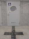
| tactile_paving | yes /no | 点字ブロック。目が不自由な人のステッキが場所を見つけたり辿ったりできることを示します。 | ||
| tidal | yes | 潮位によって水没するエリアです。 | ||
| toilets | yes / no | Describes whether a toilets is available | ||
| topless | yes / no | Indicates if the described object provides the possibility of female topless practice | ||
| tunnel | yes | トンネルを表し、layer=*タグと一緒に使います。 | ||
| toilets:wheelchair | yes / no | その場所に車いす対応トイレがあるかどうかを示します。 | ||
| wheelchair | yes / no / limited | その場所に車いすを使用して行けるかどうかを示します。 | ||
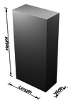
| width | 数値 | ウェイの幅(メートル単位) | ||
| landuse=forestやnatural=woodに適用し、それぞれのlanduseの中にある木の種別の詳細を示します。エリアに適用した場合は、多くのものを表します。 注意: このタグは非推奨ですので、代わりにleaf_cycle=*を使用してください。 |
This documentation is transcluded from Template:JA:Map Features:properties/doc. (Edit | history)
Note to editors: Please don't categorize this template by editing it directly. Instead, place the category in its documentation page, in its "includeonly" section.
Note to editors: Please don't categorize this template by editing it directly. Instead, place the category in its documentation page, in its "includeonly" section.
地物の一覧ページ、属性 (Properties)の一覧表の日本語版テンプレートです。翻訳は英語版テンプレートの引数として記述してください。
使用法
すべての引数は省略可能です。デフォルトではテキストが英語になります。 英語圏の利用者はテンプレートを直接編集してください(編集の重複を防ぐため)。 他の言語についてはテンプレート自身ではなく、テンプレートの引数で翻訳します。
== 見出しヘッダ ==
|name={{{name|<セクションのヘッダ行>}}}
|description={{{description|<表の前後に表示される説明、省略可>}}}

|head:<name>=  <見出し名>

== 1行分のキーと値の組み合わせ ==
|<name>:key=    <キーの日本語記事へのリンク>
|<name>:value=  <値の日本語訳 または 値の日本語記事へのリンク>
|<name>:desc=   <説明の日本語訳>
