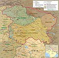
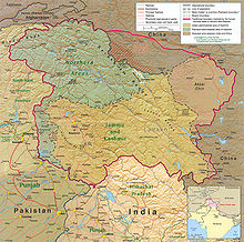
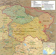
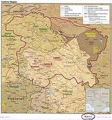
File:Kashmir Region November 2019.jpg
Jump to navigation
Jump to search


Size of this preview: 604 × 599 pixels. Other resolutions: 242 × 240 pixels | 484 × 480 pixels | 774 × 768 pixels | 1,033 × 1,024 pixels | 1,579 × 1,566 pixels.
Original file (1,579 × 1,566 pixels, file size: 1.44 MB, MIME type: image/jpeg)
File history
Click on a date/time to view the file as it appeared at that time.
| Date/Time | Thumbnail | Dimensions | User | Comment | |
|---|---|---|---|---|---|
| current | 09:14, 2 June 2022 |  | 1,579 × 1,566 (1.44 MB) | wikimediacommons>Fowler&fowler | Reverted to version as of 04:58, 21 February 2022 (UTC) Again and for the last time, there is a WikiProjects India, Pakistan, and China consensus for this file to only appear in this form. It cannot be changed to highlight one portion or other for any of the subdivisions. If you persist, I will request administrative action |
File usage
The following 65 pages use this file:
- Ar:Map Features
- Ast:Map Features
- Az:Map Features
- Bg:Map Features
- Ca:Elements cartogràfics
- Cs:Key:boundary
- Cs:Map Features
- Da:Map Features
- El:Χαρακτηριστικά Χάρτη
- Eo:Map Features
- Fa:Map Features
- Fi:Kartan ominaisuudet
- He:Map Features
- Hu:Map Features
- Key:boundary
- Lv:Map Features
- Map features
- Ne:Map Features
- Pl:Key:boundary
- Pt:Map Features
- Ro-md:Map Features
- Ro:Map Features
- Sr:Map Features
- Sv:Map Features
- Tag:boundary=disputed
- Tr:Key:boundary
- Uk:Key:boundary
- Uk:Tag:boundary=disputed
- Uk:Об'єкти мапи
- Zh-hans:Map Features
- Zh-hant:Map Features
- User:Chillly/Simple Map Features
- User:H4ck3rm1k3/OSMKeys
- Template:Ar:Map Features:boundary
- Template:Az:Map Features:boundary
- Template:Ca:Map Features:boundary
- Template:Cs:Map Features:boundary
- Template:DE:Map Features:boundary
- Template:Da:Map Features:boundary
- Template:El:Map Features:boundary
- Template:Eo:Map Features:boundary
- Template:Et:Map Features:boundary
- Template:FR:Map Features:boundary
- Template:Fi:Map Features:boundary
- Template:Generic:ES:Map Features:boundary
- Template:Hu:Map Features:boundary
- Template:IT:Map Features:boundary
- Template:JA:Map Features:boundary
- Template:Map Features:boundary
- Template:NL:Map Features:boundary
- Template:Pl:Map Features:boundary
- Template:Pt:Map Features:boundary
- Template:RU:Map Features:boundary
- Template:Sv:Map Features:boundary
- Template:Uk:Map Features:boundary
- Template:Zh-hant:Map Features:boundary
- DE:Key:boundary
- DE:Map Features
- FR:Éléments cartographiques
- ES:Tag:boundary=disputed
- IT:Map Features
- NL:Kaartelementen
- RU:Key:boundary
- JA:Key:boundary
- JA:Map Features


