Sri Lanka Tagging Guidelines
Road Classification
According to Survey Department of Sri Lanka, the major roads are divided into six main categories:
- Expressway (E)
- Main Road (A)
- Main Road (B)
- Secondary/Minor Road
- Jeep/Car Track
- Footpath
Values
See below for details of commonly used tag values in OSM compare with Survey Department of Sri Lanka Road Classification:
| Sri Lanka Road Classification | OSM Tag | Visual | ||||||
|---|---|---|---|---|---|---|---|---|
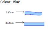
| Feature Name | Implementation Entity | Description | Key | Value | Element | Rendering | Photo | |
| Expressway(E) | Road Development Authority (RDA) | A highway especially planned for high-speed traffic, usually having few if any intersections, limited points of access or exit and A wide road (more than 30m width or less than 30m width) for high speed transportation. | highway | motorway | 
| |||
| Main Road(A) | Road Development Authority (RDA) | The most important roads in a country's system that aren't motorways. (Need not necessarily be a divided highway). and Inter-provincial trunk roads Connecting major cities and ports and access to link the province to province. | highway | trunk | 
| |||
| Main Road(B) | Road Development Authority (RDA) | The next most important roads in a country's system. (Often link larger towns.)Intra-provincial arterial roads connecting major urban areas. | highway | primary | 
| |||
| Secondary/Minor Road (C & D) | Provincial Road Development Authority (PRDA) of relevant Provincial Council | The next most important roads in the country's system. (Often link smaller towns and villages.) and Minor feeder roads connecting settlements with markets and other activities places. | highway | secondary | 
| |||
| Jeep/Car Road | In-house Road Maintenance Unit of Municipal/Urban Council or Local Authority | Local roads providing access to specific location (Example: Roads access to religion places, historical places etc...) | highway | residential | 
| |||
| Jeep/Car Track | A roads providing access to plantation, forest, irrigation, etc… Usually unpaved. | highway | track | 
| ||||
| Footpath | For designated footpaths; i.e., mainly/exclusively for pedestrians. This includes walking tracks and gravel paths. | highway | path | 
| ||||
Road surface status
One should indicate the physical surface of the road with the surface tag:
Generically, a hard surface (asphalt, cobblestone, concrete...) is indicated with surface=paved and a soft one (ground, sand...) with surface=unpaved.
If more precise information is available, please use the following actual material instead of paved or unpaved:
If available, instead of paved use:
- For carpet, tar, asphalt and equivalent, use:surface=asphalt
- surface=concrete
- surface=paving_stones
- surface=cobblestone
If available, instead of paved use:
See pictures and more detailed description for each surface here: highway=*
By default, primary/secondary/tertiary/unclassified/residential and service highway=* are supposed to be paved. If it is not the case, one must mention it, especially if the surface is soft. When potholes represent more than 50% of the surface, the way may be considered as unpaved.
In opposite, highway=track are supposed to be unpaved by default.
In addition to surface material, on can indicate "viability" or "roughness" of the road with smoothness=*. This should help determining which kind of vehicle may use the road or the track.
Building Characteristics
This model has been created and used extensively for the exposure mapping project done in District of Batticaloa.
Building usage
| Key | Value | Element | Comment | Photo |
|---|---|---|---|---|
| building | residential | A general tag for a building used primarily for residential purposes. Where additional detail is available consider using one or more areas tagged as 'apartments', 'terrace' or 'house'. | ||
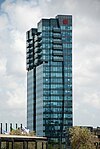
| building | commercial | A building where non-specific commercial activities take place; use office=* to describe the type of office. Consider tagging the area using landuse=commercial. Use 'retail' if the building consists primarily of shops. Building used for retail shops, private companies, garages, food and fish markets, education institutes, computer classes, restaurant, guest houses , Bank etc... | ||
| building | industrial | A building where some industrial process takes place. Use warehouse if the purpose is known to be primarily for storage/distribution. Consider using landuse=industrial for the surrounding area and the proposed industrial=* tag to describe the industrial activity.Garment factories, quarries, other factories for mass production | ||
| building | hospital | A building which forms part of a hospital. Use amenity=hospital for the hospital grounds.All kind of public and private hospitals including dispensary | ||
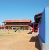
| building | school | For any generic school buildings. Buildings for specific uses (sports halls etc) should be tagged for their purpose. Use amenity=school for the perimeter of the school grounds.All the government and private,Pre schools up to tertiary education | ||
| building | place_of_worship | A church, mosque, or temple, etc. Note that you also need religion=*, usually denomination=* and preferably name=* as well as amenity=place_of_worship. See the article for details. | ||
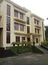
| building | government | All the central, provincial and local government office including Grama Niladari office at village level | ||
| building | service | Electricity, water, telephone, mobile telecommunication service stations,etc... | ||
| building | construction | Used for buildings under construction. Use construction=* to hold the value for the completed building. | ||
| building | roof | A structure that consists of a roof with open sides, such as a rain shelter, and also gas stations | ||
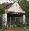
| building | abandoned | Derelict bike repair shop that can't be brought back into use easily. It's still a building, however: most of the roof's still on, and the walls are standing. The tagging reflects its former use, its state of abandonment, and the fact it's still a building. |
Principal material of construction of the walls
Principal material of construction of the roof
Number of Stories
If it is more than single story building indicate number of stories by counting number of floors. Roof top will not be considered.and Given the wide range of different apartment blocks, it is useful to add some additional building tags, such as:
- building:levels=* : the number of floors (including the ground floor) in the building
Foundation height
Number of faces for the main roof
You can characterize the building roof using a catalogue of well known roof types. Additional roof shapes may be introduced later (S3DB_Proposals), including advanced approaches for manual modelling (e.g., ProposedRoofLines or parts of OSM-4D/Roof_table).
| Image | 
|

|

|

|

|

|

|

|

|

|

|

|
|---|---|---|---|---|---|---|---|---|---|---|---|---|
| roof:shape | flat | skillion | gabled | half-hipped | hipped | pyramidal | gambrel | mansard | dome | onion | round | saltbox |
Land Use Classification
Values
See below for details of commonly used tag values in OSM compare with Survey Department of Sri Lanka Land Use Classification:
| Sri Lanka Land Use Classification | OSM Tag | Visual | ||||||
|---|---|---|---|---|---|---|---|---|
| Feature Name | Description | Symbol | Key | Value | Element | Rendering | Photo | |
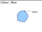
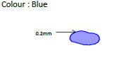
| Park | A large open space with grass and trees, especially in a city,where people can walk, play games etc. | landuse=* | park | |||||
| Forest | A field in which trees are grown. | landuse=* | forest | |||||
| Paddy | A field in which rice is grown in water. | landuse=* | farmland
crop=rice |
|||||
| Tea | A field in which coconut trees are grown | landuse=* | farmland
crop=tea |
|||||
| Coconut | A field in which coconut trees are grown. | landuse=*
trees= |
orchard
trees=coconut_palms |
|||||
| Chena | A field in which chena are grown. | landuse=* | meadow | |||||
| Scrub | A field in which low trees are grown. | natural=* | scrub | |||||
| Grass land | A field in which grasses are grown. See also landuse=meadow, landcover=grass, natural=grassland. | landuse | grass | |||||
| Rock | A areas where a lot of rocks are scattered. | natural=* | rock | |||||
| Sand | A areas where are covered by sand. | natural=* | sand | |||||
| Canals, Rivers and Streams | A canal is a long narrow stream to transport water. A river is a natural and continuous flow of water in a long line across a country into
an ocean, lake etc. A stream is a small scaled natural water flow. It is narrower than a river. |
waterway=* | Canals, Rivers and Streams | |||||
| Lake | A large area of water surrounded by land. | waterway=* | natural=water | |||||
| Tank | A reservoir that is associated with a dam. | waterway=* | natural=water | [[Image:| 100px|center]] | ||||
| Reservoir Area | A lake, especially an artificial one, where water is stored before it is supplied to people's houses. | waterway=* | reservoir Area | [[Image:| 100px|center]] | ||||
| Lagoon Area | An area of ocean that is not very deep, and that is almost completely separated from the ocean by rocks, sand, etc. | waterway=* | natural=water | [[Image:| 100px|center]] | ||||
Drain and Ditch
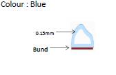
All rivers, canals and streams should normally be represented as a linear ways. The main types are waterway=river, waterway=canal or waterway=stream, waterway=drain and waterway=ditch. This way used should point in the direction of water flow and connect with other linked waterway features to create a routable network.
Tidal sections of a waterway can be tagged with tidal=yes and if it is intermittent use intermittent=yes. If a stream starts as as spring, the node can be tagged with natural=spring. The name=* tag is used to hold the name to the watercourse, and wikipedia=* for a link to a related Wikipedia page.
Point features used along to watercourses include waterway=weir, waterway=dam and ford=*. A section of waterway within a lock between the lock gates can be tagged with lock=* with node tagged waterway=lock_gate at each end. The name of the lock can be added using lock_name=* and/or lock_ref=*. boat=*, ship=* and CEMT=* tags can be used to specify if boats are allowed to use the watercourse.
Man-made structures
- see also Water management
Where a river or stream goes under a road, railway or similar the upper way should be tagged with bridge=yes and layer=1, or alternatively tag the watercourse with layer=-1 and tunnel=yes or tunnel=culvert (used for streams and drains). Where a canal is carried over an aqueduct the way should be tagged with bridge=aqueduct.
Use man_made=pier for structures projecting out over the water and add a mooring=yes tag if boats can be moored alongside.
Tag water towers using man_made=water_tower and pipelines with man_made=pipeline and also type=water, type=drain or type=sewer as appropriate. For sewage treatment plant use man_made=wastewater_plant. Hydro plants should be tagged with power=generator and generator:source=hydro. For hydrometric measurements of the elevation and the volume use man_made=monitoring_station in combination with monitoring:water_level=*.


