Zh-hans:Tag:highway=pedestrian
| 说明 |
|---|
| 主要或专供行人使用的道路 |
| 在OSM Carto中渲染 |

|
| 组: 道路 |
| 用于这些元素 |
| 常用组合 |
| 另见 |
| 状态:已批准 |
| 此标签的工具 |
highway=pedestrian是一条步行街或一个主要或专门供行人使用的区域,其中某些车辆可能拥有特殊通行权(例如紧急情况、出租车、送货车辆等)。通常出现在购物区、市中心、有旅游景点的地方和休闲/市政区,在这些地方为行人提供了宽阔的通行空间。
如何绘制
要绘制步行街,只需要简单的![]() 即可。添加highway=pedestrian标签和一个name=*使其更加完整。
即可。添加highway=pedestrian标签和一个name=*使其更加完整。
对于太窄而不能被视为道步行街的道路,请使用highway=footway或highway=path。
广场
An area (closed way or multipolygon) tagged with highway=pedestrian + area=yes is the most common way to map the pedestrian area of a square or plaza, where pedestrians can travel freely in all directions. If there are roads passing through the area of the square, map them as usual and make connecting nodes at all intersections with the pedestrian area. Also other paths such as highway=footway as well as roads have to connect with the edge of the pedestrian area where they intersect. [However, note that few routers will route through the area, most will route around the edge of it.]
If there are features or areas within the square or plaza which are not part of the walkable pedestrian area, these should be excluded by creating a multipolygon relation.
Also see the tag place=square for named squares which might include other features, use the pedestrian tag for actual pedestrian areas only. Add a node at the center of the square or draw the way at the outer limits of the pedestrian area, possibly even connecting with surrounding walls, fences, buildings, etc.
车辆通行权
Vehicles may be allowed during special hours to unload merchandise, but are often prevented from entering by bollards.
Cycling may be allowed, depending on the country or local restrictions. This can be specified with bicycle=yes or bicycle=no.
For narrow paths which are too small for cars to pass (not proper streets) use highway=footway instead.
各地用法
意大利
In Italy, access for bicycles to pedestrian areas is allowed by default. If you are mapping in Italy, you are encouraged to explicitly state bicycle=* when mapping highway=pedestrian in order to avoid ambiguity.
示例
| Picture/Description | Tags | OSM-Carto |
|---|---|---|

|
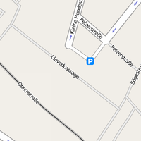
highway=pedestrian name=Lloydpassage |
 |
|
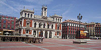
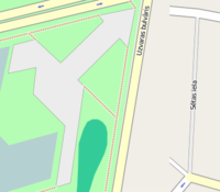
highway=pedestrian area=yes name=Weyher Marktplatz place=square |
|

|
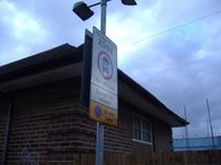
highway=pedestrian access:conditional=delivery @ (00:00-11:00) bicycle=yes |
|
|
highway=pedestrian name=The Moorings motorcar=destination motorcycle=destination |
— |
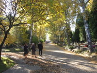
|
highway=pedestrian | https://www.openstreetmap.org/#map=19/50.09722/19.97816 |
| highway=pedestrian name=Fiskergade vehicle=yes note="Gågade" Pedestrian street with "Kørsel tilladt" vehicles allowed. Driving is allowed here, but (tourist)pedestrians are prioritized higher, so motorists basically can't expect to move faster than the pedestrian in front of them. Similar to highway=living_street, but slightly stricter on vehicles. |
参见
- area:highway=pedestrian - an area representation of pedestrian streets
- highway=footway - for designated footpaths, i.e. mainly/exclusively for pedestrians
- place=square - a named square (indicates a town or village square, which is an open public space common in urban centres, such as cities, towns or villages)
- Proposed features/Pedestrianised road
| ||||||||||||||||||||||||||||||

