Template:JA:Map Features:highway
(Redirected from Template:Ja:Map Features:highway)
Jump to navigation
Jump to search
This documentation is transcluded from Template:JA:Map Features:highway/doc. (Edit | history)
Note to editors: Please don't categorize this template by editing it directly. Instead, place the category in its documentation page, in its "includeonly" section.
Note to editors: Please don't categorize this template by editing it directly. Instead, place the category in its documentation page, in its "includeonly" section.
地物の一覧ページ、道路 (Highway)の一覧表の日本語版テンプレートです。翻訳は英語版テンプレートの引数として記述してください。
使用法
すべての引数は省略可能です。デフォルトではテキストが英語になります。 英語圏の利用者はテンプレートを直接編集してください(編集の重複を防ぐため)。 他の言語についてはテンプレート自身ではなく、テンプレートの引数で翻訳します。
== 見出しヘッダ ==
|name={{{name|<セクションのヘッダ行>}}}
|description={{{description|<表の前後に表示される説明、省略可>}}}

|head:<name>=  <見出し名>

== 1行分のキーと値の組み合わせ ==
|<name>:key=    <キーの日本語記事へのリンク>
|<name>:value=  <値の日本語訳 または 値の日本語記事へのリンク>
|<name>:desc=   <説明の日本語訳>
道路 (Highway)
道路や遊歩道を記述するのに使用します。使い方の説明はJA:道路のページをご覧ください。車両の種類・時間・日・重さ・目的などによる通行制限についての説明は、JA:制限のページをご覧ください。
注意: 日本の道路についてはJA:Japan tagging#道路の種別を参照してください。
| キー | 値 | 要素 | 説明 | レンダリング | 写真 | |
|---|---|---|---|---|---|---|
道路 | ||||||
|
道路ネットワークのための主要なタグです。最も重要なものから最も重要でないものまであります。 | ||||||
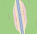
| highway | motorway | 入口が少ない中央分離帯付きの主要な道路で、通常は2本以上の車線と緊急用に硬い路肩があります。アメリカのフリーウェイやドイツのアウトバーンが相当します。 | ||||
| highway | trunk | 国の道路体系で最も重要な道路で、 motorway ではないものです。(中央分離帯付きである必要はありません。) | ||||
| highway | primary | 国の道路体系で trunk の次に重要な道路です。(通常は大きな街を結んでいます。) | ||||
| highway | secondary | 国の道路体系で primary の次に重要な道路です。(通常は町を結んでいます。) | ||||
| highway | tertiary | 国の道路体系で secondary の次に重要な道路です。(通常は小さい町や村を結んでいます。) | ||||
| highway | unclassified | 国の道路体系で最も重要度の低い、通過するための道路です。つまり tertiary の下の分類ですが、不動産へのアクセス以上の目的を持っています。通常は村や村落を結んでいます('unclassified' という用語はイギリスの道路体系における産物であり、分類が不明という意味ではありません。その場合は highway=road を使用してください)。 | ||||
| highway | residential | 居住地間を接続する機能がなく、住宅へのアクセスとして機能する道路です。ふつうは住宅沿いに引かれています。 | ||||
接続道路 | ||||||
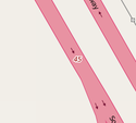
| highway | motorway_link | motorway 同士またはそれ以下のクラスの道路との間を結ぶ接続道路(ランプ)です。通常は motorway と同じ通行制限があります。 | ||||
| highway | trunk_link | trunk 同士またはそれ以下のクラスの道路との間を結ぶ接続道路(ランプ)です。 | ||||
| highway | primary_link | primary 同士またはそれ以下のクラスの道路との間を結ぶ接続道路(ランプ)です。 | ||||
| highway | secondary_link | secondary 同士またはそれ以下のクラスの道路との間を結ぶ接続道路(ランプ)です。 | ||||
| highway | tertiary_link | tertiary 同士またはそれ以下のクラスの道路との間を結ぶ接続道路(ランプ)です。 | ||||
特殊な道路種別 | ||||||
| highway | living_street | 生活道路。法的に自動車よりも歩行者が優先され、速度が非常に低く抑えられ、子どもが道路上で遊べるような住宅地の道路です。 | ||||
| highway | service | 個人の住宅、キャンプ場、オフィス地域、駐車場などの中にある、アクセスのための道路です。使用方法の種類を表すために service=* を、誰が、またはどんな状況で利用できるかを表すために access=* を組み合わせて使用することができます。 | ||||
| highway | pedestrian | 主に(または専ら)歩行者のための道路で、商店街や住宅街にあり、動力付きの車両は一日の非常に限られた時間だけ通行が許されている場合もあります。「広場」や「プラザ」を作成するには、閉じたウェイを作成して pedestrian としてタグ付けし、 area=yes も設定してください。 | ||||
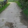
| highway | track | 主に農業や林業に使用される道路。道の品質を記述する場合はtracktype=*を参照してください。なお、trackの多くは舗装されていませんが、このタグは道路の品質ではなく、用途を記述するためのものです。したがって、一般に使用される道路をタグ付けしたい場合は、 track ではなく一般的な highway の値の一つを使用してください。 | ||||
| highway | bus_guideway | 車両が道路にガイドされるバスの道路で(しかし鉄道ではない)、他の交通には適しません。なお、通常のバス専用車線の場合は、代わりに access=no と psv=yes を使用してください。 | ||||
| highway | escape | 緊急退避所、緊急避難所。車両ののブレーキが壊れたときに、安全に停止できるものです。 | ||||
| highway | raceway | (自動車)レース用のコースやトラックです。 | ||||
| highway | road | 種類が不明な道路、道、街道、自動車専用道路などです。歩道から自動車専用道路までのあらゆるものを指します。このタグは、道路などを正しく調査するまでの間、一時的にだけ使用するようにしてください。もし道路の種類が分かっている場合は、この値を使わずに、もっと具体的な highway=* の一つを使用してください。 | ||||
| highway | busway | A dedicated roadway for bus rapid transit systems | ||||
小道 | ||||||
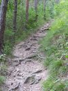
| highway | footway | 明示された歩道です。つまり、主に歩行者用か、歩行者専用の道路です。遊歩道や砂利道も含みます。自転車の通行が許可されている場合は、 bicycle=yes を追加して示すことができます。主な使用法や使用目的が不明な小道には使用するべきではありません。商店街や住宅地にある歩行者専用道路には highway=pedestrian を使用し、農業機械や同様の車両が使用することができる場合には highway=track を使用してください。 | ||||
| highway | bridleway | 馬用の小道。 highway=path + horse=designated と同じです。 | ||||
| highway | steps | 歩道にある一連の階段です。段数を表すときは step_count=* を使用してください。 | ||||
| highway | corridor | For a hallway inside of a building. | ||||
| highway | path | 用途が特定されていない小道です。主に歩行者が使用する小道には highway=footway を、自転車も使用できる小道には highway=cycleway を使用してください。歩行者と馬が使用できる小道には highway=bridleway を、農業機械や同様の車両が使用することができる小道には highway=track を使用してください。 | ||||
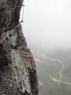
| highway | via_ferrata | A via ferrata is a route equipped with fixed cables, stemples, ladders, and bridges in order to increase ease and security for climbers. These via ferrata require equipment : climbing harness, shock absorber and two short lengths of rope, but do not require a long rope as for climbing. | ||||
When sidewalk/crosswalk is tagged as a separate way | ||||||
| footway | sidewalk | Sidewalk that runs typically along residential road. Use in combination with highway=footway or highway=path | ||||
| footway | crossing | 横断歩道です。歩行者はここで道路を横切ることができます。 | ||||
| footway | traffic_island | The way between two crossings, safespot for pedestrians, has micromapping characteristics as a detailed alternative to =*. Use in combination with highway=footway or highway=path. | ||||
主となる道路に対して歩道をタグ付けするとき(JA:歩道を参照) | ||||||
| sidewalk | both | left | right | no | Specifies that the highways has sidewalks on both sides, on one side or no sidewalk at all | ||||
自転車道を単体のウェイとして描画するとき(JA:自転車を参照) | ||||||
| highway | cycleway | 明示された自転車道です。もし default-access-restrictions が適用されないならば、 foot=* のみ追加してください。 | ||||
主となる道路タグ付けされた自転車道や車線(JA:自転車を参照) | ||||||
| cycleway | lane | 道路内に設定されている自転車通行帯です。 | ||||
| cycleway | oneway=yes がタグ付けされたウェイで、自転車には両方向の走行が許されているところ。 oneway:bicycle=no と一緒に使われます。 | |||||
| cycleway | 反対方向の自転車通行帯。 oneway=yes と共に使い、自転車通行帯が通常の通行方向(「対面通行」の車線)とは逆の場合に指定します。 oneway:bicycle=no と一緒に使われます。 | |||||
| cycleway | track | 自転車通行帯。車道と分離して設置されたルートがあることを示します。アメリカでは、この用語は自動車の車線から路側帯、杭、駐車車線、縁石などで分離された自転車通行帯を指すために使われます。なお、自転車専用道路は道路の隣に別なウェイとして描き、 highway=cycleway でタグ付けすることもあります。 | ||||
| cycleway | 反対方向の自転車道。 oneway=yes と共に使い、自転車道が通常の通行方向とは逆の場合に指定します。 | |||||
| cycleway | share_busway | 自転車が利用できるバス専用車線があります。 | ||||
| cycleway | Deprecated variant for ways with oneway=yes that have a bus lane that cyclists are also permitted to use, and which go in the opposite direction to normal traffic flow (a "contraflow" bus lane). Replaced by oneway:bicycle=no + cycleway:left=share_busway/cycleway:right=share_busway + cycleway:left:oneway=-1/cycleway:right:oneway=-1. | |||||
| cycleway | shared_lane | 自転車が自動車と車線を共用しますが、車線に自動車と車線を共用する旨が標示されています。 | ||||
Busways tagged on the main roadway or lane (see Bus lanes) | ||||||
| lane | 道路の両側に設置されたバス専用車線です。 | |||||
| opposite | Deprecated variant for ways with oneway=yes where buses are legally permitted to travel in both directions. Replaced by oneway:bus=no | |||||
| opposite_lane | Deprecated variant for ways with oneway=yes that have a bus lane which go in the opposite direction to normal traffic flow (a "contraflow" bus lane). Replaced by oneway:bus=no and lanes:bus=* / lanes:psv=*) / bus:lanes=* / psv:lanes=* | |||||
Street parking tagged on the main roadway (see Street parking) | ||||||
| parking:left / :right / :both (hereafter: parking:side) |
lane | street_side | on_kerb | half_on_kerb | shoulder | no | separate | yes | Primary key to record parking along the street. Describes the parking position of parked vehicles in the street. | ||||
| parking:sideorientation=* | parallel | diagonal | perpendicular | To specify the orientation of parked vehicles if there is street parking. | ||||
ライフサイクル (see also lifecycle prefixes) | ||||||
| highway | proposed | 計画中の道路で、 proposed=* と共に使用し、値に計画中の道路の種類を指定します。 | ||||
| highway | construction | 工事中の道路です。 construction=* で完成時の道路の種類の値を保持します。 | different colours | |||
属性 | ||||||
| abutters | commercial | industrial | mixed | residential | retail etc. | 詳しくは JA:Key:abutters を参照してください。 | ||||
| bicycle_road | yes | 自転車道は自転車向けに特定された道路です。居住区域内道路が自転車道とされている場合は、ふつう、特別な標識で、自動車の交通は住民に限られ、スピードも抑えられています。 | ||||
| bus_bay | both | left | right | A bus bay outside the main carriageway for boarding/alighting | ||||
| change | yes | no | not_right | not_left | only_right | only_left | Specify the allowed/forbidden lane changes | ||||
| destination | <place name of destination> | Destination when following a linear feature | ||||
| embankment | yes | dyke | A dyke or a raised bank to carry a road, railway, or canal across a low-lying or wet area. | ||||
| embedded_rails | yes | <type of railway> | A highway on which non-railway traffic is also allowed has railway tracks embedded in it but the rails are mapped as separate ways. | ||||
| ford | yes | 洗い越し。道路が小川や川を横切る際に、車両が水に入らなければならない場所。 | ||||
| ice_road | yes | 凍った氷上にある道路で、夏場は存在しません。 | ||||
| incline | 数値 %/° | 斜面の傾きをパーセント(5%)または角度(20°)で表します。ウェイの方向に見て、正の数が上り坂、負の数が下り坂を表します。 | ||||
| junction | roundabout | 自動的に oneway=yes を含み、一方通行の向きはウェイのノードの順番で決まります。これはすでに highway=* がタグ付けされているウェイに適用してください。 | ||||
| lanes | 数値 | 一般目的の通行、バス、その他の特定種類の車向けの通行車線の数です。 | ||||
| lane_markings | yes | no | Specifies if a highway has painted markings to indicate the position of the lanes. | ||||
| lit | yes | no | 道路の照明です。 | ||||
| maxspeed | <number> | Specifies the maximum legal speed limit on a road, railway or waterway. | ||||
| motorroad | yes | no | motorroad タグは、 motorway ではないが motorway と同様の通航制限がある道路を記述するために使用します。 | ||||
| mountain_pass | yes | 峠の最も高い地点です。 | ||||
| mtb:scale | 0-6 | highway=path や highway=track に適用します。 MTB トレイルの分類体系です。 | ||||
| mtb:scale:uphill | 0-5 | 山登りをするときに重要な勾配があるかどうかを示すMTBトレイルの分類体系です。 | ||||
| mtb:scale:imba | 0~4 | バイクパークに使用されるIMBA難易度評価システムによる評価です。人工的な障害物を MTB トレイルに合わせます。 | ||||
| mtb:description | 文字列 | highway=path や highway=track に適用します。道路のマウンテンバイクに関する様々な情報を人間の言葉で入力するキーです。 | ||||
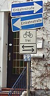
| oneway | yes | no | reversible | Oneway streets are streets where you are only allowed to drive in one direction. | ||||
| oneway:bicycle | yes | no | | Used on ways with oneway=yes where it is legally permitted to cycle in both directions. | ||||
| overtaking | yes | no | caution | both | forward | backward | 法的に追い越しが禁止されている区間を設定します。 | ||||
| parallel | diagonal | perpendicular | marked | no_parking | no_stopping | fire_lane. | 駐車スペースを表します。詳しくは parking:lane=* を参照してください。 | |||||
| free | ticket | disc | residents | customers | private | 駐車の状態を表します。詳しくは parking:condition=* を参照してください。 | |||||
| passing_places | yes | 待機所がたくさんある道路です。 | ||||
| priority | forward | backward | Traffic priority for narrow parts of roads, e.g. narrow bridges. | ||||
| priority_road | designated | yes_unposted | end | Specifying roads signposted as priority roads. | ||||
| sac_scale | strolling | hiking | mountain_hiking | demanding_mountain_hiking | alpine_hiking | demanding_alpine_hiking | difficult_alpine_hiking | highway=path や highway=footway に適用します。ハイキングコースの分類体系です。 | ||||
| service | alley / driveway / parking_aisle など | 敷地内道路の種類です。 詳しくは Key:service を参照してください。 |
||||
| shoulder | no | yes | right | both | left | Presence of shoulder in highway | ||||
| smoothness | excellent | good | intermediate | bad | very_bad | horrible | very_horrible | impassable | Specifies the physical usability of a way for wheeled vehicles due to surface regularity/flatness. See Key:smoothness for more details. | ||||
| surface | paved | unpaved | asphalt | concrete | paving_stones | sett | cobblestone | metal | wood | compacted | fine_gravel | gravel | pebblestone | plastic | grass_paver | grass | dirt | earth | mud | sand | ground | 道路の表面です。 詳しくは Key:surface を参照してください。 |
||||
| tactile_paving | yes | no | 視覚障碍者の杖でたどるための点字ブロックです。 | ||||
| tracktype | grade1 | grade2 | grade3 | grade4 | grade5 | 表面の品質を記述します。詳しくは Key:tracktype と Key:surface を参照してください。 | ||||
| traffic_calming | bump | hump | table | island | cushion | yes | etc. | 詳しくは Key:traffic_calming を参照してください。 | ||||
| trail_visibility | excellent | good | intermediate | bad | horrible | no | highway=path、 highway=footway、 highway=cycleway、 highway=bridleway に適用します。ハイキングコースの可視性の分類です。 | ||||
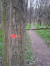
| trailblazed | yes | no | poles | cairns | symbols | Applies to highway=*. Describing trail blazing and marking. See Key:trailblazed for more information. | ||||
| trailblazed:visibility | excellent | good | intermediate | bad | horrible | no | Applies to trailblazed=*. A classification for visibility of trailblazing. See Key:trailblazed:visibility for more information. | ||||
| turn | left | slight_left | through | right | slight_right | merge_to_left | merge_to_right | reverse | The key turn can be used to specify the direction in which a way or a lane will lead. | ||||
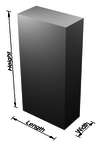
| width | <number> | The width of a feature. | ||||
| winter_road | yes | 冬の間に利用できる道路で、夏場はおそらくドライブできません。 | ||||
その他の地物 | ||||||
| highway | bus_stop | 小さいバス停。車両が停止する位置に public_transport=stop_position を、乗客が待つ場所に public_transport=platform を使用して、より厳密にマッピングすることができます。詳しくは public_transport=* を参照してください。 | ||||
| highway | crossing | A.k.a. crosswalk. Pedestrians can cross a street here; e.g., zebra crossing | ||||
| highway | cyclist_waiting_aid | Street furniture for cyclists that are intended to make waiting at esp. traffic lights more comfortable. | ||||
| highway | elevator | エレベーターです。 | ||||
| highway | emergency_bay | An area beside a highway where you can safely stop your car in case of breakdown or emergency. | ||||
| highway | emergency_access_point | 非常時に現在の位置を知るために使うことが出来る位置番号の標識です。 ref=標識上の番号 と共に使う。 | ||||
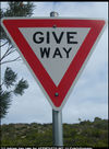
| highway | give_way | 「前方優先道路」の標識または道路標示(白い▽印)です。 | ||||
| emergency | phone | 非常時に現在位置を知らせることができる電話。 ref=標識上の番号 と共に使用してください。 | ||||
| highway | ladder | A vertical or inclined set of steps or rungs intended for climbing or descending of a person with the help of hands. | ||||
| highway | milestone | Highway location marker | ||||
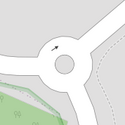
| highway | mini_roundabout | roundabout と同様ですが、中心にはペイントの円または完全に乗り越えることができる島があるものです。乗り越えることができない島が中央にある場合は、 junction=roundabout を使用してください。
デフォルトでは反時計回りでレンダリングされます。時計回りにするには、 direction=clockwise でタグ付けしてください。 |
||||
| highway | motorway_junction | 高速道路の出入口(イギリスでは "junction"、アメリカでは "exit")やジャンクション。出口番号かジャンクション識別子を設定するために、 ref=* を設定してください。(一部の道路、たとえばイギリスのA14という道路名はジャンクション番号にも適用されるため、名前にかかわらず他にも使用される可能性があります。) | ||||
| highway | passing_place | 対向車の通行を待つための待機所です。 | ||||
| highway | platform | A platform at a bus stop or station. | ||||
| highway | rest_area | 休憩のために道路を離れることができる場所ですが、給油設備はありません。パーキングエリアなど | ||||
| highway | services | 飲食物を購入できるところで、しばしば高速道路で見かけるもの。サービスエリア、道の駅、ドライブインなど | ||||
| highway | speed_camera | 路肩か上部に設置されているスピードカメラです。 | ||||
| highway | speed_display | A dynamic electronic sign that displays the speed of the passer-by motorist. | ||||
| highway | stop | 一時停止の道路標識又は道路標示。 | ||||
| highway | street_lamp | 街路灯です。道路の隅にある高い位置の光源で、毎夜決まった時刻に点灯します。 | ||||
| highway | toll_gantry | A toll gantry is a gantry suspended over a way, usually a motorway, as part of a system of electronic toll collection. For a toll booth with any kind of barrier or booth see: barrier=toll_booth | ||||
| highway | traffic_mirror | Mirror that reflects the traffic on one road when direct view is blocked. | ||||
| highway | traffic_signals | 交通を制御する信号です。 | ||||
| highway | trailhead | Designated place to start on a trail or route | ||||
| highway | turning_circle | 道路の終端で車両の転回を容易にするための場所で、通常は丸味を帯びて広がった場所であるが、必ずしもそのようになっている必要はありません。 | ||||
| highway | turning_loop | A widened area of a highway with a non-traversable island for turning around, often circular and at the end of a road. | ||||
| highway | ユーザー定義 | よく使われている値をTaginfoで確認できます。 | ||||
